Glacier, Montana
Looking for the best hiking in Glacier? We've got you covered with the top trails, trips, hiking, backpacking, camping and more around Glacier. The detailed guides, photos, and reviews are all submitted by the Outbound community.
Top Hiking Spots in and near Glacier
-
West Glacier, Montana
Backpack to Logging Lake
8.8 miBackcountry camping is the best plan if you’d like to visit Logging Lake, and the primitive campsites lay at the end of a four and a half mile hike through some of the most unspoiled sections of the park. The trail follows logging creek most of the way to the lake traversing through a variety of ...Read more -
Martin City, Montana
Drive around Hungry Horse Reservoir
About 100 miles of mostly gravel roads (14 miles of pavement) will take you around this beautiful reservoir. With that many miles of road and the shoreline to go with it, it is obvious that there is plenty to see and do in the Hungry Horse area. Check out some of my other adventures for ideas of...Read more -
Essex, Montana
Hike to Dickey Lake
5.2 mi / 1463 ft gain*Parking for this hike is very limited, as the parking area can hold one, maybe two, vehicles. This 5.2 mile roundtrip hike begins near Essex, Montana, at 4,620 feet of elevation, and leads to a small, hidden lake nestled in the Great Bear Wilderness. Immediately after leaving the parking area, ...Read more -
West Glacier, Montana
Camp at Bowman Lake
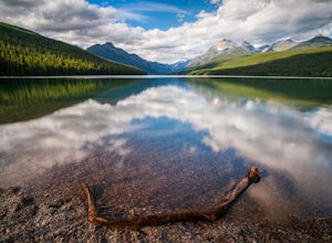
5.026.85 mi / 3005 ft gainBowman lake is the 3rd largest lake in Glacier National Park and one of the most remote areas accessible by car. The drive out on a dirt road is slow and bumpy but the reward is an area without crowds and lots of adventure potential. The first-come-first-served campground offers 48 sites near t...Read more -
West Glacier, Montana
Waterton Lake via Bowman Lake
49.5 mi / 6365 ft gainOur trip started on Thursday evening, spending the night at the Bowman Lake campground. You can park your car here and it's where the hike will start and end. I recommend staying here the night before because day 1 is a doozy, so you'll want an early start. Day 1 is the hardest day of the hike, ...Read more -
West Glacier, Montana
Bowman Lake to Quartz Lake Loop
5.013.3 mi / 2618 ft gainThe trail to Quartz lake begins on southend of the Bowman Lake beach. I recommend going in a clockwise direction and getting the steep bit out of the way, but the ~13 mile loop can be done either way. Follow the Bowman Lake shore on the West Lakes Trail for about half a mile and then you will fi...Read more -
Flathead County, Montana
Hike to Blaine Mountain
7.3 mi / 2350 ft gainTo reach the trailhead for this hike, it is about an hour's drive from nearby Kalispell. You will drive around Hungry Horse Reservoir on the West Side Road, and turn off onto Doris Creek Road. Be sure NOT to get this mistaken with the nearby Doris Ridge Road. Once turning onto Doris Creek Road, i...Read more -
Browning, Montana
Backpack to Cosley Lake
27.2 mi / 475 ft gainThe hike goes through different wooded areas, open fields, and passes by the ranger's ranch. In no time, you will be able to see the aqua blue colors of Cosley Lake, as you approach the campground for the night.The campground has pit toilets and a bear bag hanging station, along with a cooking ar...Read more -
Browning, Montana
Backpack to the Foot of Glenns Lake
20.6 mi / 950 ft gainStarting from the Chief Mountain Parking Area, take the trail to the left of the bathrooms at the end of the parking lot (left of the bathrooms if you are facing the bathrooms and the main road is to your right). You will quickly hike to a wooden kiosk. Read this kiosk for any pertinent informati...Read more -
Whitefish, Montana
Hike Whitefish Mountain via the Danny On Trail
5.07.6 mi / 2250 ft gainThe Danny On Trail starts from the base area of Whitefish Mountain Ski Resort and zig zags its way up to the summit. The trailhead is near the Chalet building/Hellroaring Saloon upper parking lot (there's a big sign). The trail passes through Douglas fir, western larch, spruce and fir trees. The ...Read more -
Waterton, Alberta
Hike to Crypt Lake
4.310.8 mi / 2296.6 ft gainThe hike begins with a gradual climb through shaded forest, which thins as you progress into the hanging valley. Along the way, you will pass by three amazing waterfalls: Twin Falls at 3.5km (2 mi), Burnt Rock Falls at 5.6km (3.5 mi) and the 600ft Crypt Falls at 8km (5 mi). There is also a 1km (0...Read more -
Waterton, Alberta
Backpack the Alderson-Carthew Trail
5.012.4 mi / 4101.1 ft gainTake the Akamina Parkway in Wateron Lakes National Park to its terminus at Cameron Lake. Your hike will start from here. If you’re through-hiking either drop another vehicle off at Cameron Falls in the town site, or be prepared to hitch a ride back to Cameron Lake, due to heavy traffic this is ...Read more -
Waterton, Alberta
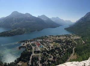
Hike Bear's Hump, Waterton Lakes NP
4.71.7 mi / 738 ft gainThe trailhead is located at the Visitor Center of Waterton Lakes National Park. The trail is very well maintained, but know that the elevation gain is quick - in less than a mile you gain 738 ft. Roundtrip is 1.7 miles and is totally worth the short but strenuous hike.When you reach the top there...Read more -
Waterton, Alberta
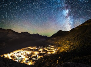
Stargaze at the Top of Bear's Hump
1.7 mi / 656.2 ft gainBear's Hump is one of the shortest hikes in Waterton Lakes National Park. Fortunately, it also offers one of, if not the best, views of the small mountain town of Waterton and surrounding peaks. At 2.8 kilometres and 200 meters of elevation gain round trip, this hike can be done in about an hou...Read more -
Kalispell, Montana
Flathead Lookout
5.02.4 mi / 666 ft gainFlathead Lookout is an out-and-back trail that takes you through a nice forest located near Kalispell, Montana.Read more -
Waterton, Alberta
Hike Mount Lineham
I’ve heard a lot about the hiking in Waterton and the stunning scenery, but I never really bought into it from the pictures alone – I’m glad I finally took the opportunity to find out for myself. Mount Lineham is a short extension of Lineham Ridge, and while it might not eclipse the views from th...Read more

