Clinton, Montana
Looking for the best photography in Clinton? We've got you covered with the top trails, trips, hiking, backpacking, camping and more around Clinton. The detailed guides, photos, and reviews are all submitted by the Outbound community.
Top Photography Spots in and near Clinton
-
Florence, Montana
Backpack the Sweeney Creek Trail
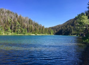
14 mi / 2600 ft gainThe hike into Duffy Lake was approximately 7 miles with ~2600' gain. The first mile or two is fairly steep, then it will wiggle up and down the mountain until it drops down into the drainage to the lake. You can hike to Holloway Lake too if the trail isn't completely covered in snow. Late spring ...Read more -
Philipsburg, Montana
Hike the Hogback Ridge Trail
11 mi / 5242 ft gainThe trailhead is accessed at the Hogback Homestead. [GPS Info. (Latitude, Longitude):46.41056, -113.7019446°24'38"N, 113°42'7"W] Due to the isolated location of this trailhead, and the miles of rough dirt road that it takes to get there, you will more than likely have the place to yourself. Park ...Read more -
Arlee, Montana
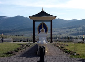
Explore Ewam Garden of One Thousand Buddhas
4.0Situated just north of Arlee, MT; the Garden of One Thousand Buddhas is not only extremely relaxing and absolutely beautiful, but it also aligns positive properties of the physical world in a sacred architectural arrangement based on the eight-spoked Dharma wheel. Visitors can relax and enjoy the...Read more -
Victor, Montana
Hike to Bear Creek Overlook
5.05 mi / 1160 ft gainAt the start of your hike, stay to left and meander your way through a shaded forest of Douglas fir and lodgepole pine. Your steady uphill climb features about two dozen switchbacks with pockets of vibrant wildflowers and a meadow of fallen trees near the rim. At the top, you'll be greeted with...Read more -
Condon, Montana
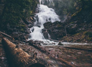
Hike to Morrell Falls
4.02.7 mi / 150 ft gainFrom the town of Seeley Lake, travel 0.5 mile north on Highway 83. Turn east (right) on Morrell Creek Road (small green street sign) which becomes Forest Service Road #477/Cottonwood Lakes Road, and travel 1.1 miles. Turn north (left) on West Morrell Road #4353 and travel about 6 miles. Turn east...Read more -
Victor, Montana
Hike to Bear Creek Falls
5.03 mi / 400 ft gainThe trailhead is well established with a small campground and bathroom facilities.The hike begins in dense forest and slowly climbs over Bear Creek through a canyon. You get your typical (but always beautiful!) Bitterroot scenery: jagged rocky mountains towering over you on each side.At 1.5 miles...Read more -
Lolo, Montana
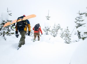
Backcountry Snowshoe and Snowboard near Lolo Pass
1.03 mi / 1250 ft gainFor this trip, you want to head towards Lolo Pass, which is the landmark of the Idaho/Montana border on Highway 12. This highway's two main towns that it begins and ends at are Lolo, Montana and Lewiston, Idaho. If you are on the Montana side, Crooked Fork Road is just a mere 100 yards from the L...Read more -
Seeley Lake, Montana
Hike to Crescent Lake
9 mi / 1500 ft gainAn hour drive north of the town of Seeley Lake Montana is the Glacier Lake Trailhead and the starting point for your hike. Glacier Lake Trailhead is a popular trailhead, and the parking lot can fill up quickly on hot summer weekends since it provides access to trails which lead to three different...Read more -
Lincoln, Montana
Pick Huckleberries at Reservoir Lake
If you live anywhere near the Pacific Northwest, you've likely heard of huckleberries -- if you haven't, what are you doing with your life? These juicy little gems are worth every once it takes to pluck them from the bush. While there are plenty of places to pick huckleberries in Northwestern Mon...Read more -
Charlo, Montana
Photograph The National Bison Range
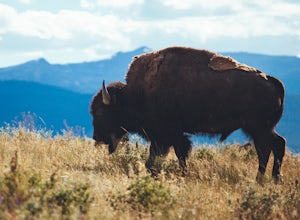
5.0The Bison Range is open year round, however, the road is mostly closed in the winter months, so the best times are the spring, summer or fall.The Range was established in 1908 to help preserve a natural population of the nearly extinct animal. Today, between 350-500 bison roam the hills.You will...Read more -
Deer Lodge, Montana
Summit Mount Powell
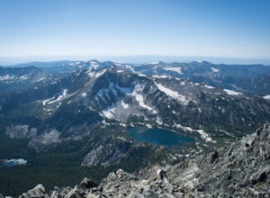
11.6 mi / 4730 ft gainFrom Interstate 90, exit at Racetrack #195. Continue west for one mile and turn north at a T intersection. Follow the road for about 0.75 mi. to Quinlan Rd. and continue west with a dogleg south for 3.5 mi. Take a sharp right to the north east to a Y and take the left fork. After about 0.07 mi., ...Read more -
Anaconda, Montana
Hike to Fourmile Basin Lakes
Distance: 8 miles round-tripTime: 4 hoursDifficulty: Easy to ModerateTrailhead: 46.135170, -113.207803From MT-1, follow the signs for Trail 44 along Twin Lakes Creek Road until it ends. The trail begins at the end of the road.The area is largely second-growth forest, having been cut several times...Read more

