Browning, Montana
Looking for the best hiking in Browning? We've got you covered with the top trails, trips, hiking, backpacking, camping and more around Browning. The detailed guides, photos, and reviews are all submitted by the Outbound community.
Top Hiking Spots in and near Browning
-
Browning, Montana
Ptarmigan Tunnel
5.010.68 mi / 2713 ft gainThis amazing 11 mile hike with 2,300 feet of vertial gain begins behind the Swiftcurrent Motor Inn cabins. If you start early enough you can park by the trailhead, but if you get a little later start you may need to park in the main lot of the Motor Inn. As you begin your hike, you will pass the...Read more -
Swiftcurrent, Montana
Glacier's North Circle Route (North East Section)
9.7 miPlanning & Preparations As amazing as this trek is, it's certainly not without its challenges, and the first one you will run into is obtaining a backcountry permit for camping. As it absolutely should, backcountry camping is very regulated. Essentially, you request permits and multiple da...Read more -
Browning, Montana
Iceberg Lake
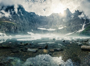
4.99.7 mi / 1200 ft gainThe 9.7-mile out-and-back trail starts in the Many Glacier area of Glacier National Park, near the Swiftcurrent Motor Inn. The trailhead is easy to find at the northwest corner of the Inn area and the trail is well marked the whole way. The trail heads northwest almost the entire time except for ...Read more -
Glacier County, Montana
Ptarmigan Falls
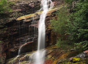
5.05.11 mi / 768 ft gain...The hike to Ptarmigan Falls begins next to the cabins near the Swiftcurrent Motor Inn. There’s enough parking for about 10-16 vehicles in the lot next to the trailhead. This is a heavily trafficked area, so extra parking is available in front of the Swiftcurrent Motor Inn. This is where I park...Read more -
Glacier County, Montana
Ptarmigan Lake Trail
8.78 miPtarmigan Lake Trail is an 8.6 mile out and back hike that takes you by a waterfall located near Babb, Montana in Glacier National Park.Read more -
Essex, Montana
Hike to Dickey Lake
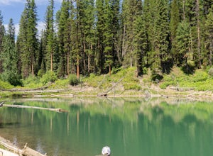
5.2 mi / 1463 ft gain*Parking for this hike is very limited, as the parking area can hold one, maybe two, vehicles. This 5.2 mile roundtrip hike begins near Essex, Montana, at 4,620 feet of elevation, and leads to a small, hidden lake nestled in the Great Bear Wilderness. Immediately after leaving the parking area, ...Read more -
West Glacier, Montana
Waterton Lakes via Packers Roost
5.022.15 mi / 4596 ft gainDay 1: This gorgeous backpacking adventure begins at the Packer's Roost trailhead, which is almost halfway between West and East Glacier on the Going-to-the-Sun Road. This trailhead is marked on the highway before you get to the "Loop." It's a quick left turn so keep your eyes peeled as you pass ...Read more -
West Glacier, Montana
Avalanche Lake via Trail of Cedars
4.95.91 mi / 730 ft gainThis very scenic Glacier National Park hike off of Going-to-the-Sun road is 4.5 miles with a total elevation gain of 730 feet. The hike to Avalanche Lake begins from the Trail of the Cedars trailhead. Be prepared for a lot of incline. Approximately one half mile from the trailhead you’ll reach...Read more -
West Glacier, Montana
Trail of the Cedars
5.00.88 mi / 121 ft gainTrail of the Cedars Trail is a loop trail that takes you by a river located near Lake Mc Donald, Montana.Read more -
West Glacier, Montana
Explore Avalanche Creek
5.00.7 miAvalanche Creek is one of Glacier National Park's easiest features to access and also one of its most unique. The old-growth cedar forest is home to towering trees, moss-covered boulders, and a rushing stream of glacial water. A small loop trail winds through the lower forest and leads to a bri...Read more -
West Glacier, Montana
Hike to the Mt. Brown Lookout
5.0The trail is accessible (though sometimes covered in snow) year-round because the trailhead lies in the lower elevation area of the park. It begins at the Sperry Trailhead, located directly across the street from the lake McDonald Lodge. Follow the Sperry Trail for 1.6 miles until you reach the M...Read more -
West Glacier, Montana
Backpack to Lincoln Lake
16.75 mi / 3747 ft gainIt's a 1600 ft slow increase in elevation. You can walk around the loose rocks going around the lake for an additional 2 miles of hiking. There is a back-country campground at the base of the glacier-fed lake and an amazing waterfall at the opposite end of the of the campground. To camp overnig...Read more -
Choteau, Montana
Hike Mount Werner
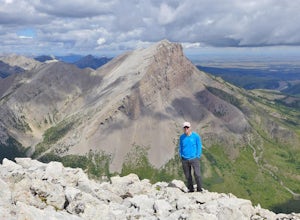
9.5 mi / 3048 ft gainThe Mount Werner Trail starts at the Blackleaf Canyon Trailhead in the Montana front range of the Rocky Mountains. On a side note, Blackleaf Canyon is also a popular rock climbing area. On the trail, you'll walk along Blackleaf Creek, and Muddy Creek so water will be available during the hike in ...Read more -
Browning, Montana
Backpack to the Foot of Glenns Lake
20.6 mi / 950 ft gainStarting from the Chief Mountain Parking Area, take the trail to the left of the bathrooms at the end of the parking lot (left of the bathrooms if you are facing the bathrooms and the main road is to your right). You will quickly hike to a wooden kiosk. Read this kiosk for any pertinent informati...Read more -
Browning, Montana
Backpack to Cosley Lake
27.2 mi / 475 ft gainThe hike goes through different wooded areas, open fields, and passes by the ranger's ranch. In no time, you will be able to see the aqua blue colors of Cosley Lake, as you approach the campground for the night.The campground has pit toilets and a bear bag hanging station, along with a cooking ar...Read more -
Hungry Horse, Montana
Hike to the Blue Lakes
2 mi / 100 ft gainThe drive out to the trailhead where this hike starts is an adventure in and of itself. As the Forest Service website describes it. "Silvertip Trailhead is accessed from Highway 2. From the town of Hungry Horse, drive east on Highway 2 for ½ mile to the East Side Reservoir Road #38. Turn right (s...Read more

