Bozeman, Montana
Top Spots in and near Bozeman
-
Gallatin Gateway, Montana
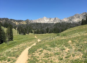
Beehive Basin Trail No. 40
5.07.01 mi / 1601 ft gainBeehive Basin Trail No. 40 is an out-and-back trail that takes you by a lake located near Big Sky, Montana.Read more -
Big Sky, Montana
The Reflector Loop
5.03.65 mi / 814 ft gainThe Reflector Loop is a well-known hiking trail located in Big Sky, Montana. This trail is approximately 3.65 miles long and is rated as moderate in difficulty. It features an elevation gain of about 814 feet, making it a suitable choice for hikers with a moderate level of fitness. The trail is...Read more -
Big Sky, Montana
Run the Rut
17.4 mi / 7800 ft gainThunderdome. That's the only way to describe it. Eight months later and I'm still thinking about it on a regular basis. My half-way grown out black toenail is a constant reminder of the epic-ness of that brutal race day. The Rut is held the first weekend of September in Big Sky, MT -- a pretty r...Read more -
Livingston, Montana
Summit Arrow Peak
2.4 mi / 3600 ft gainStarting in Livingston, MT, take Hwy 89 for 16 miles and take a left on Mill Creek Road. A junction with Road 540 will be reached. At this junction, continue on Mill Creek Road for another 8 miles until a large rock gully on the left is present and a wooden fence is on the right. The route is not...Read more -
Ousel Falls Road, Montana
Short Hike to Ousel Falls
5.01.6 mi / 250 ft gainThe trailhead is easy to find, and has a vault toilet and a decently sized parking lot. The trail leaves from right next to the toilets, and is very easy to follow. Follow a couple easy switchbacks down the hillside, cross the memorial bridge and stop to take in the beautiful scenery before follo...Read more -
Gallatin Gateway, Montana
Backpack the Gallatin Crest Trail
42 mi / 6000 ft gainThere are some different options for starting and ending this hike, but the route I did started at Buffalo Horn Trailhead and ends at the Hyalite Creek Trailhead, and is approximately 42 miles total. I did the trail over the course of three and a half days, spending three nights in the backcountr...Read more -
Mc Leod, Montana
Hike to the Natural Bridge Falls
5.02 mi / 300 ft gainAlthough this recreation area is at minimum 30 minutes out from any town, the road leading to the location is amazing and allows for some sweet views. Once you arrive, there will be a relatively small, paved place to park as well as bathrooms. Right behind the bathroom is the start to the trail.T...Read more -
Harrison, Montana
Relax at Potosi Hot Springs
4.3Rain filled the air and fog hung low. It was to dreary to do much, but the idea of soaking in a natural warm springs beneath the peaks of the Tobacco Root mountains was too tempting to stay in side.Potosi Hot Springs is about 25 minutes out of the town of Pony, MT. It’s one of my favorite places ...Read more -
McAllister, Montana
Camp at South Meadow Creek Lake
4.0To access the lake, take South Meadow Creek Road that exits US 287 at McAllister, MT. This dirt road will head west into the Tobacco Roots before turning into FS Road 1221 approximately 3 miles before the lake. If you are in a vehicle not equipped for off-roading, park your vehicle where FS Road ...Read more -
Big Timber, Montana
Crazy Peak Scramble
4.5Do you like high alpine scrambles? Climbing exposed spires? Partying on a mountain top?If you said yes to any of the above, head to Big Timber Montana and prepare for a great time. Crazy Peak is an epic highpoint within the Crazy Mountains, located in southwestern Montana. Although this hike can ...Read more

