Charlevoix, Michigan
Looking for the best photography in Charlevoix? We've got you covered with the top trails, trips, hiking, backpacking, camping and more around Charlevoix. The detailed guides, photos, and reviews are all submitted by the Outbound community.
Top Photography Spots in and near Charlevoix
-
Charlevoix, Michigan
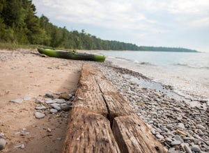
Camp at Fisherman's Island State Park
0 mi / 0 ft gainLocated just south of Charlevoix is Fisherman's Island State Park. The park offers miles of biking/hiking trails, and campsites directly on the beach of Lake Michigan. Although located just outside of town, there is no service in this area, leaving you completely cut off from the outside world. ...Read more -
Boyne Falls, Michigan
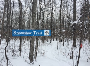
Snowshoe at Boyne Mountain
3.1 miThe trailhead for the snowshoe trail is located across the street from the Boyne Cross Country Ski center parking lot. The trail starts out by winding through the woods sandwiched between the Boyne Mountain Resort maintenance facility and a road, so you’ll hear traffic and equipment noise for th...Read more -
Traverse City, Michigan
Hike Old Mission Peninsula Park
6 mi / 183 ft gainAt the end of the Old Mission peninsula sits Mission Point Lighthouse. The lighthouse is surrounded by 5 acres of wooded township and many acres of state land! Upon arriving you can explore the shores just below the lighthouse - there can intriguing iceberg islands forming at the edge of the wate...Read more -
Traverse City, Michigan
Explore Mission Point Lighthouse
0.2 miMission Point Lighthouse is situated between the East and West Grand Traverse Bays, about 20 minutes north of downtown Traverse City. This historic lighthouse offers stunning views of Grand Traverse Bay in Lake Michigan. There is a parking lot located a few hundred feet away where visitors can p...Read more -
Leland Township, Michigan
Paddle Board Lake Michigan from Leland Harbor
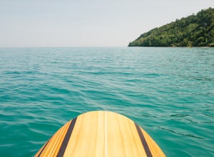
5.0For a day on the water, off the shores of Lake Michigan head to Leland. Park in the marina and load onto your paddle boards from the boat ramp. You'll quickly find your way out of the marina, in which you can head right, left or to open water. Either way you'll find accessible beaches and clear s...Read more -
Maple City, Michigan
Hike Pyramid Point Trail
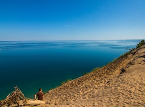
4.32.8 mi / 570 ft gainBeginning at the trailhead, the 2.8 mile round trip takes you on a gravel/sand trail up 570 feet. The trail slowly winds uphill until you hit an opening at the top that looks out at the Sleeping Bear Dunes and down on Lake Michigan.Read more -
Maple City, Michigan
Winter Hike Pyramid Point Trail
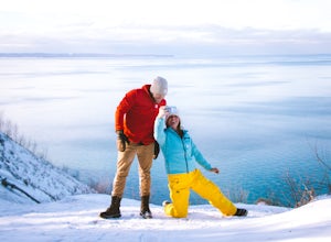
2.8 mi / 570 ft gainThe trail beings at the parking lot, it takes about 20 minutes to get to the famous overlook, about a 570 foot elevation gain. As you start the trail, after about .4 miles you will find a juncture off to your right, stay straight and it will lead you to the overlook. After you take in the sweepin...Read more -
Mackinaw City, Michigan
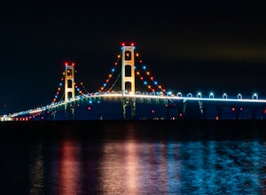
Photograph the Mackinac Bridge
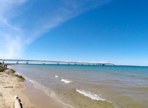
5.0The upper peninsula of Michigan is connected to the mainland by the Mackinac Bridge. This bridge is quite impressive from a distance and it makes a great object for photography at any time of the day. If you want to get up close to the bridge, try visiting one of the parks located on the north or...Read more -
Traverse City, Michigan
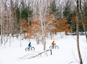
Fat Tire Biking on the Vasa Pathway
10 miIf you’re looking for a place to fat bike ride in the area, then this is the spot for you! To access the Vasa Pathway you’ll want to head to Timber Ridge Resort, feel free to park in the main area. From the southeast corner of the Timber Ridge Resort, you will be able to jump on the pathway. You ...Read more -
St. Ignace, Michigan
Mackinac Bridge
Straits State Park is located on the upper peninsula of Michigan and is minutes from the Mackinac Bridge. Named after the straits that pass through the two peninsulas, this state park offers gorgeous views of the bridge at night. From the campground, head just a few feet towards the beach on the...Read more -
Maple City, Michigan
Paddle Glen Lake
A pristine lake thats just waiting to be explored by kayak, SUP, canoe or boat (keep in mind that power boats are allowed on this lake). The water is amazingly clear and a beautiful shade of aqua blue. During the summer months, the air temperature remains relatively cool and makes for perfect, lo...Read more -
Glen Arbor, Michigan
Hike the Ghost Forest Trail and the Dunes of Glen Haven
3 miPark your car at the Sleeping Bear Point Trailhead in Glen Haven, Michigan, once parked find your way to the sign for point of reference with the map. You'll find that the Ghost Forest Trail is a 2.8 mile loop. You can start the loop at the trailhead which is near the bathroom, or at the sign whe...Read more -
Glen Arbor, Michigan
Hike the Sleeping Bear Point Trail
5.02.8 miThe Sleeping Bear Point Trail is a 2.8 mile loop through the sand dunes with amazing views of Lake Michigan and South Manitou Island. There is a 0.5 mile spur hike from the trailhead to the Lake Michigan beach. It is less strenuous than the hike from the Dune Climb to Lake Michigan.Read more -
Empire, Michigan
Hike to Big Glen Lookout
5.04.4 miStart at the Alligator Hill trail head and make your way up the hill for roughly .1 of a mile until you hit a marker. Turn left at the sign and keep on the trail for another 1.3 miles. You will hit a scenic lookout called Islands Lookout which you can stop and get pictures at. From there you will...Read more -
Mackinac Island, Michigan
Bike around Mackinac Island
4.08.05 mi / 115 ft gainMackinac Island is accessible only by ferry, and there are no cars allowed on the island. While you can rent bikes over there, we opted to bring ours along on the Star Line ferry. Super easy and we had no problems! Lake Shore Boulevard, or State Highway M-185, wraps around the entire island and ...Read more -
Glen Arbor, Michigan
Hike Sleeping Bear Dunes National Lakeshore
4.43.5 miThere are two approaches to conquering the Dune Climb at Sleeping Bear Dunes National Lakeshore. You can run to the top (the preferred method for those under the age of 10). Or, you can slowly trek up the side of this seemingly vertical wall of sand, breathing and sweating heavily, cursing each l...Read more

