Towson, Maryland
Top Spots in and near Towson
-
McLean, Virginia
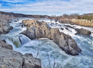
Photograph Great Falls of the Potomac
5.00.69 mi / 131 ft gainViewing Great Falls is easy which makes this adventure great for all levels of adventurers. There is a ~$10 entrance fee, there you will receive a map of the park. There are 3 platforms of viewing Great Falls, each platform has stunning panoramic views. Make sure you do not forget to bring your ...Read more -
McLean, Virginia
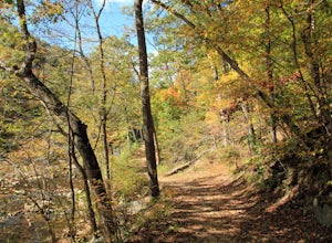
Difficult Run, Ridge, and River Trails
4.53.28 mi / 463 ft gainDifficult Run is a popular hiking location right down the street from Great Falls National Park. Starting at the Difficult Run parking lot you head to the trail at the far end of the lot. The trail will split. The green blazes will take you to the left but you can also stay to the right and hike ...Read more -
Marietta, Pennsylvania
Climb At Chickies Rock
From parking at the fairly new lot on Furnace Road, head down river on the walking trail about a half mile to an obvious large face next to the train tracks. From here you choose from a variety of routes including some two pitch routes like Witches’ Brew 5.4 to Main Street 5.5 over to some of the...Read more -
Falls Church, Virginia
Bike the W&OD Trail
45 miThe Washington and Old Dominion (W&OD) trail stretches through northern Virginia and is a great spot for bike riding, running, or walking. The trail is paved, well maintained, and wide enough for traffic in both directions. There are also a couple breweries along the way that you can make a f...Read more -
Bear, Delaware
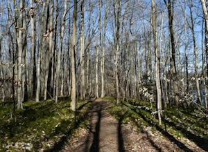
Hike the Swamp Forest Trail
6.75 mi / 144 ft gainEspecially scenic in the fall, this well maintained trail loops around a small pond. It is an easy walk (or bike ride) that has a good chance of numerous wildlife sightings.Read more -
Thurmont, Maryland
Hike Catoctin Mountain
4.58.4 mi / 1370 ft gainPark at Catoctin Mountain Visitor Center. The hike starts at the end of the gravel parking lot across from the visitor center. This is definitely a popular hiking location, so come early on the weekends to guarantee a parking spot and to avoid the crowds. To start, take the right trail towards th...Read more -
Thurmont, Maryland
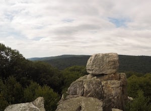
Hike Chimney Rock at Catoctin Mountain Park
4.25 mi / 600 ft gainChimney Rock is the quintessential breathtaking view that makes a hike worthwhile. By parking at the most northeast parking lot on the trail map you are able to include the sweeping views of Thurmont Vista, and Wolf Rock on your way to Chimney Rock. Highly recommend visiting in the fall, and on w...Read more -
Thurmont, Maryland
Hike the Catoctin Mountain Extended Loop Trail
4.58.6 mi / 1696 ft gainThis 8.6 mile loop trail in Catoctin Mountain Park is good for both hikers and trail runners. This loop is the larger loop in the park, comprised of Cunningham Falls, Hog Rock, Blue Ridge Summit, Thurmont Vista, Wolf Rock, and Chimney Rock. The trail gets a moderate rating because it's mostly roc...Read more -
Thurmont, Maryland
Cat Rock via Old Misery Trail
3.02.89 mi / 797 ft gainThe best place to park is on Catoctin Hollow Road in the parking lot that's on the same side of the road as the lake. It's not a huge lot but we were here mid-summer around 10 am and found a spot easily. The trailhead is on the other side of the street from this parking lot; there is a sign letti...Read more -
Bear, Delaware
Camp at Lums Pond State Park
5.0Lums Pond State Park offers endless adventures while you camp in the newly renovated campground. Explore the pond via kayak, hike through more than 12 miles of trails, fish from the water’s edge, take your dog to enjoy the off-leash dog park, or try the Go Ape Treetop Adventure Course. The camp...Read more -
Smithsburg, Maryland
Hike to Cunningham Falls
4.22.8 miThis 78-foot waterfall, among the largest in the state, is easily accessible by two short trails. Lower Trail (0.5 miles) leads directly to the falls, whereas Cliff Trail (0.75 miles) has slightly more difficult terrain and takes you to a viewing platform. To lengthen the adventure, Hunting Creek...Read more -
Lewisberry, Pennsylvania
Hike Quaker Race's Lakeside Trail
4.03 miThis trail is best accessed from the Quaker Race Day Use Area or from the Cabin Colony for cabin occupants. This trail has a dirt or rocky surface, uneven terrain and one steep but short hill. This trail connects to Lakeside Trail at its end to form a 3-mile loop that passes through diverse habit...Read more -
Alexandria, Virginia
Run or Bike the Dyke Marsh Wildlife Preserve
3 miStart your adventure at the Belle Haven Parking area then head down the Dyke Marsh Trail. To add on additional distance, head south down the Mt. Vernon Trail for more views, well maintained paths, and even some sitting areas. You'll find boardwalks that take you right across the marsh, so keep an...Read more -
Newark, Delaware
Hike the PennDel Trail at White Clay Creek SP
5.01.9 mi / 0 ft gainWhite Clay Creek State Park is a large expanse of beautiful woods and streams with over 37 miles of trails. The PennDel Trail follows White Clay Creek and winds through the hardwood forests. The PennDel Trail actually begins at the Pennsylvania state line, but the easiest way to access the trail...Read more

