Owings Mills, Maryland
Top Spots in and near Owings Mills
-
Wildlife Trail Parking Area, Maryland
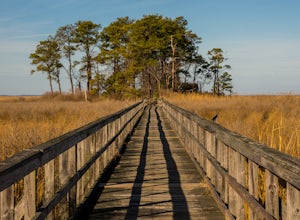
Explore Eastern Neck National Wildlife Refuge
1 miAlthough the trails at Eastern Neck may be small in size (the longest is just over a mile) they're big on sights. It's practically impossible to visit the refuge and not see wildlife, particularly the dizzying number of avian species here. Visit during the winter to see the majestic Tundra Swan, ...Read more -
Conestoga, Pennsylvania
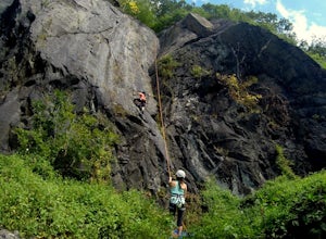
Climb at Safe Harbor
3.3Directions: Drive to Safe Harbor. From Safe Harbor, take River Road south to Green Hill Road--this road is very windy. Drive towards Shenk's Ferry Wildflower Preserve. When you reach the tunnel, park on either side of the tunnel. There isn't too much parking here so I'd suggest carpooling.The tra...Read more -
Sabillasville, Maryland
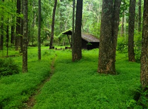
Camp at the Adirondack Shelters in Catoctin Mountain Park
5.04 mi / 1200 ft gainFor outdoor enthusiasts, Maryland is an ideal place to live. Between the mountains and the Bay--and the rivers, bike paths, and trails along the way--we couldn't ask for much more. But if we were feeling greedy, we would probably ask for additional backpacking options, right? Of course, there are...Read more -
North East, Maryland
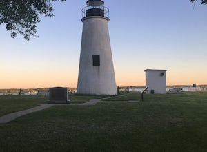
Hike to the Turkey Point Lighthouse in Elk Neck SP
3.01.6 mi / 60 ft gainThis hike begins from the parking lot trailhead that is well-marked. Be cautious - parking is limited and may be full on weekends, and the paved road suddenly ends at the parking lot entrance. The path is crushed stone, wide, and relatively flat. Dogs are welcome but must be on leashes. On th...Read more -
Knoxville, Maryland
Explore Point of Rocks/ Potomac River Overlook
4.00.2 mi / 95 ft gainPark at the Chesapeake and Ohio Canal parking lot. Walk to the US 15 and cross the road. Trail is not marked, though its faint traces can be detected as you continue on. GPS is recommended. Enjoy the overlook and when you're ready to go back, retrace your steps.Read more -
Falls Church, Virginia
Bike the W&OD Trail
45 miThe Washington and Old Dominion (W&OD) trail stretches through northern Virginia and is a great spot for bike riding, running, or walking. The trail is paved, well maintained, and wide enough for traffic in both directions. There are also a couple breweries along the way that you can make a f...Read more -
North East, Maryland
Hike the White Banks Trail at Elk Neck SP
5.06 miMost people visit Elk Neck to photograph the lighthouse, or access to the Bay (the throttle of speed boats is never far), but don't miss out on the trails. The three mile out-and-back White Banks Trail offers crazy-beautiful views of the Chesapeake as well as a moderately difficult workout. Park ...Read more -
Dickerson, Maryland
Hike along the C&O Canal: Whites Ferry to Edwards Ferry
5.010 mi / 165 ft gainPark in the lot on Whites Ferry road and hop on the Chesapeake Ohio towpath. This is an out-and-back so you can make it as short as you want or up to 10 miles. Great for familes and dog friendly!Read more -
7, Smithsburg, Maryland
Hike to Devil's Racecourse on the Appalachian Trail
4.53 mi / 1500 ft gainStart your hike where the AT crosses Raven Rock Road (Maryland Route 491). This crossing is well-marked from both sides by large, yellow signs and blazed stakes. You will need to park on the side of the road, but the shoulder is wide and can accommodate a crowd. The first half mile or so of this...Read more -
Sabillasville, Maryland
Hike to High Rock on the Appalachian Trail
4.06 mi / 2000 ft gainStart your hike where the AT crosses Raven Rock Road (Maryland Route 491). This crossing is well-marked from both sides by large, yellow signs and blazed stakes. You will need to park on the side of the road, but the shoulder is wide and can accommodate a crowd. The first half mile or so of this...Read more -
Stevensville, Maryland
Bike or Run the Kent Island South Trail
12 mi / 20 ft gainRun, bike, walk or use any other means to travel this paved route from the Romacoke Pier Park up to the Metapeake Public Beach. 6 miles one way, this path is paved the entire way and stays off the main road. Public parking at either end and beautiful views of the bay. The path winds through fo...Read more -
Leesburg, Virginia
Hike the Red Rock Wilderness Overlook Loop
5.01.2 mi / 100 ft gainRed Rock Wilderness Overlook provides 60+ acres of trails to explore right in Leesburg, Virginia. The site is home to some ruins and buildings from the late 1800's and is a wonderful spot for picnics, hiking, trail running, and geocaching.The preferable loop is to take the trail that leads straig...Read more -
Myersville, Maryland
Hike to Annapolis Rock and Black Rock Cliff
4.48 mi / 840 ft gainHike along the Appalachian Trail as it passes through South Mountain State Park, taking you to a number of very scenic lookout spots.From the parking area, take the connector trail a short distance until you see blue blazes on the left – these will lead you to the Appalachian Trail (white blazes)...Read more -
Sterling, Virginia
Washington & Old Dominion Trail and Broadlands Ramble
5.019.55 mi / 863 ft gainWashington & Old Dominion Trail and Broadlands Ramble is a point-to-point trail where you may see local wildlife located near Ashburn, Virginia.Read more -
Lewisberry, Pennsylvania
Hike Quaker Race's Lakeside Trail
4.03 miThis trail is best accessed from the Quaker Race Day Use Area or from the Cabin Colony for cabin occupants. This trail has a dirt or rocky surface, uneven terrain and one steep but short hill. This trail connects to Lakeside Trail at its end to form a 3-mile loop that passes through diverse habit...Read more -
Marietta, Pennsylvania
Climb At Chickies Rock
From parking at the fairly new lot on Furnace Road, head down river on the walking trail about a half mile to an obvious large face next to the train tracks. From here you choose from a variety of routes including some two pitch routes like Witches’ Brew 5.4 to Main Street 5.5 over to some of the...Read more

