Oldtown, Maryland
Looking for the best photography in Oldtown? We've got you covered with the top trails, trips, hiking, backpacking, camping and more around Oldtown. The detailed guides, photos, and reviews are all submitted by the Outbound community.
Top Photography Spots in and near Oldtown
-
Oldtown, Maryland
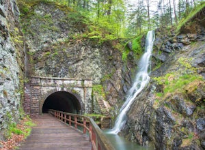
Hike to Paw Paw Tunnel
3.82.4 miThis hike is short and sweet, with it only being 2.4 miles to the other side of the tunnel and back. It's easily accessible, located right off the highway at the Paw Paw Tunnel Campground on the Potamac River at the border of Maryland and West Virgina. The town of Paw Paw is on the West Virgina s...Read more -
Salisbury, Pennsylvania
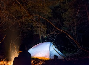
Primitive Camp along Wolf Rocks Trail
3.01.5 mi / 50 ft gainThis is a GREAT location for beginning backpackers with minimal backpacking rules, short trails and cell service. Although all trails (with a few exceptions found in this brochure -labeled as "Areas Closed to Camping") in the Forbes State forest allow primitive backpack camping (primitive backpac...Read more -
Wardensville, West Virginia
White Rocks Loop, George Washington NF
4.59.26 mi / 1690 ft gainThe trail begins near the upper parking area next to a closed gate. If you park in the lower parking area, you'll have to walk about .3 miles up the road to get to this gate. Start out on the forest service (FS) orange-blazed trail, following it for about a quarter mile. From there head onto Old...Read more -
Oakland, Maryland
Hike the Herrington Manor/Swallow Falls Trail
5.011 mi / 25 ft gainI began my adventure at the trailhead in Herrington Manor State Park. The parking lot was empty and the trail was very easy to access. From start to finish this trail varies in the width of its path. For the first mile I had a lot of foot room, but as I went deeper into the forest, the trail turn...Read more -
Wardensville, West Virginia
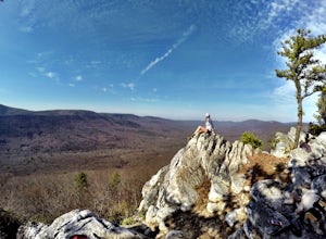
Tibbet Knob via Wolf Gap
5.03.17 mi / 702 ft gainPark for free at Wolf Gap Campground and cross the road where you will pass some picnic tables and campsites. Follow the signs to the yellow-blazed Tibbet Knob trail. In half a mile, there is a little path to a summit on your left where you can catch a glimpse of Mill Mountain and Big Schloss. ...Read more -
Mill Run, Pennsylvania
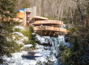
Explore Fallingwater
4.8"Fallingwater is the name of a house built over a waterfall in southwest Pennsylvania. Frank Lloyd Wright, America’s most famous architect, designed the house for his clients, the Kaufmann family. Fallingwater was built between 1936 and 1939. It instantly became famous, and today it is a Natio...Read more -
Ohiopyle, Pennsylvania
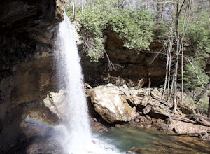
Explore Cucumber Falls
4.30.25 mi / 30 ft gainJust off Kentuck Road, at the southern end of Ohiopyle State Park, you arrive at Cucumber Falls' marked parking lot. Access to this lot is limited (about 20 cars). Most of the time you will be able to find a spot, but when not, parking on the side of the road is perfectly acceptable.Walking down ...Read more -
Davis, West Virginia
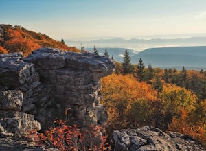
Photograph Bear Rocks Preserve
5.0The Bear Rocks Preserve is a 477 acre land tract maintained and supported by The Nature Conservancy. Offering a diverse range of plant species more commonly seen in the Northeast, visitors will find blueberries, huckleberries, mountain laurel, azalea, and rhododendron among the sandstone outcrop...Read more -
Maysville, West Virginia
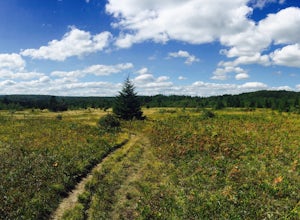
Lions Head Loop
5.020.35 mi / 2195 ft gainWhat used to be an artillery testing site during WWII, Dolly Sods is a great place for backpackers of almost any expertise. Water is easily found throughout the wilderness area and while 21 miles might feel like a lot, it is very manageable over the course of 3 days. Attached (at the bottom) is...Read more -
Mathias, West Virginia
Hike Cranny Crow to Millers Rock Loop
10.6 mi / 2100 ft gainThis is a really good day hike to explore another one of the many fantastic state parks that West Virginia has to offer while avoiding some of the crowds that many of the popular ones have. The main feature of the park is the Cranny Crow Overlook which features views into two Virginia and three W...Read more -
Davis, West Virginia
Bear Rocks and Beaver Dam Loop
6.36 mi / 699 ft gainStarting on Bear Rocks Trail, hike down to the Red Creek. Sometimes water levels can be high, but most of the time you can cross the creek without getting any deeper than your knees. Link up with the Raven Ridge Trail and head south. Enjoy the views through this section, as it's a great place to ...Read more -
Davis, West Virginia
Bear Rocks Loop
4.710.54 mi / 1293 ft gainThis particular hike is great as there are multiple camping sites, both established and backcountry, and views for miles around almost every bend. Still not convinced? This high-altitude plateau has characteristics typically found in Canadian landscapes. so you can travel north without leaving y...Read more -
Davis, West Virginia
Snowshoe or Cross-Country Ski Dolly Sods
8 mi / 1400 ft gainFrom January to April, the forest roads that provide vehicle access to the Dolly Sods Wilderness in West Virginia are closed. If you're up for a cold weather adventure, park your car (in accordance with the signage and without blocking the road) and hike up the Forest Road 75 near Davis, WV, to B...Read more

