Millersville, Maryland
Top Spots in and near Millersville
-
Parkton, Maryland
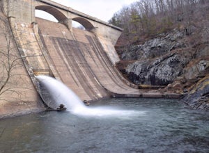
Photograph Prettyboy Dam
4.0Make sure you park in the designated spots located above the Dam. Walk across the Dam road bridge and about mid way stop and take a look over the edge. You will be greeted with the a beautiful view of the valley. To explore more keep walking over the dam bridge and walk down the stairs to view ...Read more -
Great Falls, Virginia
Hike from Riverbend Regional Park to Great Falls National Park
5.02.5 mi / 75 ft gainThis hike utilizes the Potomac Heritage Trail from Riverbend Park to Great Falls National Park. This section is an easy, mostly flat trail that will take you along the Potomac until you reach Great Falls National Park. When you reach Riverbend Park turn right into the parking lot. At the end of t...Read more -
Great Falls, Virginia
Canoe from Algonkian Regional Park to Riverbend Park
4.0Starting at Algonkian Regional Park and ending at Riverbend Park, this 8.5 mile canoe trip is a perfect way to get away from the traffic that is Northern Virginia. Paddling hard, people have completed it in 4 hours. It can easily be turned into an all day trip lasting 8 or more hours, if paddli...Read more -
Potomac, Maryland
Great Falls and the Billy Goat Trail
4.54.61 mi / 272 ft gainJust outside of Washington DC is a great hike and rock scramble you don't want to miss. Great Falls lies in both Virginia and Maryland and has beautiful views of the Potomac River. Start out at the Great Falls Tavern parking lot (Maryland side), and keep in mind it is $10 to park here if you don...Read more -
McLean, Virginia
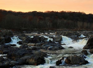
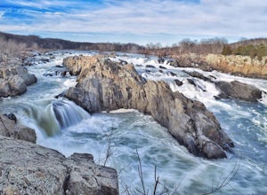
Photograph Great Falls of the Potomac
5.00.69 mi / 131 ft gainViewing Great Falls is easy which makes this adventure great for all levels of adventurers. There is a ~$10 entrance fee, there you will receive a map of the park. There are 3 platforms of viewing Great Falls, each platform has stunning panoramic views. Make sure you do not forget to bring your ...Read more -
McLean, Virginia
Difficult Run, Ridge, and River Trails
4.53.28 mi / 463 ft gainDifficult Run is a popular hiking location right down the street from Great Falls National Park. Starting at the Difficult Run parking lot you head to the trail at the far end of the lot. The trail will split. The green blazes will take you to the left but you can also stay to the right and hike ...Read more -
Street, Maryland
Hike the White Trail
5.03.4 mi / 643 ft gainPark in the lot off of St. Clair Bridge Rd to access the trail. Be aware that some parts of the trail are rocky and/or steep. This trail is dog friendly and is accessible from October through November.Read more -
Bel Air, Maryland
Hike the Deer Creek Trail
5.02 miBecause Palmer State Park is still under development (with no timeline given for its completion), there are only a few trails that meander through this 555-acre reserve. Palmer's official website offers a not-so-helpful topographical map, but the easiest way into the park that I could find was ne...Read more -
Boyds, Maryland
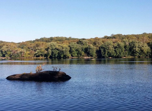
Black Hill Regional Park Loop
5.02.78 mi / 312 ft gainThe Black Hill Regional Park has 1300 acres of oak forests that have views of the Little Seneca Lake. This lake offers a place for visitors to canoe and stand up paddle board. This trail is open to hiking and mountain biking. In addition, dogs are welcome to use the trail but must be on leash a...Read more -
North East, Maryland
Hike to the Turkey Point Lighthouse in Elk Neck SP
3.01.6 mi / 60 ft gainThis hike begins from the parking lot trailhead that is well-marked. Be cautious - parking is limited and may be full on weekends, and the paved road suddenly ends at the parking lot entrance. The path is crushed stone, wide, and relatively flat. Dogs are welcome but must be on leashes. On th...Read more -
Boyds, Maryland
Hike or Bike the Hoyles Mill Trail
9.16 mi / 390 ft gainPark on Clarksburg Road (see map) and head onto the marked trail. It can get muddy at times so pack accordingly. Great for kids, and dog friendly too.Read more -
Pylesville, Maryland
Hike to Kilgore Falls
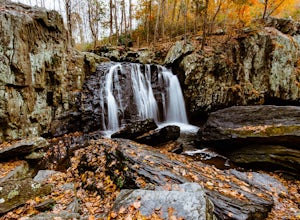
3.81.2 miThis 1.2 mile roundtrip hike leads to the second tallest waterfall in the state of Maryland. It is a short hike that's great for families and bringing the dog. In the warmer months, you can swim in the pool at the base of the waterfall. People have cliff jumped here, but exercise caution and do s...Read more -
North East, Maryland
Hike the White Banks Trail at Elk Neck SP
5.06 miMost people visit Elk Neck to photograph the lighthouse, or access to the Bay (the throttle of speed boats is never far), but don't miss out on the trails. The three mile out-and-back White Banks Trail offers crazy-beautiful views of the Chesapeake as well as a moderately difficult workout. Park ...Read more -
Freeland, Maryland
Hike Hemlock Gorge
5.03.5 mi / 300 ft gainThis is one of Baltimore's little known gems. The area contains an ecosystem which is essentially non-existent outside of the Appalachian mountain regions. It has also been seemingly under-appreciated and abused by locals. I am trusting that the Outbound Collective community will do its part to e...Read more -
Havre de Grace, Maryland
Hike the Susquehanna Ridge Trail at Susquehanna State Park
6 miWhat is it with Harford County and its slew of awesome parks? Nestled in the Northeast corner of Maryland, between the Chesapeake Bay and the river it takes its name from, Susquehanna State Park is gorgeous. A couple miles and a world away from I-95, SSP is expansive and lush. There are 15 miles ...Read more -
Dickerson, Maryland
Hike the Sugarloaf Mountain Trail
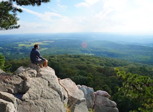
4.76.05 mi / 1509 ft gainPark on Sugarloaf Mountain Drive (as indicated on the map below) to access the trail. It is open from March-November and is dog friendly.Read more

