Freeland, Maryland
Top Spots in and near Freeland
-
Newville, Pennsylvania
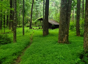
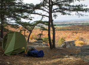
Camp at Tom's Run Shelter
3 mi / 85 ft gainStarting from the small parking area on Bunkerhill Rd, head north (turn right) onto Michaux Rd. After about 1/3 of a mile you will reach the Appalachian Trail where you will want to head west (turn left).This will lead you on a leisurely hike through the woods (follow the white blazes). It won't ...Read more -
North East, Maryland
Hike the Elk Neck State Forest Trails
3.56.6 mi / 450 ft gainPark in the lot (see map) and follow signage for the loop trail. This is not a highly trafficked trail so there may be sections that need some maintenance, but that won't get in the way of completing the hike.Read more -
Smithsburg, Maryland
Hike to Cunningham Falls
4.22.8 miThis 78-foot waterfall, among the largest in the state, is easily accessible by two short trails. Lower Trail (0.5 miles) leads directly to the falls, whereas Cliff Trail (0.75 miles) has slightly more difficult terrain and takes you to a viewing platform. To lengthen the adventure, Hunting Creek...Read more -
Sabillasville, Maryland
Camp at the Adirondack Shelters in Catoctin Mountain Park
5.04 mi / 1200 ft gainFor outdoor enthusiasts, Maryland is an ideal place to live. Between the mountains and the Bay--and the rivers, bike paths, and trails along the way--we couldn't ask for much more. But if we were feeling greedy, we would probably ask for additional backpacking options, right? Of course, there are...Read more -
Sabillasville, Maryland
Hike to High Rock on the Appalachian Trail
4.06 mi / 2000 ft gainStart your hike where the AT crosses Raven Rock Road (Maryland Route 491). This crossing is well-marked from both sides by large, yellow signs and blazed stakes. You will need to park on the side of the road, but the shoulder is wide and can accommodate a crowd. The first half mile or so of this...Read more -
Carlisle, Pennsylvania
Hike to the Cumberland Valley Overlook
4.06 miThis hike is steep at points but the climb up the mountain has lots of switchbacks so it isn't just straight up. The hike is beautiful and during the summer there are lots of blackberry and raspberry bushes along the trail that we stopped to snack on. The Overlook is just before you crest the top...Read more -
7, Smithsburg, Maryland
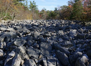
Hike to Devil's Racecourse on the Appalachian Trail
4.53 mi / 1500 ft gainStart your hike where the AT crosses Raven Rock Road (Maryland Route 491). This crossing is well-marked from both sides by large, yellow signs and blazed stakes. You will need to park on the side of the road, but the shoulder is wide and can accommodate a crowd. The first half mile or so of this...Read more -
Marysville, Pennsylvania
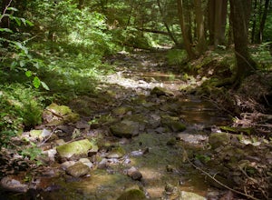
Hike Trout Run
1.01 miHike along the creek for about a half mile, we stop where the trail meets the stream and let the kids play in the water for a bit and then head back. There are 2 large pull-off parking areas alongside of the road. The spot is exactly 3.7 miles from Adventure Park in Mechanicsburg. If you are unfa...Read more -
Montgomery Village, Maryland
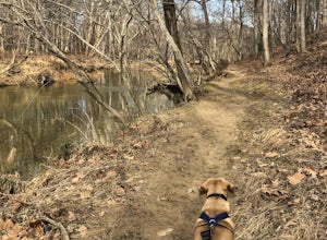
Hike the Seneca Creek Greenway Trail Upper Section
5.014.86 mi / 836 ft gainPark in the lot off of Watkins Mill Road to access the trail. This hike is dog friendly and is accessible from March until November.Read more -
Chambersburg, Pennsylvania
Rock Climb at White Rocks
White Rocks, a segment of the slightly larger Pond Bank area, is a single pitch top rope or traditional climbing area. To get there, follow 30 until you are a few miles west of Caledonia State park and reach an intersection of 997. You can then head south on 997 until you reach White Rock Road. ...Read more -
Derwood, Maryland
Hike, Bike, or Run the Lakeside Trail and Muncaster Mill Trail
4.53.41 mi / 196 ft gainPark at the Meadowside Nature Center to Access the trailhead. This is a 3.4 mile loop with opportunities for birding and observing wildlife. Dogs are welcome on leash.Read more -
Laurel, Maryland
Hike the South Tract Trails at Patuxent Research Refuge
5 miFrom the visitors center, start on the Fire Road trail. From there, it's a choose-your-own adventure (choose-your-own ecosystem, actually). Pick the Laurel and Valley Trails to stay in the quiet (and maybe enchanted? It felt enchanted) forest. Goose Pond trail is a short jut to a--yup--pond, wher...Read more -
Marysville, Pennsylvania
Hike to the Susquehanna Overlook
3.57 miOnce you reach the power lines, about a mile after cresting the top of the mountain you can look one way and you’ll see the Susquehanna River. Look the other way, and you’ll see beautiful woods and farm fields in Perry County. Return by the same route for a total of about 7 miles.Parking is at th...Read more -
Boyds, Maryland
Black Hill Regional Park Loop
5.02.78 mi / 312 ft gainThe Black Hill Regional Park has 1300 acres of oak forests that have views of the Little Seneca Lake. This lake offers a place for visitors to canoe and stand up paddle board. This trail is open to hiking and mountain biking. In addition, dogs are welcome to use the trail but must be on leash a...Read more -
Dickerson, Maryland
Hike the Sugarloaf Mountain Trail
4.76.05 mi / 1509 ft gainPark on Sugarloaf Mountain Drive (as indicated on the map below) to access the trail. It is open from March-November and is dog friendly.Read more -
Newark, Delaware
Hike the PennDel Trail at White Clay Creek SP
5.01.9 mi / 0 ft gainWhite Clay Creek State Park is a large expanse of beautiful woods and streams with over 37 miles of trails. The PennDel Trail follows White Clay Creek and winds through the hardwood forests. The PennDel Trail actually begins at the Pennsylvania state line, but the easiest way to access the trail...Read more

