Ellicott City, Maryland
Top Spots in and near Ellicott City
-
McLean, Virginia
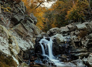
Scott's Run Nature Preserve Loop
4.22.51 mi / 397 ft gainThis nature preserve can be hiked year-round and is a sanctuary for rare wildflowers, birds, and other wildlife including deer and fox. There are six main interconnecting trails that run through the preserve; winding their way around matured hardwood forest, sheer bluffs, and rocky cliffs overloo...Read more -
McLean, Virginia
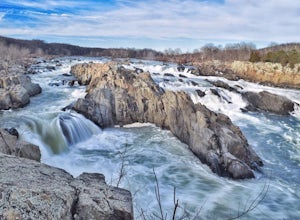
Photograph Great Falls of the Potomac
5.00.69 mi / 131 ft gainViewing Great Falls is easy which makes this adventure great for all levels of adventurers. There is a ~$10 entrance fee, there you will receive a map of the park. There are 3 platforms of viewing Great Falls, each platform has stunning panoramic views. Make sure you do not forget to bring your ...Read more -
McLean, Virginia
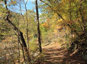
Difficult Run, Ridge, and River Trails
4.53.28 mi / 463 ft gainDifficult Run is a popular hiking location right down the street from Great Falls National Park. Starting at the Difficult Run parking lot you head to the trail at the far end of the lot. The trail will split. The green blazes will take you to the left but you can also stay to the right and hike ...Read more -
Dickerson, Maryland
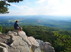
Hike the Sugarloaf Mountain Trail
4.76.05 mi / 1509 ft gainPark on Sugarloaf Mountain Drive (as indicated on the map below) to access the trail. It is open from March-November and is dog friendly.Read more -
Falls Church, Virginia
Bike the W&OD Trail
45 miThe Washington and Old Dominion (W&OD) trail stretches through northern Virginia and is a great spot for bike riding, running, or walking. The trail is paved, well maintained, and wide enough for traffic in both directions. There are also a couple breweries along the way that you can make a f...Read more -
Street, Maryland
Hike the White Trail
5.03.4 mi / 643 ft gainPark in the lot off of St. Clair Bridge Rd to access the trail. Be aware that some parts of the trail are rocky and/or steep. This trail is dog friendly and is accessible from October through November.Read more -
Wildlife Trail Parking Area, Maryland
Explore Eastern Neck National Wildlife Refuge
1 miAlthough the trails at Eastern Neck may be small in size (the longest is just over a mile) they're big on sights. It's practically impossible to visit the refuge and not see wildlife, particularly the dizzying number of avian species here. Visit during the winter to see the majestic Tundra Swan, ...Read more -
Pylesville, Maryland
Hike to Kilgore Falls
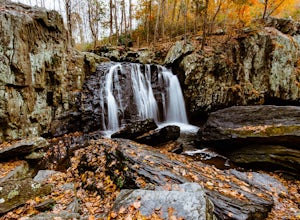
3.81.2 miThis 1.2 mile roundtrip hike leads to the second tallest waterfall in the state of Maryland. It is a short hike that's great for families and bringing the dog. In the warmer months, you can swim in the pool at the base of the waterfall. People have cliff jumped here, but exercise caution and do s...Read more -
Bel Air, Maryland
Hike the Deer Creek Trail
5.02 miBecause Palmer State Park is still under development (with no timeline given for its completion), there are only a few trails that meander through this 555-acre reserve. Palmer's official website offers a not-so-helpful topographical map, but the easiest way into the park that I could find was ne...Read more -
Alexandria, Virginia
Run or Bike the Dyke Marsh Wildlife Preserve
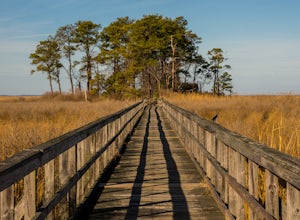
3 miStart your adventure at the Belle Haven Parking area then head down the Dyke Marsh Trail. To add on additional distance, head south down the Mt. Vernon Trail for more views, well maintained paths, and even some sitting areas. You'll find boardwalks that take you right across the marsh, so keep an...Read more -
Stevensville, Maryland
Bike or Run the Kent Island South Trail
12 mi / 20 ft gainRun, bike, walk or use any other means to travel this paved route from the Romacoke Pier Park up to the Metapeake Public Beach. 6 miles one way, this path is paved the entire way and stays off the main road. Public parking at either end and beautiful views of the bay. The path winds through fo...Read more -
Spring Grove, Pennsylvania
Hike the Ranger Trails at Codorus State Park
4.05 miI'll be honest. I wasn't expecting much from Codorus State Park. But, my Saturday was open and I wanted to go somewhere I wouldn't have to fight for legroom. I didn't need anything majestic--just some space. Codorus, centrally located in the picturesque hills of York County, PA, seemed to fit the...Read more -
Sterling, Virginia
Washington & Old Dominion Trail and Broadlands Ramble
5.019.55 mi / 863 ft gainWashington & Old Dominion Trail and Broadlands Ramble is a point-to-point trail where you may see local wildlife located near Ashburn, Virginia.Read more -
Dickerson, Maryland
Hike along the C&O Canal: Whites Ferry to Edwards Ferry
5.010 mi / 165 ft gainPark in the lot on Whites Ferry road and hop on the Chesapeake Ohio towpath. This is an out-and-back so you can make it as short as you want or up to 10 miles. Great for familes and dog friendly!Read more -
Leesburg, Virginia
Hike the Red Rock Wilderness Overlook Loop
5.01.2 mi / 100 ft gainRed Rock Wilderness Overlook provides 60+ acres of trails to explore right in Leesburg, Virginia. The site is home to some ruins and buildings from the late 1800's and is a wonderful spot for picnics, hiking, trail running, and geocaching.The preferable loop is to take the trail that leads straig...Read more -
Knoxville, Maryland
Explore Point of Rocks/ Potomac River Overlook
4.00.2 mi / 95 ft gainPark at the Chesapeake and Ohio Canal parking lot. Walk to the US 15 and cross the road. Trail is not marked, though its faint traces can be detected as you continue on. GPS is recommended. Enjoy the overlook and when you're ready to go back, retrace your steps.Read more

