Southwest Harbor, Maine
Looking for the best photography in Southwest Harbor? We've got you covered with the top trails, trips, hiking, backpacking, camping and more around Southwest Harbor. The detailed guides, photos, and reviews are all submitted by the Outbound community.
Top Photography Spots in and near Southwest Harbor
-
Bar Harbor, Maine
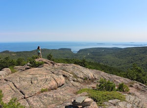
Explore Cadillac Mountain
4.80.35 miSeeing the sunrise on top of Cadillac Mountain is an absolute must when in Acadia National Park. Not only is it awesome to catch the first sunrise in the U.S., but the views from Cadillac Mountain are unparalleled. At 1,532 feet, Cadillac Mountain is the highest point along the North Atlantic sea...Read more -
Mount Desert, Maine
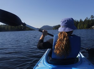
Kayak Long Pond
You can reach the northern shore of Long Pond by following 102 South until you reach Somesville. A few miles past this you will notice a Kayak Rental shop on your right and Whitney Farm Road. You can park near here and utilize the shore to put your kayak in, or you can rent from the shop. A pu...Read more -
Mount Desert, Maine
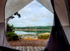
Camp at Mount Desert Campground on Somes Sound
5.0Being in the center of Mt. Desert Island, you are just a quick drive to Acadia National Park and Bar Harbor.This campground offers waterfront and off-waterfront sites. The waterfront is right along Somes Sound and offers amazing views at anytime of the day. We went during off season (no reserva...Read more -
Bar Harbor, Maine
Summit Dorr Mountain via the Ladder Trail
5.03.6 mi / 1100 ft gainTo find the trail head, drive out of Bar Harbor down Route 3. There are no signs for the trailhead or for parking, so as soon as you pass Tarn Lake on the right, you can pull off and park on the side of the road. Elevation on the ladder trail starts immediately and doesn't let up until you reach...Read more -
Bar Harbor, Maine
Precipice Trail of Champlain Mountain
5.02.0 mi / 1000 ft gainThe Precipice Trail is one of the most well known trails in Acadia, probably for its difficulty and the fact that it is along the exposed edge of Champlain Mountain. Much of this trail is more of a climb rather than a usual hike. You will have to climb and scramble over large rocks as well as c...Read more -
Bar Harbor, Maine
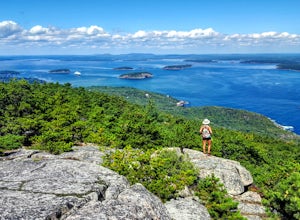
Cadillac North Ridge Trail
5.04.15 mi / 1530 ft gainThe Cadillac North Ridge Trailhead is accessible through Paradise Hill Road once you enter the park through the Hulls Cove Entrance. When driving on route 3 in Bar Harbor, keep an eye out for a sign that says "Acadia National Park Hulls Cove Entrance, Visitor Center Right Lane". Stay in the right...Read more -
Bar Harbor, Maine
Bar Island Trail
5.01.9 mi / 160 ft gainThe Bar Island Trail is something I was a little hesitant to do at first, mainly because of my tendency to wander and take a lot longer on a trail than I anticipated. This trail is unique in that you can only access it and Bar Island at low tide by foot (crossing the sand bar) or if you have 4-wh...Read more -
Bar Harbor, Maine
Walk the Bar Harbor Shore Path
4.01.21 mi / 30 ft gainThe Bar Harbor shore path is a simple walking trail that runs along the eastern shore of Mt. Desert Island. There's little to no elevation change since it's on the water's edge, but the views of this picturesque harbor are always worthwhile. Despite being a mellow walk, this is something you re...Read more -
Winter Harbor, Maine
Ravens Nest, Schoodic Peninsula
4.50.12 mi / 20 ft gainRavens Nest is located east of Mt Desert Island south of Winter Harbor Maine. Taking the Schoodic Loop Road will get you to the pull off that you need to find Ravens Nest. There will be three pull offs on the side of the road, the third one will be for Ravens Nest that has a little unmarked trail...Read more -
Blue Hill, Maine
Hike Blue Hill Mountain
2 mi / 600 ft gainThere are two main trailheads to access the mountain, both of which have various ways of getting up. One easy trail that has only a few steep sections is the Osgood trail. Start by parking at the Osgood parking lot. Cross the street, and follow the well marked trail up. Cross a small bridge, and ...Read more -
Isle au Haut, Maine
Camp at Acadia National Park's Duck Harbor
8.85 mi / 150 ft gainIntroduction Didn't think there was backpacking to be done in Acadia National Park? Think again! Isle au Haut (pronounced "isle ah ho") is a little island off of Stonington, Maine. Half of the island is a quiet and quaint New England island community and the other half is part of Acadia Natio...Read more -
Camden, Maine
Hike Mount Megunticook in Camden Hills State Park
2.9 mi / 1000 ft gainAfter driving in to Camden Hills State Park, there is a fork where you can go straight (to the campgrounds) or left (to head up Mount Battie). Take a left and then park in the parking lot immediately on your right. That is the trailhead to Mount Megunticook! The trail itself winds through the tre...Read more -
Camden, Maine
Explore Mount Battie
5.01.5 mi / 669 ft gainThe summit of Mount Battie is accessible from either the front trail that is located just outside of the state park, or there is an auto road that leads up to the summit within the park (the location drop pin reflects the route within the park). To access the front trail, the trailhead is on moun...Read more -
Roque Bluffs, Maine
Hike the Roque Bluffs State Park Loop
2.1 mi / 187 ft gainThere are several short trails within the park that loop upon each other, so there are several different routes you could take. We chose the Houghton's Hill trail (which is a total of ~1 mile) and looped up with Pond Cove trail (also ~1 mile) by taking Millhill trail. The entire loop ended up bei...Read more -
Orono, Maine
Walk along the Orono Bog Boardwalk
1.5 mi / 19 ft gainTo access the boardwalk you must park in the Bangor City Forest. From closest parking lot in Bangor its about .25 mile walk to the entrance. Take the trail on the far right of parking. You will eventually come across a small station with an information kiosk. The start of the boardwalk is behind ...Read more


