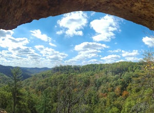
The Best Backpacking in Olive Hill
Looking for the best backpacking in Olive Hill? We've got you covered with the top trails, trips, hiking, backpacking, camping and more around Olive Hill. The detailed guides, photos, and reviews are all submitted by the Outbound community.
Top backpacking spots in and near Olive Hill
-
Morehead, Kentucky
Sheltowee Trace NRT - Northern Terminus to Cave Run Lake
38.17 mi / 3760 ft gainSheltowee Trace NRT - Northern Terminus to Cave Run Lake is a point-to-point trail that takes you by a waterfall located near Morehead, Kentucky.Read more -
Morehead, Kentucky
Sheltowee Trace Northern Terminus to Morehead Conference Center
25.08 mi / 2631 ft gainSheltowee Trace Northern Terminus to Morehead Conference Center is a point-to-point trail that takes you by a lake located near Muses Mills, Kentucky.Read more -
Blue Creek, Ohio
Shawnee Backpacking Trail Camp 6 Loop
7.61 mi / 1148 ft gainShawnee Backpacking Trail Camp 6 Loop is a loop trail where you may see beautiful wildflowers located near Stout, Ohio.Read more -
Salt Lick, Kentucky
Sheltowee Trace Cave Run to Pinch Em Tight Campground
31.34 mi / 4656 ft gainSheltowee Trace Cave Run to Pinch Em Tight Campground is a point-to-point trail where you may see beautiful wildflowers located near Salt Lick, Kentucky.Read more -
West Portsmouth, Ohio
Shawnee Backpacking Trail Loop
8.55 mi / 981 ft gainShawnee Backpacking Trail Loop is a loop trail where you may see local wildlife located near West Portsmouth, Ohio.Read more -
West Portsmouth, Ohio
Shawnee State Park North Loop
19.82 mi / 3806 ft gainShawnee State Park North Loop is a loop trail where you may see beautiful wildflowers located near West Portsmouth, Ohio.Read more -
Wellington, Kentucky
Copperas Falls
3.77 mi / 397 ft gainCopperas Falls is an out-and-back trail that takes you by a waterfall located near Campton, Kentucky.Read more -
Pine Ridge, Kentucky
Indian Staircase and Adena Arch Loop
2.27 mi / 656 ft gainIndian Staircase and Adena Arch Loop is a loop trail that takes you through a nice forest located near Denniston, Kentucky.Read more -
Pine Ridge, Kentucky
Indian Staircase Trail
3.02 mi / 787 ft gainIndian Staircase Trail is a loop trail where you may see beautiful wildflowers located near Pine Ridge, Kentucky.Read more -
Pine Ridge, Kentucky
Indian Staircase to Pinch Em Tight Ridge Loop
17.1 mi / 3425 ft gainIndian Staircase to Pinch Em Tight Ridge Loop is an out-and-back trail that takes you by a river located near Frenchburg, Kentucky.Read more -
Pine Ridge, Kentucky
Bison Way, Indian Staircase, Sheltowee, Rough and Swift Camp Creek Trail
16.04 mi / 3301 ft gainBison Way, Indian Staircase, Sheltowee, Rough and Swift Camp Creek Trail is a point-to-point trail that takes you by a river located near Frenchburg, Kentucky.Read more -
Pine Ridge, Kentucky
Bison Way Trail 210
5.6 mi / 925 ft gainBison Way Trail 210 is an out-and-back trail where you may see beautiful wildflowers located near Frenchburg, Kentucky.Read more -
Frenchburg, Kentucky
Gray's Arch via Sheltowee Trace National Recreation Trail
10.39 mi / 1706 ft gainGray's Arch via Sheltowee Trace National Recreation Trail is a loop trail that takes you through a nice forest located near Pine Ridge, Kentucky.Read more -
Frenchburg, Kentucky
Sheltowee Trace: Red River Gorge
12.33 mi / 2133 ft gainSheltowee Trace: Red River Gorge is a point-to-point trail that takes you by a lake located near Pine Ridge, Kentucky.Read more -
Frenchburg, Kentucky
Red River Gorge East Loop
8.46 mi / 1358 ft gainRed River Gorge East Loop is a loop trail that takes you by a river located near Frenchburg, Kentucky.Read more -
Campton, Kentucky
Rock Bridge and Lower Swift Camp Creek Trail
4.05 mi / 738 ft gainRock Bridge and Lower Swift Camp Creek Trail is a loop trail that takes you by a waterfall located near Campton, Kentucky.Read more