Oglesby, Illinois
Looking for the best hiking in Oglesby? We've got you covered with the top trails, trips, hiking, backpacking, camping and more around Oglesby. The detailed guides, photos, and reviews are all submitted by the Outbound community.
Top Hiking Spots in and near Oglesby
-
Oglesby, Illinois
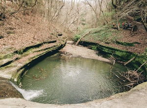
Hike the Matthiessen State Park Loop
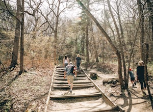
4.85.8 miWith 5 miles of trails, which alternate between cliffs, canyons, and bluffs, Matthiessen State Park has plenty to offer. This particular trail also includes three waterfalls, along the way. From the Dells Area parking lot, head down the steps next to the log fort replica. At the 4-way junction tu...Read more -
Oglesby, Illinois
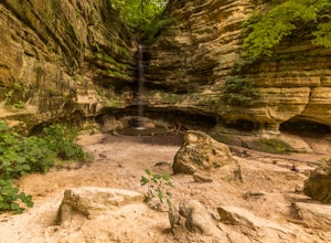
Hike the Lower Dells at Matthiessen State Park
4.83.5 mi / 250 ft gainStarting off right from the parking lot at Matthiessen State Park, follow the trail markers through the forest, across beautiful bridges, and find your way to one of the many stunning waterfalls. Depending on when you go, the water level will vary greatly. During the summer months the water level...Read more -
Oglesby, Illinois
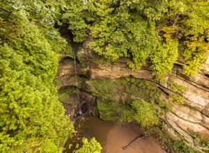
Hike the Upper Dells of Matthiessen State Park
4.32.2 mi / 627 ft gainFrom the start of the parking lot you will cross a picnic area to your left where you can have a bite to eat before or after your hike. The trailhead starts off with a couple flights of stair leading you down to the bridge. After taking in the spectacular views at the top of the waterfall you wil...Read more -
Oglesby, Illinois
Red River Loop
2.57 mi / 266 ft gainThe Red River Loop in Matthiessen State Park River Area runs alongside the Vermillion River and is typically used by hikers, walkers, and those wishing to see unique birds. The Red River Trail is open for use year-round. The trail winds through beautiful canyons, streams, prairies, and forests in...Read more -
Oglesby, Illinois
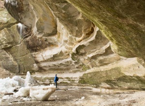
Hike to St. Louis Canyon at Starved Rock State Park
5.03 miStarved Rock has some very interesting rock formations you can explore. The valley was formed by a series of floods as glacial melt waters broke through moraines, sending torrents of flood water surging across the land that eventually eroded the sandstone and sedimentary rock. If you arrive in ...Read more -
Oglesby, Illinois
Hike Ottawa Canyon at Starved Rock State Park
5.03.9 miThis canyon is not as popular as some of the others in this park but it is my favorite by far. You can either hike the full 3.9 miles from the visitor center or you can jump in your car and head over to one of the parking lots on the east side for a shorter hike. Either way you will not be disap...Read more -
Oglesby, Illinois
Hike to Starved Rock's La Salle Canyon
4.34.4 mi / 370 ft gainThis out-and-back trail is one of the parks longest trails. Starting from the visitors center it is 2.2 mile hike one way and 4.4 miles if you go out and back. The trail is very much worth the long trek. You enjoy the views and fresh air of the Illinois river. You will also walk past the Illinois...Read more -
Oglesby, Illinois
Hike to Wildcat Canyon at Starved Rock SP
4.52 miIf you happen to find yourself in the Chicagoland area be sure to check out the Wildcat Canyon hike at Starved Rock State Park. This is a 2 mile out and back hike from the visitor's center that leads to the largest waterfall in the park. There are two viewpoints from the top of the canyon or yo...Read more -
Oglesby, Illinois
Hike Starved Rock's French Canyon
4.50.4 miStarting from the visitors center or the parks restaurant, depending on where you parked. If you were forced to park by the restaurant because of a busy day, you will start the trail head with a map of the park. You will follow the tallest stairs of the park down to the visitors center where the ...Read more -
Franklin Grove, Illinois
Explore the Nachusa Grasslands
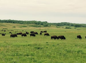
The Nachusa Grasslands is a wildlife restoration and recreational area located near Franklin Grove, Illinois that contains several hiking trails through prarie land with over 700 native plant species and features a 1500 acre enclosure for a bison heard that inhabits the preserve. The land is cur...Read more -
Wilmington, Illinois
Hike the Twin Oaks and Bunker Field Trail
4.2 mi / 85 ft gainThe trail is open for use year-round, and is great for snowshoeing in winter months. This trail allows dogs, but please keep your dog on a leash throughout the duration to avoid disturbing the wonderful bison. Be weary of ticks - bring bug spray for you and your dog.Read more -
Elwood, Illinois
Buffalo Viewing Trail
5.03.65 mi / 72 ft gainThe trail features chances to see bison, and scenic wild flowers. The Buffalo Viewing Trail is in Midewin National Tallgrass Prairie, and is open year-round. Dogs are allowed on this trail but must be kept on leash. Old army bunkers are scattered along the trail. The trail winds through a prairi...Read more

