Arco, Idaho
Top Spots in and near Arco
-
Arco, Idaho
Devil's Orchard
3.00.52 mi / 16 ft gainThe Devil's Orchard is a quick, family friendly stroll through unique volcanic scenery. If you follow the road past the entrance to Craters of the Moon National Monument, the road to Devil's Orchard will be on your left, marked by a sign. You'll drive a minute or two before reaching the parking l...Read more -
Arco, Idaho
Craters of the Moon Crater Trail
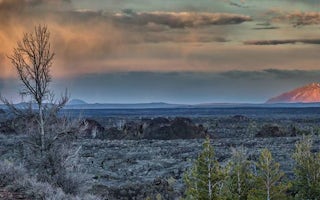
4.01.84 mi / 69 ft gainCraters of the Moon National Monument in Southern Idaho is a vast ocean of lava flows, with scattered islands of cinder and splatter cones created by volcanic activity 15,000 years ago. Over 618 square miles, this surreal field displays the strange geography that can be caused by significant erup...Read more -
Arco, Idaho
Bike the Loop Road at Craters of the Moon National Monument
7 mi / 500 ft gainBiking Crater of the Moon National Monument's seven mile loop road provides an intimate experience through a wild landscape.Park at the Visitor's Center. Grab a map and check out the interactive display explaining how Craters of the Moon was formed in the same tectonic event that birthed Yellowst...Read more -
Arco, Idaho
Backcountry Ski on a Cinder Cone at Craters of the Moon
2 mi / 500 ft gainCraters of the Moon National Monument is 1100 square miles of basalt lava and sagebrush. It looks like another planet: desolate in macro, beautiful in micro. Craters is most popular in the summer, when visitors from nearby Sun Valley arrive to hike on sun-baked lava hot enough to melt their shoes...Read more -
Arco, Idaho
Hike the North Crater Trail
4.03.5 mi / 666 ft gainOne of the longest hikes at Craters (none of them are very long), the North Crater trail boasts a view of beautiful red and orange rock along the ridgeline of some massive volcanic craters. You can start the trail from either end—at the campground parking lot near the entrance to the park or at t...Read more -
Arco, Idaho
Hike the Inferno Cone
4.01 mi / 500 ft gainTo reach the parking lot at the Inferno Cone Trailhead enter the Craters of the Moon National Monument at the main entrance on the north side of the park off US Highway 26 and go approximately 1.5 miles on the 17 miles Loop Road. There will be clear signage indicating the parking lot at the base ...Read more -
Arco, Idaho
Hike the Tree Molds Trail
2 mi / 100 ft gainThe trail starts at the parking lot with bathrooms, bike rack and picnic table at the trailhead. Trailhead coordinates (43°25'40.5"N 113°32'55.3"W)It winds its way along a pretty flat and straight path through desert pine forest along the edge of a lava floe. It passes a small crater which is sur...Read more -
Mackay, Idaho
Hike to the Shay Trestle
2 mi / 200 ft gainMine Hill Tour is a self-guided driving tour focused on Mackay's mining history. Stops showcase artifacts of the once-vibrant towns that housed miners and their families.Much of the tour is available to passenger vehicles. Begin by picking up a Mine Hill Tour map from any local merchant in Mackay...Read more -
Mackay, Idaho
Hike to Bear Creek Lake
5.06 mi / 1600 ft gainThe trailhead starts at the end of an old jeep trail. If you are brave with your 4 wheel drive you can drive to here and cut 1.4 miles off your hike. My mile counting started at the trail head. The trail is very well marked. At about 0.3 miles it crosses Bear Creek. In the summer this will often ...Read more -
Craters of the Moon NM & PRES, Idaho
Hike to Indian Tunnel at Craters of the Moon
1.6 mi / 75 ft gainIndian Cave is the largest cave or tube, measuring 30 feet tall and 800 feet long with several massive skylights. The skylights provide so much sunlight, a flashlight isn’t necessary, but is helpful in some areas. In order to enter the caves you will need to acquire a free permit at the visit...Read more -
Mackay, Idaho
Hike to Lower Cedar Springs
4.53.4 mi / 200 ft gainThis is one of the easiest, yet scenically rewarding, hikes in the Lost River Range. Traveling only 1.2 miles (3.4 miles round trip) with an elevation gain of about 200 ft. You travel in a canyon surrounded by some of the highest mountains in Idaho. Mt. McCaleb is the giant 11,682 ft peak on the ...Read more -
Mackay, Idaho
Hike Mount McCaleb
4 mi / 3500 ft gainMt. McCaleb's beautiful south face towers over the little town of Mackay, Idaho. The domineering peak is seen from US-93 just waiting to be climbed. It's a part of the Lost River Range, which boasts seven of Idaho's nine 12K-foot peaks; at 11,682 feet tall, McCaleb is Idaho's 34th highest peak.Th...Read more -
Mackay, Idaho
Climb Mt. Breitenbach
8 mi / 4600 ft gainDirections to the "trailhead": From Mackay, Idaho take Highway 93, approximately 2 miles past Mackay reservoir, turn right on Upper Cedar Creek road (FS rd 127). Follow this road straight toward the mountains. There will be a number of cattle gates to go through. About 3 miles up, the road crosse...Read more -
Hailey, Idaho
Hike to Johnstone Pass
5.05.4 mi / 2200 ft gainJohnstone Pass is a diamond in a valley flush with hidden gems.Turn east onto East Fork Big Wood River Road from Highway 75. Continue through the defunct mining town of Triumph where the road turns to dirt and becomes Forest Service Road 118. At the fork stay right. Pass the Sawmill and Federal G...Read more -
Mackay, Idaho
Backpack through Surprise Valley to Lake 10148
4.013 mi / 2900 ft gainI have a hard time getting the word "legendary" out of my mind when referencing this hike. I liked it that much. The trailhead begins at 7200'; be prepared to drive 20 miles on a maintained gravel road to get there. The first 3 miles of this out-and-back hike are pretty flat, meandering through ...Read more -
Mackay, Idaho
Climb Mount Borah
4.87.5 mi / 5200 ft gainRising high above the sage brush covered landscape, Mount Borah is the tallest mountain in Idaho and is referred to as the "roof of Idaho." This behemoth is part of the Lost River Range in the central part of the state. The strongest earthquake in Idaho occurred along the fault line in 1983 and r...Read more
Top Activities
Visit Idaho
Idaho is a picturesque state filled with beautiful scenery and warm, wonderful people. It's an ideal destination for family travelers, outdoor enthusiasts, adventure seekers, or those just looking for a relaxing getaway.
Learn MoreCamping and Lodging in Arco

Arco, Idaho
Craters of the Moon / Arco KOA Journey
This award-winning campground sits at the edge of the Lost River Range and Mount Borah (Idaho's tallest mountain). The campground is only...

Moore, Idaho
Craters Of The Moon Group Campground
Overview
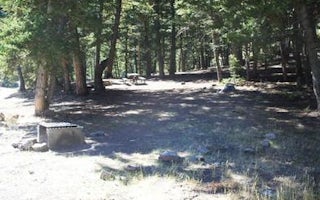
This secluded camping area at Craters of the Moon National Monument is the perfect spot for organized groups. It is available by...

Mackay, Idaho
Loristica Group Campground
Overview
Loristica Group Campground is located in a wooded meadow high in the Lost Creek Range, in eastern Idaho. It sits at an elevation...

Mackay, Idaho
Copper Basin Guard Station
Overview
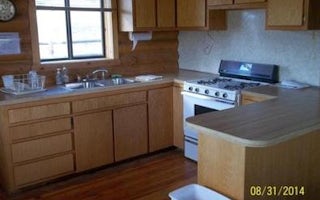
Copper Basin Guard Station is located in Copper Basin, a rugged and beautiful area in the Pioneer Mountains of south-central Ida...


