LaFayette, Georgia
Looking for the best chillin in LaFayette? We've got you covered with the top trails, trips, hiking, backpacking, camping and more around LaFayette. The detailed guides, photos, and reviews are all submitted by the Outbound community.
Top Chillin Spots in and near LaFayette
-
Rising Fawn, Georgia
Camp at Cloudland Canyon State Park
4.8If you're looking to camp somewhere with exceptional hiking and beautiful waterfalls, Southeastern Tennessee locals know not to look further than Lookout Mountain. Located on the western edge, Cloudland Canyon State Park straddles Sitton Gulch Creek and is perfect for a weekend exploration.If sta...Read more -
Rising Fawn, Georgia
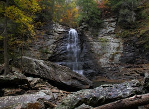
Hike the West Rim Trail to Cherokee Falls
4.54.77 mi / 814 ft gainGood luck finding something you dislike about Cloudland Canyon State Park - one of Georgia's largest and most scenic parks. Sitting on the western edge of Lookout Mountain, it is home to a plethora of luscious trails, easily-accessible campgrounds or yurts, and flowing waterfalls. The West Rim L...Read more -
Lookout Mountain, Georgia
Explore Lula Lake Land Trust
3.93.4 mi / 459 ft gainLula Lake Land Trust may only be accessible on the first and last Saturday of every month, but a visit to this North Georgia park is well worth planning for. It offers a small, but beautiful lake, a large waterfall, and over 6 miles of trails for hiking or biking. The 1-mile level gravel road fro...Read more -
Mentone, Alabama
Hike to the Base of DeSoto Falls
4.80.7 mi / 285 ft gainThe main visitor entrance to DeSoto Falls in Mentone, AL provides easy, paved trails along the upper rim of the falls. For a more private an intimate view, there is a pull off on the side of the road and trail access. Heading south on AL Hwy 89, take a left turn on Dekalb Country Road 613. Afte...Read more -
Chattanooga, Tennessee
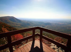
Relax at Sunset Rock
4.3Sunset Rock provides spectacular access to the Bluff and Gum Spring Trails for hiking, is home to some of the top trad climbing routes in the area, and is perfect for residents and visitors alike who are seeking a great view of the Chattanooga area. Parking is allowed in a tiny lot provided on We...Read more -
Lookout Mountain, Tennessee
Photograph Moccasin Bend From Point Park
4.0Located in Chickamauga & Chattanooga National Military Park, Point Park is a ten acre memorial park that overlooks the Lookout Mountain Battlefield and the city of Chattanooga. There is a paved walking path around the park that takes visitors by several historic tablets, monuments, confederat...Read more -
Chattanooga, Tennessee
Bike or Run the Tennessee Riverwalk
4.013 miThe Tennessee Riverwalk is a part of the Tennessee Riverpark System that features the Coolidge Park, Renaissance Park, Ross's Landing, and the Walnut Street Bridge, all jewels of downtown Chattanooga. It is a networks of boardwalks, bridges, and paved pathways that runs alongside the Tennessee Ri...Read more -
Chattanooga, Tennessee
Stroll Chattanooga's Walnut Street Bridge
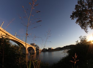
5.0Chattanooga's Walnut Street Bridge was once almost demolished, but instead it was revitalized to be one of the longest pedestrian bridges in the world. Connecting the Downtown Arts District to Northshore's Frazier Avenue, this bridge hosts visitors and locals year round. Whether you walk, bike, o...Read more -
Chattanooga, Tennessee
Park Day at Renaissance Park
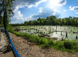
4.0Renaissance Park is a 23-acre urban wetlands park, snuggled between the Market Street Bridge and Cherokee Blvd. on Chattanooga's North Shore. This pet-friendly park features nature trails, an outdoor pavilion, public art, and more. If you're smart, you'll bring some broken down cardboard and slid...Read more -
Chattanooga, Tennessee
Mountain Bike Raccoon Mountain
5.0Raccoon Mountain is an extensive, yet newer system of singletrack that circle the TVA Raccoon Mountain pumped storage facility, just 15 minutes east of downtown. The 30 miles of trails primarily span from intermediate to advanced levels, but a few beginner friendly routes can be found as well.Gra...Read more -
Chattanooga, Tennessee
Hike and Swim at the Middle Creek Slide
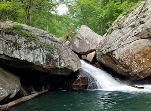
3.04 mi / 200 ft gainYou park just west of the map waypoint on the wide shoulder (remember to lock your car, thefts have been reported in this area). The trailhead is really just an opening on the side of the road. Follow this to the creek and start making your way along the rocks upstream. The difficulty of the cl...Read more -
Fort Payne, Alabama
Swim at Little Falls (Martha's Falls)
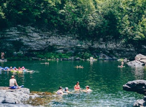
4.41.5 miLittle Falls, also referred to as Martha Falls and the “Hippie Hole” by the locals, is a popular swimming hole a part of Little River Canyon National Preserve, located along the state line of Alabama and Georgia. Perks include free parking and free admission. Drive up Lookout Mountain and pull i...Read more -
Signal Mountain, Tennessee
Hike to Rainbow Falls
4.75.7 mi / 1500 ft gainMost Rainbow Lake Trail hikers have seen or heard the majestic Rainbow Falls, but fewer have ventured down the treacherous path to the falls themselves. Albeit a bit daunting, especially if there has been recent rain, the path from Rainbow Lake Trail down to Rainbow Falls is a rewarding trek for ...Read more -
Chatsworth, Georgia
Hike the West Overlook Trail and CCC Stone Tower Trail Loop
4.71 mi / 200 ft gainFort Mountain State Park is filled with horse trails, biking trails, walking trails, camping sites, and a lake. Once you arrive at the park you pay a $5 entrance fee and will receive a park map. While visiting I walked the West Overlook Trail and came back down the CCC Tower Trail. This is a 1 mi...Read more -
Soddy-Daisy, Tennessee
Hike the Hogskin Loop to Stripmine Falls
2.51.3 miStripmine Falls is not the biggest waterfall in the area, but it is both beautiful and accessible with just a short and easy out-and-back (or loop) hike. The additional attraction of cool swimming pools along Chickamauga creek make this an ideal destination for a day full of relaxation and adven...Read more -
Benton, Tennessee
Watch the Sunset from Sugarloaf Overlook
The overlook is easily accessible from a parking circle located off Oswald Road. Follow U.S. Highway from Ocoee, Tennessee for 8 miles then turn left onto Oswald Road. Follow Oswald Road for 2.5 miles until you encounter the overlook on your left. The overlook will be clearly marked with signage....Read more

