Helen, Georgia
Top Spots in and near Helen
-
Clayton, Georgia
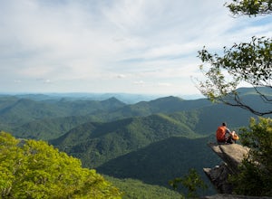
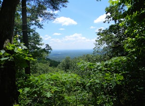
Hike the James E. Edmond trail to Lookoff Mountain Overlook
4.07.5 mi / 2378 ft gainBlack Rock Mountain State Park is Georgia's highest elevation State Park. It is adorned with several waterfalls, sweeping overlooks, blooming Rhododendron's, and plenty of miles of trail. The James E. Edmond trail is the longest and by far most challenging hike in the park. Its medium-long dis...Read more -
Long Creek, South Carolina
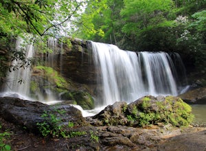
Hike to the Brasstown Falls
4.50.5 miThese waterfalls are absolutely beautiful during the summer greenery and fall foliage, but open to access year around.Driving Directions: From Westminister, follow US 76 West for 11.8 miles and turn left onto Brasstown Road. Follow this road 4.1 miles to FS 751. (The pavement ends in 2.6 miles.) ...Read more -
Gainesville, Georgia
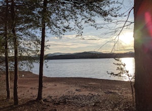
Swim in Lake Sidney Lanier at Dogwood Park
3.0Lake Sidney Lanier is pretty big, but you don't need to be overwhelmed when you visit the lake via Dogwood Park. The park has a large pavilion and a few other picnic tables, lots of shade trees, and a couple of ways to access the lake. On the left side, there's an abandoned marina (dangerous—it's...Read more -
Clayton, Georgia
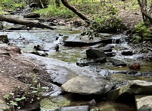
Hike to Martin Creek Falls
5.00.6 miThere are two different ways to get to this waterfall.The easiest way is through a trail in the Warwoman Wildlife Management Area. To get to this trail head, drive east on Warwoman Road from Clayton, GA. At approximately 3.5 miles, take a left onto Finney Creek Road (FS 152). You will see a sign ...Read more -
Otto, North Carolina
Hike to and Climb Pickens Nose
4.81.5 mi / 200 ft gainFrom the parking area (fits about 6 cars) follow the trail on the same side of the road up the ridge through dense rhododendron. Several spur trails branch off of the main trail and lead to rock outcroppings with excellent views. Getting to the parking area is slow. The narrow gravel road winds...Read more -
Blairsville, Georgia
Nottely Reservoir Trail
2.53 mi / 335 ft gainNottely Reservoir Trail is a loop trail that takes you by a river located near Blairsville, Georgia.Read more -
Franklin, North Carolina
Backpack the Standing Indian Loop on the Appalachian Trail
24 miBegins at the parking lot for the Standing Indian Campground. (No permits are needed to park here) For the first 3.7 miles, take Kimsey Creek Trail, which runs along the water, until you meet up with the AT at Deep Gap. Rolling hills and lots of foliage throughout, leading up to Standing Indian M...Read more -
Dawsonville, Georgia
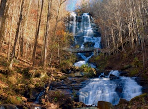
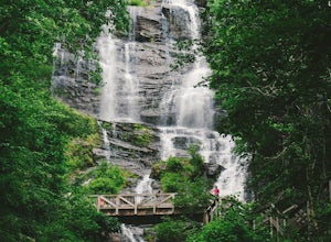
Amicalola Falls
4.30.73 mi / 292 ft gainAdventurers access the falls through the state park entrance. From the parking lot, hikers follow the clearly marked signs to the base of the falls. The incline begins by the pond at the base of the falls. From the pond, follow the incline along the cascading portion of the falls to the stairs. A...Read more -
Dawsonville, Georgia
Hike to Springer Mountain
3.519 mi / 4346 ft gainBegin your journey from Amicalola Falls State Park. Despite the steep climb, you should park at the base of the falls and climb the steps for a great view of one of the grandest falls in the South. (For more on that hike, see: "Climb the Stairs to Amicalola Falls"). From the top of the falls, fol...Read more -
Dawsonville, Georgia
Amicalola Falls Loop via Upper Observation Platform
5.01.93 mi / 666 ft gainTo get there you can use Google Maps or Waze to “Upper Observation Platform” – W Ridge Staircase, Dawsonville, GA 30534. The other option is to start at the visitor center. If you start at the visitor center, it will add about a mile to your hike so parking in the upper parking lot like us will s...Read more -
Dillard, Georgia
Hike to Rabun Bald
5.03 mi / 4696 ft gainStarting at the trailhead you begin by following the yellow blazes. The trail isn't well marked so keep an eye out for the blazes you see. The trailhead starts at the dead end of Kelsey Mountain Trail. The path immediately starts to incline and doesn't stop. A few minutes in you will come to a fo...Read more -
Franklin, North Carolina
Nantahala National Forest via the Appalachian Trail
4.027.11 mi / 5420 ft gainWinding Stair Gap on Highway 64 is the starting point for this spectacular backpacking trip through the Nantahala National Forest. It's right outside the hiker friendly town of Franklin, NC, so the town is your last chance for a hot meal and any last minute supplies. There is a parking lot at the...Read more -
Morganton, Georgia
Camp at Morganton Point
Morganton Point Campground is one of the most well-maintained campgrounds in North Georgia. There are sites available for both RVs and tents, but the tent section is separate from the RV area so don't worry about any noisy generators! I camped at Site F, a tent-only campsite. This campsite (and ...Read more -
Blue Ridge, Georgia
Long Branch Loop Trail
5.02.33 mi / 299 ft gainLong Branch Loop Trail is a loop trail where you may see beautiful wildflowers located near Blue Ridge, Georgia.Read more -
Gainesville, Georgia
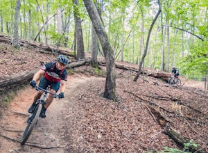
Mountain Bike Chicopee Woods' Flying Squirrel Trail
4.7 mi / 200 ft gainThere is a designated parking lot for the Chicopee Woods mountain bike trails with plenty of parking, but it can fill up on weekends.To access the trailhead for Flying Squirrel, you have to take a few other trails (a good warm-up!) to get back to a junction known as ‘Confusion Corner’, which is w...Read more -
Franklin, North Carolina
Siler Bald from Wayah Gap
5.03.66 mi / 1060 ft gainThe Appalachian Trail does not need a lot of hype beyond its existing legendary status. However, there are certain parts of it that do stand out as being a little extra special. Siler Bald is one of those spots. A large clearing starting from Snowbird Gap and going all the way up to Siler Bald...Read more


