Blairsville, Georgia
Looking for the best photography in Blairsville? We've got you covered with the top trails, trips, hiking, backpacking, camping and more around Blairsville. The detailed guides, photos, and reviews are all submitted by the Outbound community.
Top Photography Spots in and near Blairsville
-
Helen, Georgia
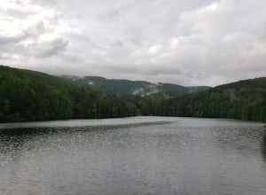
Hike the Unicoi Lake Trail
1.9 miUnicoi State Park is a pleasant, refreshing park just outside of Helen, GA. There is a hiking trail, kayaking/canoeing launch, paddle boat rentals, camping area, and even a 3 segment zipline course (all three were fantastic)! Fishing is allowed, and when we went last there were a few kayakers fis...Read more -
Cleveland, Georgia
Hike and Climb to Yonah Mountain
4.94.53 mi / 1417 ft gainThe trail starts at "Mt. Yonah Trailhead" and is 4.4 mile round-trip with elevation of 1,500' to 3,166'. The trail stays below moderate tree coverage until around the halfway point where you will come upon a clearing known as the first LZ (landing zone). The mountain is shared with hikers by Army...Read more -
Clarkesville, Georgia
Paddle Lake Burton
3.0Lake Burton is, in my opinion, Georgia's most scenic large lake. It is completely surrounded by the Blue Ridge Mountains and has some of the clearest water in the state. Moccasin Creek State Park is a great launching point for all of your paddling adventures, whether you own your own vessel or ...Read more -
Dahlonega, Georgia
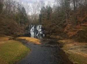
Explore Cane Creek Falls
From the parking lot, walk about 500 feet to the check-in office to let the receptionist know that you would like to visit the falls. This campground operates as a retreat select times throughout the year and is closed to the public during those times so prior to visiting, be sure to call and fi...Read more -
Clayton, Georgia
Camp at Tallulah River Campground
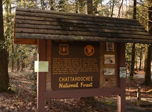
Tallulah River Campground is located in the Chattahoochee-Oconee national forest. It is just outside of Clayton, Georgia. The campground has about 15 spots that are big enough for a small to medium sized RV. Each camping spot also has a nice tent pad for a big tent. Most spots are also on the riv...Read more -
Tiger, Georgia
Hike to Glassy Mountain
5.01 mi / 3415 ft gainIn order to find this hidden gem, you'll have to drive quite a ways up the mountain first, otherwise it is a very steep incline. There will be limited parking at the gate that stops you from driving the whole way up. You will turn onto a road called "Glassy Mountain Rd" and that will be the road ...Read more -
Dawsonville, Georgia
Hike to Springer Mountain
3.519 mi / 4346 ft gainBegin your journey from Amicalola Falls State Park. Despite the steep climb, you should park at the base of the falls and climb the steps for a great view of one of the grandest falls in the South. (For more on that hike, see: "Climb the Stairs to Amicalola Falls"). From the top of the falls, fol...Read more -
Dawsonville, Georgia
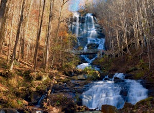
Amicalola Falls
4.30.73 mi / 292 ft gainAdventurers access the falls through the state park entrance. From the parking lot, hikers follow the clearly marked signs to the base of the falls. The incline begins by the pond at the base of the falls. From the pond, follow the incline along the cascading portion of the falls to the stairs. A...Read more -
Lakemont, Georgia
Minnehaha Falls
4.20.39 mi / 98 ft gainDespite their beauty, not many hikers know about Minnehaha Falls. Even more shocking, these are some of the most accessible falls in all of North Georgia. Round trip, the hike to the falls will only take about a half a mile. Hikers can park along the side of the road at the trailhead. Follow the ...Read more -
Franklin, North Carolina
Nantahala National Forest via the Appalachian Trail
4.027.11 mi / 5420 ft gainWinding Stair Gap on Highway 64 is the starting point for this spectacular backpacking trip through the Nantahala National Forest. It's right outside the hiker friendly town of Franklin, NC, so the town is your last chance for a hot meal and any last minute supplies. There is a parking lot at the...Read more -
Franklin, North Carolina
Siler Bald from Wayah Gap
5.03.66 mi / 1060 ft gainThe Appalachian Trail does not need a lot of hype beyond its existing legendary status. However, there are certain parts of it that do stand out as being a little extra special. Siler Bald is one of those spots. A large clearing starting from Snowbird Gap and going all the way up to Siler Bald...Read more -
Robbinsville, North Carolina
Hike Hooper Bald
1 mi / 250 ft gainHooper bald is one of the highest points in Graham County so the views from the top can be spectacular year round. The trail-head starts at mile marker 8 on the Cherohala Skyway. From the trail-head you start your accent on a semi-paved trail and walk about a half-mile before reaching the edge o...Read more -
Otto, North Carolina
Hike to and Climb Pickens Nose
4.81.5 mi / 200 ft gainFrom the parking area (fits about 6 cars) follow the trail on the same side of the road up the ridge through dense rhododendron. Several spur trails branch off of the main trail and lead to rock outcroppings with excellent views. Getting to the parking area is slow. The narrow gravel road winds...Read more -
Lake Santeetlah, North Carolina
Huckleberry Knob
4.81.77 mi / 295 ft gainHuckleberry Knob is the highest point in the Cheoah Ranger District at 5,560 feet, and it offers expansive views of the surrounding Cherokee and Natahala National Forest. The hike is 2.4 miles roundtrip and begins at the parking lot between mile 8 and 9 up an old dirt road. You will go up the di...Read more -
Franklin, North Carolina
Photograph Wayah Bald Lookout Tower
0.1 mi / 0 ft gainThe Wayah Bald Lookout Tower is located in Nantahala National Forest in one of the oldest part of the protected land. It was first built in the 1920s then it was rebuilt throughout the years until it was finally made out of stone and concrete. The current tower that stands offers great views of t...Read more -
Clayton, Georgia
Hike the James E. Edmond trail to Lookoff Mountain Overlook
4.07.5 mi / 2378 ft gainBlack Rock Mountain State Park is Georgia's highest elevation State Park. It is adorned with several waterfalls, sweeping overlooks, blooming Rhododendron's, and plenty of miles of trail. The James E. Edmond trail is the longest and by far most challenging hike in the park. Its medium-long dis...Read more

