United States
Looking for the best cycling in United States? We've got you covered with the top trails, trips, hiking, backpacking, camping and more around United States. The detailed guides, photos, and reviews are all submitted by the Outbound community.
Top Cycling Spots in and near United States
-
Mexican Hat, Utah
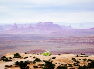
Camp at Muley Point
5.00.25 miMuley Point on the southern end of the Cedar Mesa is one of the finest camping (and car camping) sites in North America, towering some 2400' above the San Juan River Canyon (and The Goosenecks State Park) looking south directly into the northern mouth of Monument Valley. It is a breathtakingly be...Read more -
Colorado Springs, Colorado
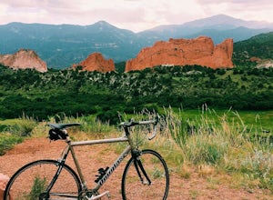
Bike the Garden of the Gods Loop
5.06 mi / 500 ft gainThe Basics: Garden of the Gods is a free, public park on the Western edge of Colorado Springs. Open year round, the excellent paved roads with wide bike lanes provide road bikers with multiple loop options from 3 to 10+ miles. From casual bike riders to seasoned pros, you choose your distance and...Read more -
Chattanooga, Tennessee
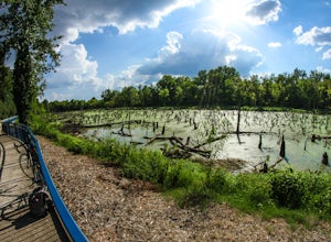
Bike or Run the Tennessee Riverwalk
4.013 miThe Tennessee Riverwalk is a part of the Tennessee Riverpark System that features the Coolidge Park, Renaissance Park, Ross's Landing, and the Walnut Street Bridge, all jewels of downtown Chattanooga. It is a networks of boardwalks, bridges, and paved pathways that runs alongside the Tennessee Ri...Read more -
Boston, Massachusetts
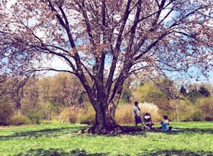
Run the Arnold Arboretum Trail
5.02.6 mi / 150 ft gainPark in the lot off of Arborway to access the trail. This place is gorgeous year round. The winter offers a quiet solitude, fall boasts bright colors, spring is the most beautiful as the flowers start to burst and cherry blossoms take over, and summer is overwhelmingly green. There are dozens of ...Read more -
Calpine, California
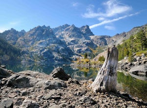
Gold Lakes, Sierra Buttes, 45mi
If you never travel north of the Tahoe Basin into the Sierra Valley and beyond, you should. It is gorgeous, peaceful country, with wide open spaces and, compared to Tahoe, relatively uncrowded roads. This loops takes us from Bassett’s Station toward Sattley, north on 89, a brief stop to regroup i...Read more -
CRATER LAKE, Oregon
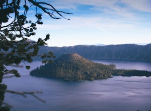
Bike around Crater Lake
5.0I forgot how large Crater Lake was. Wikipedia said it was only 6 miles in diameter, multiply X 3.14 or C = πd and boom its only 18.84 miles around, that's cake, or pie. Imaging a NASCAR track with a pond in the middle.WRONG, hindsight being 20/20, dramatic landscape rarely equates to flat, cycle ...Read more -
Saint Helena, California
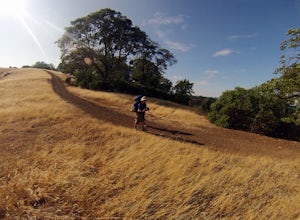
Hike Bald Mountain, Sugarloaf Ridge SP
5.06 mi / 1540 ft gainPark at the top of Adobe Canyon Road in the gravel parking lot to the left of the ranger kiosk. There is a $7.00 parking fee.There are many options for routes to the top; the easiest of which is mostly paved (although still steep in parts). To take this route, head north out of the trailhead park...Read more -
Draper, Virginia
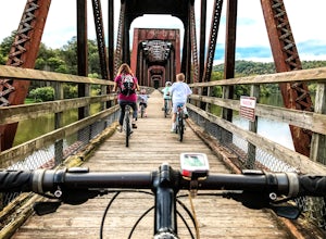
Bike the New River Trail
5.057 miThere are several locations to begin your trek on the New River Trail, but our favorite is the Draper Valley area. The pin on the map will take you right to the parking lot. There is a $5 state park fee and a self-pay envelope station. From here we head south, and after about a mile you catch you...Read more -
San Mateo County, California
Run Sawyer Camp Trail
5.012 mi / 300 ft gainThe Sawyer Camp Trail is a popular paved trail that stretches alongside the Crystal Springs Reservoir all the way to Hillcrest Blvd. The sixth mile crosses over the San Andreas Dam with nice views of San Andreas Lake.There are markers every half mile which makes timing and tracking your run easy....Read more -
Staten Island, New York
Hike the Staten Island Greenbelt
4.07.6 miThe white trail offers one of the two more ambitious hikes, passing through Egbertville Ravine, Heyerdahl Hill and Buck’s Hollow parks on Staten Island, offering an up-close view of the forest and marshland that once covered the island. About midway, the trail also passes the Greenbelt Nature Cen...Read more -
McCloud, California
Algoma Campground
The Algoma Campsite is a free campsite along the Upper Portion of the McCloud River. It features eight sites and a pit toilet. Unlike the other campgrounds in the area, this site receives very little traffic and has no fee. To get there, take SR 89 east from the McCloud Ranger Station for 13 mi...Read more -
Sisters, Oregon
The Sisters to Smith Rock Ride
5.036.6 mi / 597 ft gainStarting in the "Old West" town of Sisters, Oregon and ending at Smith Rock State Park outside the small town of Terrebonne, this route takes riders past a variety of historical sites, shows the gentle curves of the Deschutes River and frames spectacular views of the Cascade Mountains, and ends w...Read more -
Montauk, New York
Climb the Bluffs of Shadmoor State Park
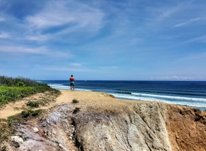
1.2 mi / 100 ft gainI've never actually been into the Shadmoor State Park, but you can climb up and onto the bluffs from the beach easily; well kind of easily.Most of the parking lots along the beach require Hamptons residency tags, so you can't park right next to beach entrances... bummer. We typically park along ...Read more -
Fraser, Colorado
Summit Byers Peak
8.8 mi / 2774 ft gainThe drive to the start of the trail is okay, having a high clearance vehicle would make the drive easier, but is not necessary. Free parking is available along the side of the road.The trail starts on a closed service road at a gate and requires you to either hike or bike up the dirt road (2 mil...Read more -
Billings, Montana
Explore The Rimrocks
5.0The Rimrocks (also known as the "Rims") are geological rimrock sandstone formations that outcrop in Billings, Montana. Eighty million years ago the Billings metro area was the shore of the Western Interior Seaway, a sea that went from the present-day Gulf of Mexico to the Arctic North. Sediment a...Read more -
Welch, Minnesota
Bike the Cannon Valley Trail
4.019.7 mi / -115 ft gainThere are multiple entry points to the Cannon Valley Trail along the 19.7 miles of paved path that connect the towns of Cannon Falls and Red Wing. Because the trail requires a $4 daily pass, pick your entry point next to a Wheel Pass station. The most elaborate entry point is via the town of Welc...Read more

