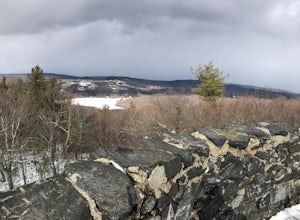
Weston, Connecticut
Looking for the best hiking in Weston? We've got you covered with the top trails, trips, hiking, backpacking, camping and more around Weston. The detailed guides, photos, and reviews are all submitted by the Outbound community.
Top Hiking Spots in and near Weston
-
Cheshire, Connecticut
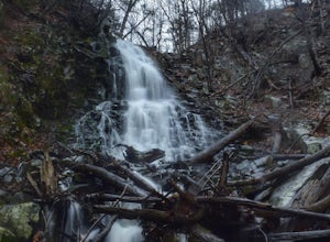
Hike to Roaring Brook Falls
1.2 mi / 377 ft gainArriving to the falls, parking is residential but don't worry everyone is friendly. Starting off the hike you will walk past a cool pond where you may be able to see some wildlife. Continuing on, you will follow the marked trail where it will take you further into the woods while gaining elevatio...Read more -
Cortlandt, New York
Hike the Camp Smith Trail
4.55.92 mi / 1759 ft gainThis approximately 3-hour hike borders the Hudson River, and is one of the best in Westchester County. Start off at the parking area at the Bear Mountain Tollhouse, or at a small parking area farther up Bear Mountain Road, if you want a slightly shorter hike. The trail is fairly steep in places, ...Read more -
Yonkers, New York
Run the Old Croton Aqueduct Trail
5.026.5 miThis trail traces the route of the Old Croton Aqueduct, which carried water to New York City between 1842 and 1955. Our recommended route starts near the Greystone Station in Yonkers, NY (Metro-North Hudson Line) and ends by the Scarborough Station, but you can easily modify your route – the enti...Read more -
Philipstown, New York
Hike the Osborn Loop
7.6 mi / 850 ft gainThe Osborn Loop trail itself is not a loop. It connects to a 2.5 mile section of the Appalachian Trail. Hiking these together creates the loop. Start at the trail head for the Appalachian Trail on South Mountain Pass Road. There is parking for two or three cars. Walk up the road a short dist...Read more -
Closter, New Jersey
Hike Alpine White Trail (Stateline Lookout)
5.05 mi / -520 ft gainStarting at about 520 feet, the White path takes you along the Stateline Lookout which is a small stone building overlooking the Hudson River. The initial descent is your average hike through the woods and across a couple of wooden bridges until you reach the Giant Steps. The Giant Steps take you...Read more -
Cold Spring, New York
Photograph Indian Brook Falls
2.8This is about as short a walk and as little effort as you can put in for a beautiful waterfall. You can barely call it a hike, but I'll list it as such since you do walk through the woods for 5 minutes. The trail is extremely well built, and is pretty easily accessible through the winter.The trai...Read more -
Philipstown, New York
Anthony's Nose via Appalachian Trail
4.61.95 mi / 682 ft gainParking for the trail runs along both sides of 9D right up until the Bear Mountain Bridge. It can be busy on the weekends so just make sure you're as far off the road as you can and be especially careful unloading kids and dogs. The trailhead is located at approximately 41.322571, -73.975949 and ...Read more -
Bear Mountain, New York
Hike Bald Mountain, Bear Mountain State Park
4.76.8 mi / 1080 ft gainFrom your starting point at the Bear Mountain Inn, go left along the Cornell Mine Trail. (This part can be a bit confusing, but go past the carousel to a shaded picnic area; that is where the trail starts.) You will go under a bridge and follow the trail until it takes a sharp left and descends t...Read more -
Closter, New Jersey
Hike to Huyler's Landing/ Closter Dock Loop
4.05.4 mi / 450 ft gainThe easiest way to access this loop hike is by parking at the Palisades State Park Headquarters. This is just off exit 2 from the Palisades Interstate Parkway. Parking here is free and it is a short walk down a road to the Closter Dock Trail. The Closter Dock Trail is more of a wide fire road ...Read more -
Washington, Connecticut
Hike Meeker Trail
3.3 mi / 639 ft gainMeeker Trail is a 3.3 mile out and back hike that takes you by a lake located near New Preston, Connecticut.Read more -
Highland Falls, New York
Popolopen Torne
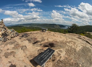
4.51.18 mi / 531 ft gainPopolopen Torne is a hidden gem in the Hudson Valley, a surprisingly unknown trail with a beautiful payoff and a far deeper meaning. A short hike to the top puts you at the foot of a memorial to those who have served their country, a pile of painted rocks carried up by those who want to pay their...Read more -
Cold Spring, New York
Mt. Taurus (Bull Hill)
4.53.52 mi / 1375 ft gainMt. Taurus (or Bull Hill) is a short, family and dog friendly, hike just outside the town of Cold Spring, easily accessible by car or taking the train into town. It snakes along the edge of an old quarry that is just now being retaken by nature and provides lookouts towards the Hudson, other near...Read more -
Cold Spring, New York
Hike the Cornish/Brook/Notch/Washburn/Undercliff Loop
8 mi / 1500 ft gainThis loop is a great option to avoid crowds on the west side of the Washburn trail. Start at the same trailhead for the Washburn Trail. The Cornish Trail is on the left and there is an obvious sign at the trail split a few feet from the parking area. The Cornish Trail is an old road from about...Read more -
Cold Spring, New York
Hike the Washburn/Nelsonville/Undercliff Loop
7.2 mi / 2000 ft gainThis is a difficult loop hike that has several different starting points. I chose to start at the Washburn Trail Head, which is the lowest starting point you can select. Nearly on the Hudson River, the trail ascends immediately along a well maintained road designated by white disc markers. Aft...Read more -
Washington, Connecticut
Hike the Mount Tom Tower Trail
1.3 mi / 337 ft gainStarting from the parking lot of Mt. Tom State Park, hop onto the Tower Trail (yellow trail) which leads more into the woods. During winter time, the trail may be slippery, please use your best judgement and always know your limits. Gaining about 300 feet in total elevation in approximately 1 mil...Read more -
Cold Spring, New York
Sugarloaf Mountain and Breakneck Ridge Loop
4.74.33 mi / 1562 ft gainThe Breakneck Ridge to Sugar Loaf Loop gives rise to various bypasses that offer hikers moderate to advanced terrain and multiple rock scrambles. The loop entails a total elevation gain of 1,670 feet and a total distance of 5.5 miles. The start of the trail begins at the (white blazes) at the no...Read more

