Westbrook, Connecticut
Top Spots in and near Westbrook
-
Glastonbury, Connecticut
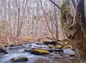
Hike the Cotton Hollow Nature Preserve
5.03 miThere are two parking locations for Cotton Hollow, the location tagged in the directions is the shortest hike to the old gun powder mill. Suggestions when it comes to exploring the preserve are to stay on the trails, know your limits, and enjoy! There are swimming holes along the river, but swim ...Read more -
Hamden, Connecticut
Mountain Bike West Rock Ridge State Park
West Rock Ridge State Park is a 700 ft high scenic ridge that is located on the west side of New Haven. There are tons of good mountain biking trails located all around the ridge that can satisfy all types of skill levels. The easiest place to park is the Lake Wintergreen parking lot, which sits ...Read more -
Stonington, Connecticut
Hike Denison Pequotsepos Nature Center Trail
5.01.7 mi / 72 ft gainDenison Pequotsepos Nature Center Trail is a 1.7 mile loop hike that takes you by a river located near Mystic, Connecticut.Read more -
Stonington, Connecticut
Hike River Road
4.03.9 mi / 55 ft gainRiver Road is a 3.9 mile point-to-point hike that takes you by a river located near Mystic, Connecticut.Read more -
Glastonbury, Connecticut
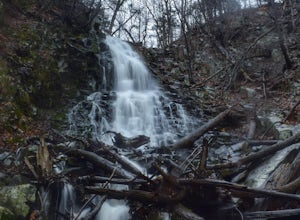
Blackledge Falls
4.01.46 mi / 207 ft gainAlthough the park contains hiking trails, a pond and a streambelt, the primary draw of this parcel of land is the 25 foot waterfall. The falls flow varies depending on the volume of precipitation, from a trickle in the dry months to a three-pronged vertical drop after some consistent snow melt or...Read more -
Cheshire, Connecticut
Hike to Roaring Brook Falls
1.2 mi / 377 ft gainArriving to the falls, parking is residential but don't worry everyone is friendly. Starting off the hike you will walk past a cool pond where you may be able to see some wildlife. Continuing on, you will follow the marked trail where it will take you further into the woods while gaining elevatio...Read more -
Franklin, Connecticut
Hike Baileys Ravine at Ayer's Gap Preserve
1.6 mi / 314 ft gainIt's steep and rocky in the beginning but it levels out after a while! When standing in the parking lot, the trailhead is hidden! Look to the right. The trail ends on Ayer's Road so you have to walk back a little ways on the road.Read more -
Southington, Connecticut
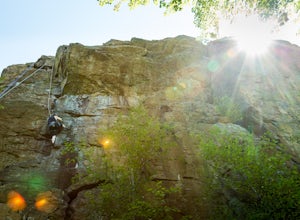
Rock Climb Ragged Mountain
The main face of Ragged Mountain (elev. 761 feet) is home to a lot climbing in central Connecticut. It runs north-south for about 600 feet. Its max height of 100 feet. The crag is home to several rock climbing guides and schools. Routes range in difficultly from great for the beginner (5.3) to su...Read more -
Berlin, Connecticut
Hike the Ragged Mountain Memorial Preserve
4.55.5 mi / 560 ft gainRagged Mountain main loop is approximately 5.5 miles long, and is known for its expansive bare-rock vistas, vertical cliff faces, and scenic views overlooking cliff-side reservoirs and ponds. The trail is rated moderate, with some flat stretches among the trees, mixed with some uneven rocky foot...Read more -
North Stonington, Connecticut
Hike Narragansett Trail
4.010.7 mi / 1 ft gainNarragansett Trail is a 10.7 mile point-to-point hike that takes you by a lake located near North Stonington, Connecticut.Read more -
Southington, Connecticut
Hike the Crescent Lake & Metacomet Trail Loop
4.02.4 mi / 269 ft gainThe hike to view Crescent Lake is peaceful. You can either walk through the woods where you will be blessed with natures finest birds and wildlife or you can take the trail along the lake edge. Both are similar distances and lead to the same hill at the end! Once you get to the top take a left on...Read more -
Westerly, Rhode Island
Napatree Point Conservation Area Trail
4.03.19 mi / 82 ft gainNapatree Point Conservation Area Trail is a loop trail that takes you past scenic surroundings located near Westerly, Rhode Island.Read more -
North Stonington, Connecticut
Hike Wyassup Lake
5.02.4 mi / 278 ft gainWyassup Lake is a 2.4 mile out and back hike that takes you past great forest setting located near North Stonington, Connecticut.Read more -
Montauk, New York
Climb the Bluffs of Shadmoor State Park
1.2 mi / 100 ft gainI've never actually been into the Shadmoor State Park, but you can climb up and onto the bluffs from the beach easily; well kind of easily.Most of the parking lots along the beach require Hamptons residency tags, so you can't park right next to beach entrances... bummer. We typically park along ...Read more -
Manchester, Connecticut
Explore Wickham Park
5.0Wickham Park Is open the first weekend in April and closes the last weekend in October. Entrances fees are $5 Monday-Friday and $7 Saturday-Sunday. The park is known for its 250 acres of open fields, wildflowers, gardens, ponds and nature center. There is no where else can you go have a picnic w...Read more -
Westerly, Rhode Island
Watch the Sunset over Misquamicut Beach
5.0Misquamicut is one of Rhode Island’s most popular beach locations during the day. As the evening approaches most beach goers pack up, tired from a day of playing in the waves and lounging on the beach’s beautiful sand. It’s during this time, when the crowds disperse and the day begins to turn to ...Read more

