Norfolk, Connecticut
Top Spots in and near Norfolk
-
East Nassau, New York
Kinderhook Creek
5.01.62 mi / 308 ft gainKinderhook Creek is a loop trail that takes you by a river located near Stephentown, New York.Read more -
Hampden, Massachusetts
Goat Rock Trail
2.67 mi / 659 ft gainGoat Rock Trail is an out-and-back trail where you may see beautiful wildflowers located near Hampden, Massachusetts.Read more -
Middletown, Connecticut
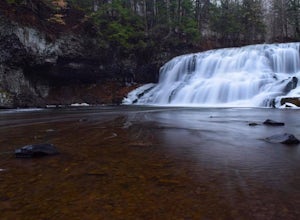
Explore Wadsworth Falls
5.00.25 miWhen it comes to exploring Wadsworth Falls its ease of access couldn't be better. As soon as you pull into the parking lot you hear the falls roaring. Take the quick walk to see the picturesque scenery.Facts about Wadsworth Falls:Height: 25ft tall and doubled in width Rock: Hampden Basalt -the ro...Read more -
Adams, Massachusetts
Explore Bellevue Falls
5.0When you reach the falls, you can cliff jump into a large swimming hole at the base. The best time to visit the falls is from April to November. Please note that dogs are not permitted here. Parking is at a cemetery, and the gates are open from 8am to 9pm. Use common sense before cliff jumping - ...Read more -
Hamden, Connecticut
Hike the Tower Trail to the Blue Trail at Sleeping Giant SP
5.03 mi / 518 ft gainSleeping Giant State Park is a place very close to my heart. I spent 4 years right across the street at Quinnipiac University and have hiked “The Giant” more times then I can count and at all different hours. There are a few different trails you can explore but my favorite one is up to the cliffs...Read more -
Hamden, Connecticut
Hike the Mill River Trail to the Blue Trail at Sleeping Giant SP
5.03 mi / 518 ft gainSince I was a child, I’ve always enjoyed hiking the Giant. As Connecticut parks go, this terrain is some of the most challenging (and unfortunately, the most dangerous) in the state. The actual ridge is approximately 2.75 miles long by 1.75 miles wide, and offers approximately 24 miles of hiking ...Read more -
Hamden, Connecticut
Boulder & Free Climb off the Blue Trail In Sleeping Giant SP
Sleeping Giant State Park does not just have great hiking, it also has great climbing and bouldering. Pick up the blue trail starting at the backside of the visitor center. This trail climbs pretty steadily but take note that as you hike up the cliff below you is a great spot to checkout for boul...Read more -
Glastonbury, Connecticut
Blackledge Falls
4.01.46 mi / 207 ft gainAlthough the park contains hiking trails, a pond and a streambelt, the primary draw of this parcel of land is the 25 foot waterfall. The falls flow varies depending on the volume of precipitation, from a trickle in the dry months to a three-pronged vertical drop after some consistent snow melt or...Read more -
Williamstown, Massachusetts
Hike the March Cataract Falls Trail
4.02.2 mi / 511 ft gainPark at the Junction of Sperry Rd and Rockwell Rd. To get to the trailhead, hike along Sperry Road for about 30 minutes. (Not to the end of the road, see map below.) Then hike along the March Cataract Trail, an out-and-back. You can bring dogs on leash. The trail is short but steep in some parts ...Read more -
Danbury, Connecticut
Hike Middle Mountain To Thomas Mountain Loop
3.7 mi / 856 ft gainMiddle Mountain to Thomas Mountain Loop is a 3.7 mile loop hike that takes you past great forest setting located near Danbury, Connecticut.Read more -
Middlesex County, Connecticut
Hike to Glen Falls
5.00.75 miAccessing Glen Falls may be a little tricky at first. Parking will be very minimal, you will park on Grist Mill Ln. Hop onto the road and you will see the trail map on the left side. The adventure begins when you cross the street and go through the gate with the yellow blaze symbol. Keep followin...Read more -
Savoy, Massachusetts
Tannery Falls Loop
0.54 mi / 135 ft gainThe hike to Tannery Falls may be a little confusing, I'll clear it up for you before you even go there! To get to The falls you will travel down a dirt road that isn't very well maintained during the winter. As you keep driving down the dirt road you will notice a pond , which means you are almos...Read more -
Greene County, United States
Hike to Newman's Ledge
4 mi / 584 ft gainLocated in the beautiful Catskill Mountains, this is an outdoors-mans(and woman's) dream spot! Although this hike is accessible year round, if you decide to go during the summer you should expect crowds. Luckily, there are so many different trails and activities that it won't even matter. North-S...Read more -
Deerfield, Massachusetts
South Sugarloaf Trail
1.48 mi / 404 ft gainSouth Sugarloaf Trail is a loop trail that takes you by a river located near South Deerfield, Massachusetts.Read more -
Hamden, Connecticut
Mountain Bike West Rock Ridge State Park
West Rock Ridge State Park is a 700 ft high scenic ridge that is located on the west side of New Haven. There are tons of good mountain biking trails located all around the ridge that can satisfy all types of skill levels. The easiest place to park is the Lake Wintergreen parking lot, which sits ...Read more -
Brewster, New York
Fly Fish the East Branch of the Croton River
If you're craving some time away from the bustle of everyday life to enjoy some silence, broken only by the babbling sound of water flowing over small boulders and the occasional crunching of leaves-- you'll find many spots along the Croton River to satisfy your desire for stillness. The Croton...Read more

