Middlefield, Connecticut
Top Spots in and near Middlefield
-
Simsbury, Connecticut
Hike to the Heublein Tower on Talcott Mountain
4.32.54 mi / 404 ft gainThe Heublien Tower Trail, located just inside the Talcott Mountain State Park entrance off of Route 185 in Simsbury CT, is a short 1.25 miles. While the hike isn't long, the first 1/3 of a mile is a steep incline that will get your heart pumping. The trail itself it very well kept, and although ...Read more -
Litchfield, Connecticut
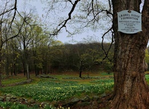
Photograph Daffodils at Laurel Ridge
Laurel Ridge is a private owned Farm , the owners are generous enough to let people visit these flowers so please be respectful of there rules. You may see the Daffodils from Sunrise-Sunset and usually fully bloomed Early April-May. Laurel Ridge is the perfect way to start Spring, the smell and ...Read more -
East Lyme, Connecticut
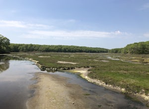
Hike Rocky Neck State Park Trail
5.02.5 mi / 141 ft gainRocky Neck State Park Trail is a 2.5 mile loop hike where you may see beautiful wild flowers located near East Lyme, Connecticut.Read more -
Franklin, Connecticut
Hike Baileys Ravine at Ayer's Gap Preserve
1.6 mi / 314 ft gainIt's steep and rocky in the beginning but it levels out after a while! When standing in the parking lot, the trailhead is hidden! Look to the right. The trail ends on Ayer's Road so you have to walk back a little ways on the road.Read more -
Granby, Connecticut
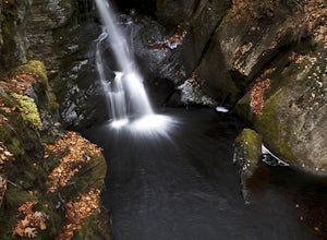
Hiking Enders Falls
4.0Enders State Forest sprawls over approximately 2000 acres, and is found within the towns of Granby and Barkhamsted in Connecticut. Enders has a good sized parking lot directly on Route 219. From the junction of Route 219 and Route 20, visitors will proceed west on Route 219 for 1.2 miles and tu...Read more -
Mansfield, Connecticut
Hike Nipmuck Trail
5.08.3 mi / 748 ft gainNipmuck Trail is a 8.3 mile out and back hike that takes you past wildlife located near Mansfield Center, Connecticut.Read more -
Norwich, Connecticut
Explore Yantic Falls Historic District
0.3 mi / 26 ft gainThe Yantic Falls Historic District encompasses a historic mill and associated worker housing on Yantic Street in Norwich, Connecticut. The 10 acre area includes a complex of mill buildings arrayed along the Yantic River, and a group of three brick mill worker houses. Today, Yantic Falls is part d...Read more -
Washington, Connecticut
Hike the Mount Tom Tower Trail
1.3 mi / 337 ft gainStarting from the parking lot of Mt. Tom State Park, hop onto the Tower Trail (yellow trail) which leads more into the woods. During winter time, the trail may be slippery, please use your best judgement and always know your limits. Gaining about 300 feet in total elevation in approximately 1 mil...Read more -
Chaplin, Connecticut
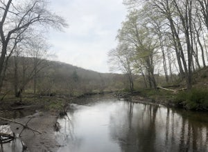
Hike to Diana's Pool
4.01.3 mi / 45 ft gainThe drive to Diana's Pool is worth it in an of itself, taking you through the backroads of Eastern Connecticut. To begin the hike just simply enter the woodland path and follow the trail. In order to go under the bridge just simply take the first left in the path and there will be a stream that f...Read more -
Washington, Connecticut
Hike Meeker Trail
3.3 mi / 639 ft gainMeeker Trail is a 3.3 mile out and back hike that takes you by a lake located near New Preston, Connecticut.Read more -
Groton, Connecticut
Visit Avery Point Lighthouse
3.0Owned by the University of Connecticut this lighthouse is a short walk from the parking area. Though the grounds are open the tower is not. Avery Point offers panoramic ocean views. From this location you can also see New London Harbor Lighthouse & New London Ledge Light. You can also see t...Read more -
Groton, Connecticut
Hike Bluff Point State Park Eastern Loop
4.54.3 mi / 344 ft gainBluff Point State Park Eastern Loop is a 4.3 mile loop hike where you may see beautiful wild flowers located near Groton, Connecticut.Read more -
Groton, Connecticut
Hike Sheep Farm
3.01 mi / 91 ft gainSheep Farm is a 1 mile loop hike that takes you by a waterfall located near Groton, Connecticut.Read more -
Bridgeport, Connecticut
Stroll around Fayerweather Island
0.5 miParking is at the end of Barnum Road in the Seaside Park. Though the lighthouse grounds are accessible the tower itself is not open to the public. To access the island you must walk across the breakwater. Please use caution as it is uneven footing and at times can be slippery. From the isla...Read more -
Shelter Island, New York
Hike through the Mashomack Nature Preserve
10 miJust a short ferry ride from the Hamptons, South Ferry Road is exactly where it sounds; very close to the South Ferry of Shelter Island. The parking lot of Mashomack Preserve is marked by a large sign. When you walk in, you'll see a large nature center. Sign in at a clipboard at the table out fro...Read more -
Groton, Connecticut
Hike Haley Farm Loop
5.02.7 mi / 193 ft gainHaley Farm Loop is a 2.7 mile loop hike that takes you past wildlife located near Groton, Connecticut.Read more

