East Haddam, Connecticut
Looking for the best hiking in East Haddam? We've got you covered with the top trails, trips, hiking, backpacking, camping and more around East Haddam. The detailed guides, photos, and reviews are all submitted by the Outbound community.
Top Hiking Spots in and near East Haddam
-
West Greenwich, Rhode Island
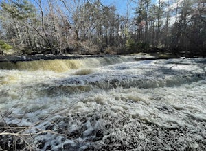
Stepstone Falls via Ben Utter Trail
5.02.64 mi / 125 ft gainStepstone Falls via Ben Utter Trail is an out-and-back trail that takes you by a waterfall located near West Greenwich, Rhode Island.Read more -
Montauk, New York
Climb the Bluffs of Shadmoor State Park
1.2 mi / 100 ft gainI've never actually been into the Shadmoor State Park, but you can climb up and onto the bluffs from the beach easily; well kind of easily.Most of the parking lots along the beach require Hamptons residency tags, so you can't park right next to beach entrances... bummer. We typically park along ...Read more -
Granby, Connecticut
Hiking Enders Falls
4.0Enders State Forest sprawls over approximately 2000 acres, and is found within the towns of Granby and Barkhamsted in Connecticut. Enders has a good sized parking lot directly on Route 219. From the junction of Route 219 and Route 20, visitors will proceed west on Route 219 for 1.2 miles and tu...Read more -
Montauk, New York
Stroll along the Montauk Point Lighthouse Cliff Walk
4.51 miThe Montauk Point Lighthouse is one of the main attractions of "The End" of Long Island, but I've only ever walked around it on the cliff walk.When you get to the lighthouse, you can park in the parking lot (depending on when you go there may be a $8 fee). Right along the edge overlooking the wa...Read more -
Hampden, Massachusetts
Goat Rock Trail
2.67 mi / 659 ft gainGoat Rock Trail is an out-and-back trail where you may see beautiful wildflowers located near Hampden, Massachusetts.Read more -
Bridgeport, Connecticut
Stroll around Fayerweather Island
0.5 miParking is at the end of Barnum Road in the Seaside Park. Though the lighthouse grounds are accessible the tower itself is not open to the public. To access the island you must walk across the breakwater. Please use caution as it is uneven footing and at times can be slippery. From the isla...Read more -
Washington, Connecticut
Hike the Mount Tom Tower Trail
1.3 mi / 337 ft gainStarting from the parking lot of Mt. Tom State Park, hop onto the Tower Trail (yellow trail) which leads more into the woods. During winter time, the trail may be slippery, please use your best judgement and always know your limits. Gaining about 300 feet in total elevation in approximately 1 mil...Read more -
South Kingstown, Rhode Island
Hike the Osprey Point Loop on Trustom Pond
2 miCareful on the drive in for deer! From the parking lot head right around the Farm Field Loop Trail then continue to your right down Osprey Point Trail (0.8 miles). This is where you will most likely see the deer up close. Continue to your right to the Osprey Point Overlook, which will (on a clear...Read more -
Washington, Connecticut
Hike Meeker Trail
3.3 mi / 639 ft gainMeeker Trail is a 3.3 mile out and back hike that takes you by a lake located near New Preston, Connecticut.Read more -
New Shoreham, Rhode Island
Walk to North Lighthouse
1 mi / 0 ft gainIn order to reach the Lighthouse you must walk along the trail that begins at the end of Corn Neck Rd. This walk is along the beach and then veers off to the left once you get closer to the light house (the seventh picture shows the start of the walk). It's only a half mile to the light house, bu...Read more

