Danbury, Connecticut
Looking for the best hiking in Danbury? We've got you covered with the top trails, trips, hiking, backpacking, camping and more around Danbury. The detailed guides, photos, and reviews are all submitted by the Outbound community.
Top Hiking Spots in and near Danbury
-
Englewood Cliffs, New Jersey
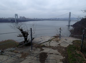
Hike the Dyckman Hill/Carpenter's Grove Loop
4.04 mi / 400 ft gainThis loop hike can be started from several different places. I chose to start from Allison Park which overlooks the Hudson River in Englewood Cliffs, NJ. From the parking area, walk out to the entrance road and travel south to Saint Peter's College. The Long Path Trail, which you join from All...Read more -
3197 U.S. 44, New York
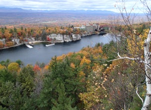
Hike to Sky Top via the Undercliff Road
7.3 mi / 900 ft gainStarting from the East Trapps parking area ascend the East Trapps connector trail marked with yellow blazes. You can also park at the Mohonk Preserve visitor center where you can purchase your access pass ($15 per person) and pick up a free map of the presere trails and carriage roads. The conn...Read more -
Gardiner, New York
Hike the Dickie Barre, Peters Kill and Awosting Falls Loop
3.07.8 miThis loop hike takes you to Awosting Falls (65 ft.), as well as to great valley views along the ridge of Dickie Barre, and across Peters Kill, on the way.Start out on West Trapps Connector Trail (yellow blazes) at the east end of the West Trapps parking lot (get their early because the lot will ...Read more -
Gardiner, New York
Hike The Millbrook Mountain Ridge Trail
5.07 mi / 1400 ft gainWant to walk on the edge? visit Millbrook Mountain in the Catskills of NY. This loops hike follows the mountains ridge line most of the way to the summit with multiple viewpoints and cliff ledges to walk out on. This hike is recommended those in the area.Park at West Trapps Parking Lot and head ...Read more -
Gardiner, New York
Hike the Overcliff - Undercliff Road Loop
5.3 mi / 350 ft gainFrom the West Trapps parking lot ($15 for hikers), walk to the end of the parking lot and past a large kiosk. The trail connects the parking lot to the Overcliff Road/Undercliff Road junction. The loop can be done in either direction. I turned left on the Overcliff Road. This takes you behind...Read more -
Mount Washington, Massachusetts
Mount Frissell and Brace Mountain Loop Trail
5.08 mi / 807 ft gainMount Frissell and Brace Mountain Loop Trail is a loop trail where you may see beautiful wildflowers located near South Egremont, Massachusetts.Read more -
Simsbury, Connecticut
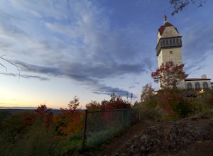
Hike to the Heublein Tower on Talcott Mountain
4.32.54 mi / 404 ft gainThe Heublien Tower Trail, located just inside the Talcott Mountain State Park entrance off of Route 185 in Simsbury CT, is a short 1.25 miles. While the hike isn't long, the first 1/3 of a mile is a steep incline that will get your heart pumping. The trail itself it very well kept, and although ...Read more -
Norfolk, Connecticut
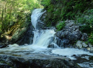
Hike to Campbell Falls
4.01.4 mi / 187 ft gainCampbell Falls, one of the most beautiful parks in CT. Don't let the size of the park fool you, that's what adds to the beauty. With it's strong pine and fresh flower scented woods you slowly forget that you're even in Connecticut. The trails aren't labeled the greatest but still can be made out....Read more -
Gardiner, New York
Gertrude's Nose
4.96.97 mi / 919 ft gainIt would be impossible to see all of Minnewaska’s beautiful spots in one day. Gertrude's Nose is, in my opinion, the best view in the entire park. Round trip, the hike is approximately 5 hours, and is a 7.5 mile trip. To get to the trailhead: Drive to the Minnewaska State Park entrance, pass the...Read more -
Gardiner, New York
Hike the Millbrook Mountain/Gertrude Nose loop
9 mi / 1700 ft gainThis great loop hike starts from the upper parking lot of Lake Minnewaska State Park. Walk towards Lake Minnewaska and once on that carriage road, turn left and follow the road to the to the opposite end of the lake. Along the way are great view points of the lake and several picnic areas for day...Read more -
Gardiner, New York
Lake Minnewaska Loop Trail
2.01 mi / 348 ft gainLake Minnewaska Loop Trail is a loop trail where you may see beautiful wildflowers located near Kerhonkson, New York.Read more -
Middlesex County, Connecticut
Hike to Glen Falls
5.00.75 miAccessing Glen Falls may be a little tricky at first. Parking will be very minimal, you will park on Grist Mill Ln. Hop onto the road and you will see the trail map on the left side. The adventure begins when you cross the street and go through the gate with the yellow blaze symbol. Keep followin...Read more -
West Milford, New Jersey
Hike Bearfort Mountain
5.05.06 mi / 1007 ft gainBearfort Mountain is a great weekend morning hike that borders NJ and NY. Parking can be tricky as the entrance to the lot looks like it is Greenwood Lake Marina's boat storage area. Once parked, find the trail entrance at the top of the little hill and continue to the blue on white marked trail....Read more -
Sheffield, Massachusetts
Hike to Race Brook Falls
4.03.4 mi / 1174 ft gainHiking along the Appalachian trail I made a detour in Mt Everett State reservation. About a 2.5 mile detour lead me down to a beautiful 100ft waterfall called Race Brook falls. The waterfall felt made me feel like i was in the tropical jungle in Hawaii. Adding to the beauty of the waterfall were ...Read more -
Glastonbury, Connecticut
Hike the Cotton Hollow Nature Preserve
5.03 miThere are two parking locations for Cotton Hollow, the location tagged in the directions is the shortest hike to the old gun powder mill. Suggestions when it comes to exploring the preserve are to stay on the trails, know your limits, and enjoy! There are swimming holes along the river, but swim ...Read more -
Granby, Connecticut
Hiking Enders Falls
4.0Enders State Forest sprawls over approximately 2000 acres, and is found within the towns of Granby and Barkhamsted in Connecticut. Enders has a good sized parking lot directly on Route 219. From the junction of Route 219 and Route 20, visitors will proceed west on Route 219 for 1.2 miles and tu...Read more

