Ashford, Connecticut
Top Spots in and near Ashford
-
East Lyme, Connecticut
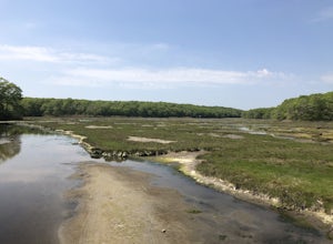
Hike Rocky Neck State Park Trail
5.02.5 mi / 141 ft gainRocky Neck State Park Trail is a 2.5 mile loop hike where you may see beautiful wild flowers located near East Lyme, Connecticut.Read more -
Granby, Connecticut
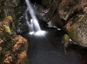
Hiking Enders Falls
4.0Enders State Forest sprawls over approximately 2000 acres, and is found within the towns of Granby and Barkhamsted in Connecticut. Enders has a good sized parking lot directly on Route 219. From the junction of Route 219 and Route 20, visitors will proceed west on Route 219 for 1.2 miles and tu...Read more -
Meriden, Connecticut
Higby Mountain Trail
2.11 mi / 486 ft gainThe popular route for this hike is to park your car at the base of the trail which is located right before merging onto 91-S in Middlefield, CT. The parking lot does seem to get crowded mid-day, especially if the weather is nice! The beginning of the hike is mostly flatter land and an incline w...Read more -
Southington, Connecticut
Hike the Crescent Lake & Metacomet Trail Loop
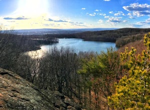
4.02.4 mi / 269 ft gainThe hike to view Crescent Lake is peaceful. You can either walk through the woods where you will be blessed with natures finest birds and wildlife or you can take the trail along the lake edge. Both are similar distances and lead to the same hill at the end! Once you get to the top take a left on...Read more -
Southington, Connecticut
Rock Climb Ragged Mountain
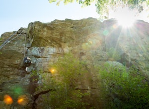
The main face of Ragged Mountain (elev. 761 feet) is home to a lot climbing in central Connecticut. It runs north-south for about 600 feet. Its max height of 100 feet. The crag is home to several rock climbing guides and schools. Routes range in difficultly from great for the beginner (5.3) to su...Read more -
Westerly, Rhode Island
Napatree Point Conservation Area Trail
4.03.19 mi / 82 ft gainNapatree Point Conservation Area Trail is a loop trail that takes you past scenic surroundings located near Westerly, Rhode Island.Read more -
Westerly, Rhode Island
Watch the Sunset over Misquamicut Beach
5.0Misquamicut is one of Rhode Island’s most popular beach locations during the day. As the evening approaches most beach goers pack up, tired from a day of playing in the waves and lounging on the beach’s beautiful sand. It’s during this time, when the crowds disperse and the day begins to turn to ...Read more -
Charlestown, Rhode Island
Visit the Frosty Drew Observatory
The Frosty Drew Observatory is located near the tip of southern Rhode Island, which means apart from summer this is a very quiet beach town. The isolation from major urban areas provides the perfect conditions for star-gazing. The building itself is located on a large plot of land dedicated to na...Read more -
Ashland, Massachusetts
Hike the Ashland Reservoir Trail
5.03.2 mi / 68 ft gainPark in the lot on State Park Road (see map) to access the trail. It's a popular trail that is dog-friendly. Pay attention to the trail as at parts it is not well marked.Read more -
Clinton, Massachusetts
Watch a Sunset at Wachusett Reservoir
4.5Wachusett Reservoir is located in central Massachusetts, northeast of Worcester. Easy location and parking, you can go anytime of the day and you won't be disappointed. The Reservoir is the second largest body of water in the State of Massachusetts, taking place in 5 cities around the area, West ...Read more -
Charlestown, Rhode Island
Watch the Sunrise at East Beach, RI
Walking over the dunes in the dark you can hear the waves breaking on shore from the parking lot. Wet suited up, camera in hand, make your way over the dunes and down to the water. East Beach is a sandy beach and with the right swell size and direction you'll get some sizable shore break to play ...Read more -
Meriden, Connecticut
Hike the Metacomet, Blue, and Yellow Loop
5.04.5 mi / 976 ft gainStart from the Castle Craig road entrance. Walk until you're greeted by a beautiful reservoir. You'll notice the strange but beautiful Mine Island in the middle of all this. You'll also notice markers for White Trails and Yellow Trails. The White Trail is an easier/wider trail. The Yellow Trail C...Read more -
Charlestown, Rhode Island
Car Camp at Charlestown Breachway Campground
Rhode Island is nicknamed the Ocean State for a reason, and camping by the coast is something absolutely necessary while in New England. During the summer and early fall, Charlestown, RI, as well as the surrounding beach towns, come alive with tourists from all over the globe. The Breachway Campg...Read more -
South Kingstown, Rhode Island
Hike the Osprey Point Loop on Trustom Pond
2 miCareful on the drive in for deer! From the parking lot head right around the Farm Field Loop Trail then continue to your right down Osprey Point Trail (0.8 miles). This is where you will most likely see the deer up close. Continue to your right to the Osprey Point Overlook, which will (on a clear...Read more -
Westminster, Massachusetts
Summit Mt. Wachusett via the West Side Trail
5.01.2 mi / 750 ft gainSet your GPS to Wachusett Mountain ski area. Coming from Rt. 2 turn onto Mile Hill Rd and look for your first right to take Bolton Rd. Take this road all the way until it intersects with West Princeton Rd. Turn left. and drive down W Princeton Rd for 1.2 miles and there should be a small parkin...Read more -
Bolton, Massachusetts
Take a Stroll at Fyfeshire Conservation Area
1.0Fyfeshire is located in Bolton Massachusetts off "Wattaquadock Hill Road", near the "Fotini's Restaurant and Bar". The trailhead begins at a small parking area with a stone gate that says Fyfeshire Conservation area on a wood plank. Once you are in the conservation area you will see an opening in...Read more

