Colorado
It's hard to beat what the Rockies have to offer. A plethora of world-class skiing in the winter, and all the hiking, backpacking, camping, mountain biking, and rafting you could hope for in the summer. Looking for a challenge?Maybe try your hand at one of Colorado's 14,000 ft peaks (there's somewhere between 53 and 58, depending who you ask).
Top Spots in and near Colorado
-
Nederland, Colorado
Hiking the Indian Peaks Wilderness' Lost Lake
4.34.5 mi / 1000 ft gainLost Lake of the Indian Peaks Wilderness area is a scenic short hike (about 3 hours) with a lot to see. The trailhead is tucked at the end of a road that passes through Eldora, a charming village of cabins and old abandoned buildings. You will pass by the lost "town" of Hessie on foot, which is w...Read more -
Teller County, Colorado
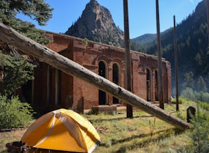
Backpack to the Abandoned Skagway Power Plant and Ghost Town
3.510 mi / 1000 ft gainConstruction of the Skagway Plant began in 1899 and was complete in 1901. In 1965, 15 days of rain brought floods washing out a lot of the pipeline and other infrastructure. Fixing the power plant didn’t make sense and funds weren’t in place. The land was reverted to the government. The hike b...Read more -
Boulder, Colorado
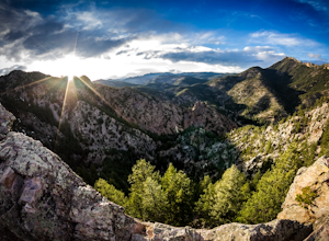
Hike the Rattlesnake Gulch Trail
4.35.3 mi / 1304 ft gainRattlesnake Gulch Trail is located in Eldorado Canyon State Park. It is a short 20 minute drive from Boulder and is one of three hikes in the park. You will need to pay an entrance fee to get inside to the park which costs $8. The trail is approximately 2.8 miles one way and carries a consistent ...Read more -
Larimer County, Colorado
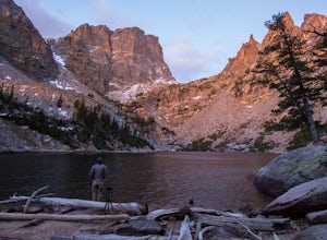
Emerald Lake via Bear Lake Trailhead
4.93.15 mi / 650 ft gainAnyone who has been to Rocky Mountain National Park, or any national park for that matter, knows they get CROWDED. One of the best ways to beat the crowds are to arrive before the sun comes up (or stay after it goes down). That's how we opted to do Emerald Lake in RMNP. After spending the night ...Read more -
Morrison, Colorado
Hike Mount Falcon
4.03.7 miJust a short drive from Denver up US-285 sits Mount Falcon Park, a 2,248 acre open space park managed by Jefferson County. With over 12 miles of hiking trails and stunning views of Denver and the Front Range, this park is perfect for getting in a quick adventure when you don’t feel like driving t...Read more -
Jefferson, Colorado
Backpack Lost Creek
4.05 miI included a trail map of where I camped. There are many sites all throughout this area. From the Lost Park Campground Parking lot follow the Lost Creek for 2.4 miles. At the 1 mile mark was the best place that we found to cross the creek (there are two logs that make a bridge across the creek). ...Read more -
Boulder, Colorado
Boulder's Skyline Traverse
5.014.77 mi / 4583 ft gainHave you ever reached the bottom of a hike with some friends and thought, 'That was nice, but I'd still like to hike more... a lot more.'? Then the Skyline Traverse is for you. Instead of hiking just Green Mountain or Bear Peak, the Skyline Traverse links South Boulder Peak, Bear Peak, Green Mou...Read more -
Aspen, Colorado
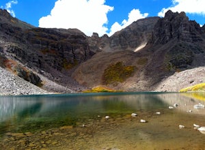
Backpack Cathedral Lake
4.75.6 mi / 2000 ft gainCathedral Lake offers an excellent alternative to escape the crowds that swarm the Maroon Bells area, especially in the peak autumn season. The drive along Castle Creek Rd towards the abandoned ski town Ashcroft is lined with aspens showing off their golden hues. Parking at the trailhead is plent...Read more -
Nederland, Colorado
Backpack to Caribou Lake
4.08.2 miThis is one of the most beautiful hikes I have ever done in Colorado. It is a great trip for photographers, fisherman or anyone who enjoys mountain views, forests filled with wildlife and peaceful meadows. Distances: Arapaho Pass: 3.2 miles, Caribou Lake: 4.2 miles, Caribou Pass: 6.4 miles, Meado...Read more -
Estes Park, Colorado
Lumpy Ridge to Gem Lake
4.33.12 mi / 950 ft gainBegin by parking at the Lumpy Ridge trailhead, which is a couple miles outside of Estes Park on McGregor Avenue. At the trailhead, there are numerous signs indicating hiking trails, climbing routes, and other information about the area. After parking start hiking on the trail to the right of the ...Read more -
Silver Plume, Colorado
Grays and Torreys Peaks
4.37.97 mi / 3458 ft gainAt about an hour's drive from Denver, Grays Peak (14,270 ft./4338m) and its sister mountain, Torreys Peak (14,267 ft./4337m), are two of the most popular 14ers in the state. Because of this, a wealth of information is available on the internet. Rather than go into all the details of the technical...Read more -
Kremmling, Colorado
Radium Hot Springs
5.0The Parking Area & Trailhead have been updated by the BLM from the previous starting point at Mugrage Campground, which is no longer open. The BLM has also built a relatively short and easy trail from the new parking area to the hot springs. The springs are not too hot, about 80-90 degree F...Read more -
Larimer County, Colorado
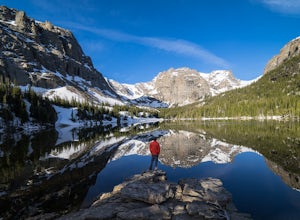
The Loch Vale Hike
5.05.53 mi / 1056 ft gainThe trail starts at the Glacier Gorge trailhead along the road to Bear Lake. After hiking for just under a mile, you'll pass Alberta Falls and continue up the trail through the gorge. At about 2 miles you'll reach a clear junction, with trails towards Mills Lake, Lake Haiyaha, and The Loch. Take ...Read more -
Estes Park, Colorado
Longs Peak
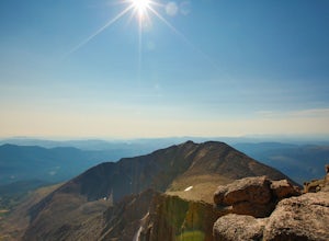
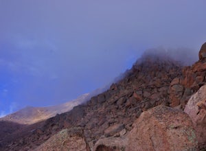
5.013.3 mi / 5100 ft gainFor the most part, this hike is very straightforward, so I'll essentially skip over the first 5.5 or so miles of the hike, but, in case you don't know: Start (very early so you get a parking spot) from the trailhead right next to the parking lot (the road to it is paved - seriously this mountain...Read more -
Cascade, Colorado
Hike Barr Trail to Pikes Peak Summit
5.012 mi / 7400 ft gainBarr Trail is a 12 mile hike that travels the east face of Pikes Peak, from Manitou Springs (6700’) at the base, to the summit (14,115’). Because there are so many factors that can influence anyone’s experience of the trail (weather, fitness level, time of day, preparedness, etc.), and because ma...Read more -
Alamosa County, Colorado
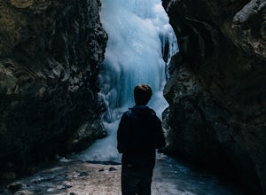
Zapata Falls
4.70.5 mi / 150 ft gainDriving towards the Sand Dunes, you will see a sign marker that indicates the road up to Zapata Falls. Turn right onto the road a follow it for about 2 miles until you hit the parking lot at the top. The road is in pretty rough condition so if your car doesn't have high clearance make sure you ta...Read more

