Vail, Colorado
Top Spots in and near Vail
-
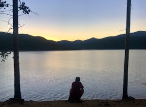
Turquoise Lake, Colorado
Escape to Turquoise Lake
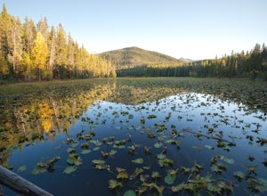
5.0Turquoise Lake is an 'off the beaten path' gem only 3 hours from the Denver Metro Area. The area surrounding the lake is home to some spacious and tree-shaded campgrounds. If you plan ahead and book early, you'll have your pick of the best spots within close proximity to the lake. The campground ...Read more -
Leadville, Colorado
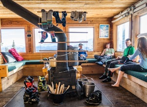
Ski Hut-to-Hut from Uncle Bud's to Skinner Hut
5.024.5 mi / 4700 ft gainThe trek starts just outside of Leadville near Turquoise Lake at 9800 ft. The first day you'll travel 6.5 miles and gain 1700 ft. to Uncle Bud's Hut, which sits around 11,400 ft. The second day you'll ski 7.1 miles to Skinner Hut and gain 2100 ft, mostly in the last 3 miles after having dropped...Read more -
Meredith, Colorado
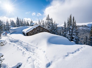
Ski Betty Bear to Skinner Hut
20.2 mi / 3650 ft gainBetty Bear and Skinner Huts reside deep in the Colorado backcountry surrounded by thick forests and snowy peaks. Both of these huts offer an opportunity for off-grid leisure and crowd-free skiing. The huts come stocked with padded mattresses, wood stoves & fuel, propane burners, all cookware ...Read more -
Loveland Pass, Colorado
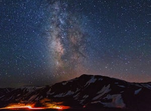
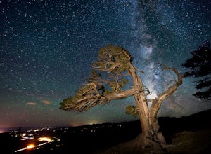
Photograph the Milky Way at Loveland Pass
Loveland Pass is often very busy during the winter as people move through the pass to access the nearby ski areas and just as popular for tourists admiring the beauty of the continental divide in the summer. It is also the start of some great hiking trails like the Mount Sniktau Trail. However, ...Read more -
Dillon, Colorado
Hiking Mount Sniktau
5.04 miMount Sniktau is a great beginner 13er. This hike offers a fun ridge walk with amazing views! Make sure you come prepared, the wind can be pretty relentless. Parking is limited so make sure you arrive early.This hike will get your blood pumping from the moment you exit your vehicle. You will cli...Read more -
Dillon, Colorado
Hike Grizzly Peak at Loveland Pass
5.06 mi / 2900 ft gainWhile a typical Colorado hike may be an ascent to your destination followed by a descent back to your car, the hike to Grizzly Peak at Loveland Pass (Grizzly Peak "D") breaks that mold. At 13,427 feet, Grizzly Peak stands in the path to Torreys Peak’s west face (14,267’). Even though it is only ~...Read more -
Leadville, Colorado
Overnight at the Emma and Marceline Yurts, Leadville
11 mi / 1200 ft gainDrive past the main downtown of Leadville and then head into the mountains south of town, following Mt. Sherman Road to the Yurt parking along a ridge before you come to the Black Cloud Mine. There are signs that say "Yurt Parking". Follow the road a little further down to a jeep road just before...Read more -
Breckenridge, Colorado
Camp at Boreas Pass
9 mi / 1500 ft gainBoreas pass is a high mountain pass in the Rocky Mountains that sits on the Continental Divide at 11,481'. Forest Service Road 33 goes over the pass and has numerous campsites all along its length, with several near the summit that feature breathtaking views of the Tenmile Range and the Breckenri...Read more -
Breckenridge, Colorado
MTB Boreas Pass
Boreas Pass is a scenic route that lies between Como (north of Fairplay on Hwy 285) and Breckenridge. It is 21 miles of low maintenance, rough gravel road that follows the Continental Divide and summits at 11,481 feet. Other than the altitude, the ride is not difficult, as the grade is not steep ...Read more -
Breckenridge, Colorado
Discover Ancient Trees on Windy Ridge
The Windy Ridge Bristlecone Pine Scenic Area is a remote stand of trees off a 4WD road near Alma, Colorado. This grove of bristlecone pines was given protected status in 1964 due to its uniquely shaped trees influenced by the winds blasting off nearby 14er, Mount Bross. The area sits at 11,700 ...Read more -
Dillon, Colorado
Off-Road to Glacier Mountain
5.07.4 mi / 2100 ft gainThe trail begins just past historical Main Street Montezuma. You will see a sign on your right for St. Johns road. This road is officially marked as 275 on a map. The original road lead to St. Johns but not much of the town remains.You will cross the Snake River almost immediately after you turn ...Read more -
Dillon, Colorado
Wildflowers, Lakes, and Peaks, Oh My!
5.0Herman Gulch is one of those special places that makes you fall in love with Colorado all over again. This spectacular wildflower hike that ends at an alpine lake will have your head swiveling from start to finish. Wildflower season is July and August, with peak season being mid-to-late July. Ple...Read more -
Dillon, Colorado
Backcountry Snowshoe and Ski Paradise
5.07 mi / 1700 ft gainA popular wildflower hike in summer, Herman Gulch is arguably even prettier covered in snow. The north-south trail offers views of the impressive Mount Sniktau to the south and Pettingell Peak to the north--with much to see along the way. Officially, the trail weaves in and out of the forest and ...Read more -
Dillon, Colorado
Snowshoe or Ski Watrous Gulch
4.04 mi / 1200 ft gainDespite sharing a trailhead with the popular Herman Gulch, I had not heard of Watrous Gulch until I stumbled across it while researching something else. Knowing that Herman Gulch is filled with spectacular views and deep snow ideal for snowshoeing/skiing, I had to discover if the smaller, lesser-...Read more -
Breckenridge, Colorado
Mount Guyot Snow Climb
5 mi / 2500 ft gainFrom Jefferson follow 35 north to 54 and drive up 54 as far as possible ending a few miles before Georgia pass. Depending on the snowpack and drifts on the unplowed road, you could hike as few as 5 miles round trip or as many as 10. If the snow blocks you from driving past Michigan Creek Campgro...Read more -
Meredith, Colorado
Hike to Chapman Lake
1.6 miFrom downtown Basalt, drive up the Fryingpan River Road 28 miles and turn right on CR #504, also known as Elliot Way, just before Norrie Colony. Drive across the river and up the switchbacks for approximately 3 miles. Take the left fork, continue 1 mile and take the right fork approximately 1/2 m...Read more

