Vail, Colorado
Looking for the best skiing in Vail? We've got you covered with the top trails, trips, hiking, backpacking, camping and more around Vail. The detailed guides, photos, and reviews are all submitted by the Outbound community.
Top Skiing Spots in and near Vail
-
Dillon, Colorado
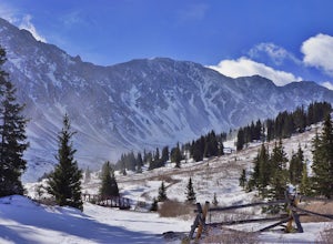
Hike Grizzly Peak at Loveland Pass
5.06 mi / 2900 ft gainWhile a typical Colorado hike may be an ascent to your destination followed by a descent back to your car, the hike to Grizzly Peak at Loveland Pass (Grizzly Peak "D") breaks that mold. At 13,427 feet, Grizzly Peak stands in the path to Torreys Peak’s west face (14,267’). Even though it is only ~...Read more -
Leadville, Colorado
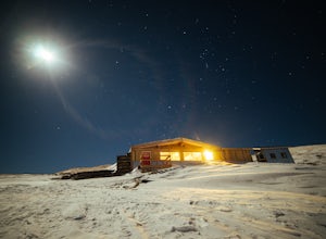
Overnight at the Emma and Marceline Yurts, Leadville
11 mi / 1200 ft gainDrive past the main downtown of Leadville and then head into the mountains south of town, following Mt. Sherman Road to the Yurt parking along a ridge before you come to the Black Cloud Mine. There are signs that say "Yurt Parking". Follow the road a little further down to a jeep road just before...Read more -
Dillon, Colorado
Backcountry Snowshoe and Ski Paradise
5.07 mi / 1700 ft gainA popular wildflower hike in summer, Herman Gulch is arguably even prettier covered in snow. The north-south trail offers views of the impressive Mount Sniktau to the south and Pettingell Peak to the north--with much to see along the way. Officially, the trail weaves in and out of the forest and ...Read more -
Dillon, Colorado
Snowshoe or Ski Watrous Gulch
4.04 mi / 1200 ft gainDespite sharing a trailhead with the popular Herman Gulch, I had not heard of Watrous Gulch until I stumbled across it while researching something else. Knowing that Herman Gulch is filled with spectacular views and deep snow ideal for snowshoeing/skiing, I had to discover if the smaller, lesser-...Read more -
Breckenridge, Colorado
Mount Guyot Snow Climb
5 mi / 2500 ft gainFrom Jefferson follow 35 north to 54 and drive up 54 as far as possible ending a few miles before Georgia pass. Depending on the snowpack and drifts on the unplowed road, you could hike as few as 5 miles round trip or as many as 10. If the snow blocks you from driving past Michigan Creek Campgro...Read more -
Dillon, Colorado
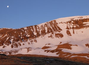
Sunset Views from Morgan Peak
8.42 mi / 2900 ft gainHow you get to Morgan Peak and the other 13ers in the area depends on if you have a 4-wheel drive with good clearance or not. If so, drive the rough Santa Fe road from the small town of Montezuma (just outside Keystone). The road is also known as Forest Service 264 and is a left at the stop sign ...Read more -
Parshall, Colorado
Snowshoe Butler Gulch
5 mi / 1500 ft gainIn fall, winter and spring, the trail is covered in snow, which makes it ideal for backcountry skiing and snowshoeing. The trail becomes indistinguishable after the first mile or two, but usually you can follow previous skiers' tracks up the mountainside.What you miss in wildflowers or mine sight...Read more -
Parshall, Colorado
Ski or Snowshoe Jones Pass
4.06 mi / 1600 ft gainIts sister trail, Butler Gulch, is an all-time favorite hike (both summer and winter), and since they share a trailhead, I knew Jones Pass would be special as well.Jones Pass is not the type of trail I normally take, since it is actually a 4x4 road that is used for Jeeping in the summer and snowm...Read more -
Dillon, Colorado
Bakerville Scenic Snowshoe/XC Ski Trek
4.0In summer, Stevens Gulch Road, the access point to Grays Peak and Torreys Peak, is typically packed with adventurers intent on summiting a 14er or two. Once the snow comes, this unmaintained road becomes impassible, and the once busy lane transforms into a silent and pristine haven for snowshoers...Read more -
Fairplay, Colorado
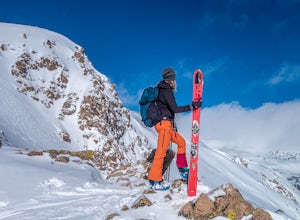
Climb Horseshoe Mountain via Boudoir Couloir
7 mi / 2500 ft gainHorseshoe Mountain is a peak that is ranked in the top 100 tallest peaks in Colorado at 13,898 feet, and it can be done in the summer but is arguably more fun in the spring as a snow climb. Avalanche safety, snow climbing, and snow safety experience is necessary. To get to the trailhead, follo...Read more -
Leadville, Colorado
Ski or Snowshoe to the Weston Pass Hut
5.013.4 mi / 2400 ft gainYour trip starts at the winter trailhead for Weston Pass, approximately 6.7 miles from the hut. Depending on road conditions, you may be able to cut off a few miles by driving further up the road.In the summer, you can drive all the way to the hut, and enjoy a great basecamp for hiking and trail ...Read more -
Berthoud Pass, Colorado
Ski or Snowboard Berthoud Pass Colorado
Berthoud Pass is 55 miles from Denver making it one of the closest places to get out and backcountry tour in the winter. At 11,370 Berthoud Pass crosses the continental divide. From the top of the pass you can do shuttle runs down the south side of the pass. Or, you can venture on the East or Wes...Read more -
Silver Plume, Colorado
Argentine Railroad Grade
5.05.35 mi / 863 ft gainThe Argentine Central Railroad Grade trail is just what it says: it follows the old rail bed of the Argentine Central line. All railway remnants have long since been removed, and in its place is a wide, well-defined trail with an easy grade. With just a 900-foot incline over the course of about t...Read more -
Dillon, Colorado
Silver Dollar Lake Trail
5.03.93 mi / 945 ft gainGuanella Pass, which connects the charming and historic town of Georgetown in the north to the blink-and-you’ll-miss-it Grant to the south, is a recreational outdoorsman’s dream. Volumes could be written on what this 22-mile scenic byway has to offer. Silver Dollar Lake Trail is just one tiny po...Read more -
Winter Park, Colorado
Snowshoe to Broome Hut
1.5 mi / 729 ft gainTake I-70 from Denver and then US 40, go all the way to Mile marker 240 of US 40 and park in the area at the side of the road. The Second Creek trail head is just behind the parking area and is easy to find.The trail climbs from a start at 10,600ft and finishes up at 11,325ft at the hut, but you ...Read more -
Dillon, Colorado
Hike the 7:30 Mine Road in Silver Plume
4.05 mi / 1200 ft gainWith a name like 7:30 Mine Road, this is one hike I had to investigate to see if it lives up to its name. Even though this is an easier hike than I normally choose, what it lacks in challenging terrain, it makes up for in historic interest. The view isn’t too bad, either.7:30 Mine Road is about t...Read more

