Summit County, Colorado
Top Spots in and near Summit County
-
Littleton, Colorado
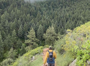
Golden Eagle Trail to Bill Couch Mountain
5.06.76 mi / 1509 ft gainGolden Eagle Trail to Bill Couch Mountain is an out-and-back trail that provides a good opportunity to view wildlife located near Indian Hills, Colorado.Read more -
Littleton, Colorado
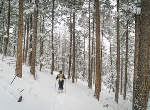
Snowshoe Deer Creek Canyon Park
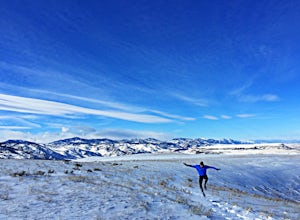
5.1 mi / 1250 ft gainDeer Creek Canyon Park offers up to 13 miles of wind-sheltered trails perfect for enjoying after a fresh snow. The Plymouth Mountain Trail offers steep climbs and big views while Homesteader Trail offers the best forest scenery in the Denver area. The recommended route is Plymouth Creek Trail to ...Read more -
Littleton, Colorado
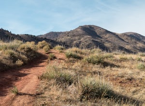
Hike the Meadowlark Plymouth Trail
4.06 mi / 1197 ft gainFrom the parking lot, you can take the Meadowlark trail to the west or the Plymouth Creek Trail to the southeast. It does not matter which trail you take because it ends up becoming loop. For a more gradual slope up the hill, take the Meadowlark trail. After a little more than a mile, it intersec...Read more -
Lakewood, Colorado
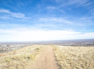
Hike to Radio Tower Overlook
4 mi / 1312 ft gainI loved this trail when I lived in Lakewood. It has a decent elevation gain, close to the city, spectacular views, and you can pretty much hike it year round unless you just had a winter snow storm (though you could just hike in snow boots!). I take the John O Hayden Trail from the Utah Parking l...Read more -
Boulder, Colorado
Hike the Tenderfoot Trail
4.32.1 mi / 400 ft gainFrom Chautauqua Park in Boulder, follow Baseline Road west (if you are driving up the mountain, you are golden). Drive 3.4 miles up Flagstaff Road and look for the sign for Realization Point on your right. It’s a little tricky to see from the road, so keep an eye on your odometer. The trail star...Read more -
Aspen, Colorado
Ute Trail to Ute Rock
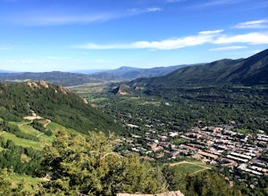
4.71.75 mi / 1122 ft gainThis shady trail of switchbacks ascends steadily (over a thousand feet in under a mile) to a rock outcropping at 9,185 feet. Yes, you can expect your heart to be pounding and to be huffing and puffing as you climb Ute Trail. But the view of Aspen that rewards you is spectacular. The trail is pre...Read more -
Pine, Colorado
Fish Cheeseman Canyon
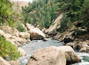
5.0Cheesman Canyon is considered one of the top fisheries in the world, and this stretch of the South Platte River is easily accessed at the Cheesman trailhead off CR 126 just Southwest of Deckers. There are tons of great fishing opportunities along this stretch of the river, but it does tend to ge...Read more -
Lakewood, Colorado
Green Mountain Trail Loop
4.16.37 mi / 1060 ft gainGreen Mountain Trail is a 6.5-mile loop and has a challenging ascent to the park's highest point. Because the mountain is one of the first to rise out of the plains, you get unique views of where the mountains meet the prairie and fascinating geology. The summit, at 6,857' offers stunning views o...Read more -
Lakewood, Colorado
Green Mountain Mountain Bike Loop
4.06.9 mi / 1047 ft gainSkip the bar and spend happy hour hiking/biking this fun and easy loop. With convenient access from the Denver-Metro Area, this spot is perfect for a quick ride after work, or hike with your dog. The park has three parking lots, and the trail can be completed as a loop system (in either directio...Read more -
Aspen, Colorado
Camp Difficult Campground, Aspen
This is a great backup campground if all of Maroon Bells campgrounds are full, which in all reality is highly likely. If you're looking to beat the crowds, this is a good number campground to consider. This campground is right off the highway, 5 miles away from the town of Aspen, easy to find, an...Read more -
Boulder, Colorado
Hike South Boulder Peak
4.56.7 mi / 2900 ft gainStarting at the Mesa trailhead, continue a half a mile through a relatively even grade before arriving at the North Fork Shanahan trailhead, which will take you another half a mile on much steeper grade up to Fern Canyon where you will start a much harder portion of the hike; here, you'll head st...Read more -
Boulder, Colorado
Hike the Big Bluestem Trail Loop
4.04.35 mi / 841 ft gainThis is a great spot for an easy/moderate hike or trail run. The trail is accessible year round and can often be hiked in winter as well as other seasons. You start out at the Mesa Trailhead parking lot off of Hwy 170. There is a parking lot here but this is a starting spot for several hikes into...Read more -
Boulder, Colorado
Hike Bear Peak
4.87 mi / 2810 ft gainThe best advice I can give you? Wake up early to start this hike.Even though the Bear Peak hike will only take you about 4-5 hours round trip, it will still be advantageous to get off the mountain before afternoon and evening storms might pass through. This is a steep 7-mile out and back trail.St...Read more -
Boulder, Colorado
Doudy Draw Trail
4.37 mi / 433 ft gainDoudy Draw Trail is an out-and-back trail where you may see beautiful wildflowers located near Boulder, Colorado.Read more -
Lyons, Colorado
Hike Meadow Mountain
4.07.7 mi / 2832 ft gainFrom the trailhead, follow the trail through the woods until you reach a meadow with a steep slope. Some portions of this slope reach an angle of 30 degrees and may feature slight avalanche danger in the winter. However, the trail is used enough that such conditions would make themselves known ...Read more -
Ward, Colorado
Hike the Ceran St. Vrain Trail
5.04 mi / 1207 ft gainThe Ceran St. Vrain trail north of Jamestown offers the hiker a nice respite from the summer sun as this path runs through dense pine forests. The trail follows the South St. Vrain Creek for most of the way and follows moderate grades throughout. There is no official end to the trail, only that i...Read more

