Summit County, Colorado
Looking for the best photography in Summit County? We've got you covered with the top trails, trips, hiking, backpacking, camping and more around Summit County. The detailed guides, photos, and reviews are all submitted by the Outbound community.
Top Photography Spots in and near Summit County
-
Vail, Colorado
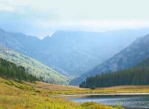
Hike the Upper Piney River Trail
4.05.6 mi / 350 ft gainBeginning at an elevation of 9,397 feet, this hike provides an easy 2.8 mile (one way) trip through the gorgeous meadows against the distant aspens and alpines. Wildflowers and wildlife are abundant, which make this trip a fantastic education and play experience for kids.Coordinates for the trail...Read more -
Vail, Colorado
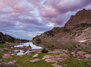
Backpack to Bubble Lake
3.013 mi / 3600 ft gainThe Gore's are a rough and remote section of the Eagle's Nest Wilderness. What this trip may lack in overall miles, it more than makes up for in elevation gain, scrambling, boulder hopping, and overall hard miles on the trail. Every trip I have had the pleasure of taking into the Gore Range has...Read more -
Leadville, Colorado
Camp at Kite Lake
5.0Kite Lake is a beautiful little lake that is surrounded plenty of fourteeners. Just outside of Alma, Colorado, Kite lake can be accessed from Buckskin Street. Buckskin is a simple left turn after the only bar in Alma, or a right turn before the only bar in Alma... Do note, this road is not drivab...Read more -
Leadville, Colorado
Mt. Democrat (CLOSED)
4.84 mi / 2150 ft gainNOTE: As of March 2023, access to parts of this loop that are on private property (including Mt. Democrat & Mt. Lincoln) are closed to the public indefinitely. (Source) To begin this wonderful hike, drive from the town of Alma, Colorado and head up Buckskin Street for about 6 miles. I would ...Read more -
Leadville, Colorado
Mounts Democrat, Lincoln, Cameron and Bross (CLOSED)
4.08 mi / 3500 ft gainNOTE: As of March 2023, access to parts of this loop that are on private property (including Mt. Democrat & Mt. Lincoln) are closed to the public indefinitely. (Source) Find your way to the Kite Lake trailhead near Alma, Colorado. The road up to the trailhead is suitable for most vehicles, i...Read more -
Breckenridge, Colorado
Discover Ancient Trees on Windy Ridge
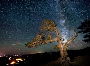
The Windy Ridge Bristlecone Pine Scenic Area is a remote stand of trees off a 4WD road near Alma, Colorado. This grove of bristlecone pines was given protected status in 1964 due to its uniquely shaped trees influenced by the winds blasting off nearby 14er, Mount Bross. The area sits at 11,700 ...Read more -
Georgetown, Colorado
Hike to Square Top Lakes
4.3 mi / 1080 ft gainStarting from Guanella Pass, right across from the Bierstadt trailhead, Square Top Lakes is definitely a hidden gem. Most people here are attempting to do the 14er, but if you've already bagged that one (or are just looking for some high altitude hiking to get you ready for it), Square Top Lakes ...Read more -
Idaho Springs, Colorado
Bierstadt, Evans, and The Sawtooth Loop
4.59.76 mi / 3438 ft gainStarting from the oddly poorly marked Guanella Pass Trailhead (Google maps directions to Guanella Campground and then drive about two miles past it to the south), the trail heads southeast toward Bierstadt, and much of your route to the first summit is visible from the parking lot. The trail to ...Read more -
Idaho Springs, Colorado
Watch the Sunrise at Guanella Pass
5.01 mi / 100 ft gainFrom Denver, take i70 to Georgetown and simply follow the signs through town to the top. This pass can also be accessed from the south via US Highway 285 at the town of Grant. Guanella Pass is closed in the winter, typically from about the last week in November through the last week of May. Watch...Read more -
Dillon, Colorado
Mount Bierstadt
4.67.18 mi / 2697 ft gainIf you’re ready for your first 14er, Mount Bierstadt holds a reputation for a great “starter” 14er. Of course, experienced climbers will enjoy this (relatively speaking) easy mountain as well. Besides the joy of the hike itself, Bierstadt is a stunning wildflower hike in July and August. Thanks t...Read more -
Silver Plume, Colorado
Argentine Railroad Grade
5.05.35 mi / 863 ft gainThe Argentine Central Railroad Grade trail is just what it says: it follows the old rail bed of the Argentine Central line. All railway remnants have long since been removed, and in its place is a wide, well-defined trail with an easy grade. With just a 900-foot incline over the course of about t...Read more -
Dillon, Colorado
Hike the 7:30 Mine Road in Silver Plume
4.05 mi / 1200 ft gainWith a name like 7:30 Mine Road, this is one hike I had to investigate to see if it lives up to its name. Even though this is an easier hike than I normally choose, what it lacks in challenging terrain, it makes up for in historic interest. The view isn’t too bad, either.7:30 Mine Road is about t...Read more -
Idaho Springs, Colorado
ATV Leavenworth Creek Road (Guanella Pass)
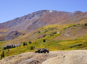
16.6 mi / 3655 ft gainSeptember is famous in Colorado for clear, deep blue skies,sublimely perfect temperatures, and gold-digging – of the leaf variety, thatis. On September 9, wildflower season was recently past and the best of theleaves were yet to come, but it was the perfect, clear and sunny day to checkout the hi...Read more -
Jefferson, Colorado
Colorado Trail: Kenosha Pass to FR 130
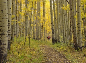
4.66.81 mi / 938 ft gainThe Colorado Trail (http://www.coloradotrail.org) is 500 miles long and stretches from Denver to Durango. Perhaps the most-traveled portion of the Colorado Trail is at Kenosha Pass. Kenosha Pass is well-known for its thick, colorful stands of aspen in the fall. During peak leaf season (late Septe...Read more -
Minturn, Colorado
Ski Notch Mountain
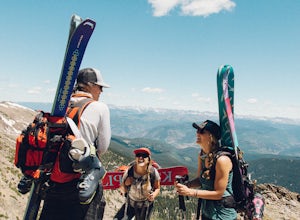
10 mi / 3000 ft gainWhat's not to love - you'll be skiing in the off season! We did this hike/ski in late June, our skis, boots, and avi gear packed with our hiking shoes on our feet. May could potentially be the most opportune time for this adventure. The hike you will take is the traditional Notch Mountain Hike. T...Read more -
Minturn, Colorado
Scramble the Halo Ridge on Mt. Holy Cross
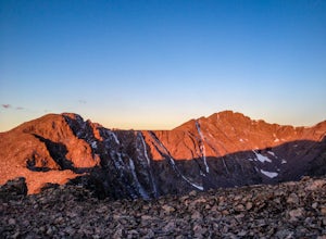
5.015 mi / 5210 ft gainThe Halo Ridge is by no means the easiest route to the summit of Mt. Holy Cross, but it is definitely the most interesting and scenic. You'll begin at the Half Moon (Tigiwon) trailhead, but instead of the popular Halfmoon Trail, you will start on the Fall Creek Trail as it leaves the campground.T...Read more

