Snowmass, Colorado
Looking for the best hiking in Snowmass? We've got you covered with the top trails, trips, hiking, backpacking, camping and more around Snowmass. The detailed guides, photos, and reviews are all submitted by the Outbound community.
Top Hiking Spots in and near Snowmass
-
Crested Butte, Colorado
Hike Gothic Mountain
6.5 mi / 3025 ft gainThe Gothic mountain trailhead starts at 9600' about 10 miles outside Crested Butte, Colorado. A four wheel or all wheel drive vehicle is recommended to make it to the trail head. Take trail 403 which will eventually turn into Gothic Mountain trail around mile 2.5. The single track trail winds thr...Read more -
Crested Butte, Colorado
Conundrum Hot Springs via Copper Creek
22.5 mi / 4000 ft gainPlease Note: Conundrum Springs camping requires an overnight permit. You must get a permit in order to camp at the springs. If you're looking for an incredibly challenging hike, Copper Creek to Triangle Pass to Conundrum Springs is the hike for you! When you plug in "Conundrum Springs" into you...Read more -
Crested Butte, Colorado
The Copper Creek Trail to Copper Lake
5.011.53 mi / 2264 ft gainThe Copper Creek Trail to Copper Lake is an out-and-back trail that takes you by a waterfall located near Crested Butte, Colorado.Read more -
Pitkin County, Colorado
Sunset Hike to Twining Peak
4 mi / 1700 ft gainTwining Peak is a ranked 13er located 2 miles north of Independence Pass. The hike involves around 1700 feet of elevation and is mostly off-trail with some class 2 scrambling (class 3 can be had if you look hard enough). Independence Pass is a prominent and popular pass on Highway 82 between Twin...Read more -
Independence, Ohio
Hike Mountain Boy Ridge from the Top of Independence Pass
5.06 miThe trailhead is to the Independence Pass viewing deck is located at the Summit parking area, which is about 20 miles from Aspen and 24 miles west of Highway 24 on the Leadville side. At the parking area you will notice a paved walkway that takes you to the viewdeck, which is a easy five minute w...Read more -
Independence, Ohio
Hike Lost Man Pass via Independence Lake
5.04.5 mi / 1200 ft gainPark at the pull out just west of independence pass. From there, begin on the Linkin's Lake Trail. The trail is generally easy to follow (although it can be muddy as it is a wet area) and climbs 900 feet in the 1.8 miles to independence lake. From Independence lake it is about 0.5 miles and 400 f...Read more -
Minturn, Colorado
Hike to Fancy Pass
5.06 mi / 2373 ft gainThe Fancy Pass Trail near Red Cliff is an excellent option for those looking to experience hiking in the rugged and pristine conditions of a wilderness area. This 6 mile roundtrip trail will take you into the Holy Cross Wilderness and up close and personal with towering peaks, verdant meadows, an...Read more -
Crested Butte, Colorado
Trail Run at Snodgrass Mountain
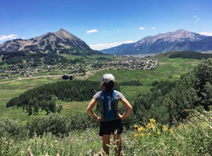
7 mi / 950 ft gainLooking for an easy trail run, close to town, with killer views? Snodgrass Mountain Trail is one of your best bets, with flowy singletrack through aspen groves and views of Mt. Gothic and Mt. Crested Butte. While there are endless beautiful trails to hike and run in the Crested Butte area, this o...Read more -
Minturn, Colorado
Backpack the High Alpine Seven Sisters Lake Chain
12 mi / 1000 ft gainThis lake chain is in a spectacular, undeveloped bowl of jagged and rugged mountain goodness located in the Holy Cross Wilderness Area. This hidden gem is easily accessible and, to my amazement, it is relatively unheard of even among many locals. More wonderful perks included in this backpacking ...Read more -
Crested Butte, Colorado
Blue Lake via Oh Be Joyful Campground
12.96 mi / 2201 ft gainOverview: Round Trip is about 13 miles, about 500 ft ascent at the beginning and 1500 ft ascent in the last 1.5 miles. The majority of the hike is flat and through an AMAZING valley. Getting There: Blue Lake Trailhead is located at Oh Be Joyful Campground on Slate River Rd, just across a river,...Read more -
Crested Butte, Colorado
Explore the waterfalls of Oh Be Joyful Creek
If you're not already camping there, park at Oh Be Joyful Campground, about 5 miles up County Road 734 from downtown Crested Butte. There's parking on either side of the river crossing, but you're going to have to get your feet wet anyway, so might as well park in the first parking lot and walk a...Read more -
Crested Butte, Colorado
Hike Oh Be Joyful Pass
16 miFrom Crested Butte, drive north on Gothic Road and turn left on Slate River Road. Drive 4.5 miles on the dirt road and look for the Oh-Be-Joyful Campground which will be on your left. Drive about 0.5 miles to the campground at the bottom of the hill, by a wide river. This trail begins by a quick...Read more -
Crested Butte, Colorado
Hike to Meridian Lake
4.0The trail starts off with a small river crossing. You can find an easier place to cross nearby, or just march right through, if you have waterproof shoes or sandals.The beginning of the trail is the hardest. You will have a steep incline for about a quarter mile, following switchbacks up to the l...Read more -
Crested Butte, Colorado
Upper Westside to Crested Butte
5.010.92 mi / 2730 ft gainUpper Westside to Crested Butte is an out-and-back trail where you may see beautiful wildflowers located near Crested Butte, Colorado.Read more -
Buena Vista, Colorado
Summit La Plata Peak
5.09.25 mi / 4500 ft gainThe Northwest Ridge is the most easily accessible and popular route, and for good reasons. The trailhead is on the side of Hwy 82, otherwise known as Independence Pass, about 14.5 miles from the Hwy 24 junction, or about 10 miles from Twin Lakes to the east. The trailhead is hard to miss, and you...Read more -
Minturn, Colorado
Climb Mount of the Holy Cross, North Ridge
4.5Just a few miles South Minturn, Colorado, turn onto Tigiwon Road (dirt) and take it about 5 miles to the Half Moon trailhead at . Tigiwon Road is easily accessed by 2WD vehicles and the trailhead should be reachable in the Summer months after the snows have melted.Start early as, at 12 miles, thi...Read more

