Silverton, Colorado
Looking for the best hiking in Silverton? We've got you covered with the top trails, trips, hiking, backpacking, camping and more around Silverton. The detailed guides, photos, and reviews are all submitted by the Outbound community.
Top Hiking Spots in and near Silverton
-
Ouray, Colorado
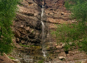
Lower Cascade Falls
3.00.5 miLocated within the picturesque town of Ouray, Colorado, Cascade Falls is what most city parks strive to be. This park and amazing waterfall are located on the edge of town along the longer 5+ mile Perimeter Trail and provides a place for picnics, relaxing, and further days hikes through connector...Read more -
Durango, Colorado
Columbine Pass via Purgatory Flats
5.034.52 mi / 6932 ft gainThis hike begins at the Purgatory Flats Trailhead across from the Purgatory resort. The register is about a hundred yards from the Trailhead and is located next to a trail map. From here you will begin your descent down into the flats, which is roughly a 600-700 foot descent over the course of ju...Read more -
Ouray, Colorado
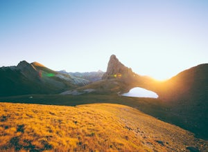
Backpack to Dragon's Back via Horsethief Trail
5.016 mi / 3520 ft gainThe Uncompahgre Wilderness stretches out through the mountains and forests of southwestern Colorado, with worn trails lingering beside abandoned 19th-century mines and crossing old alpine sheep pastures. Dragon's Back is the unofficial name for Point 12,968', a small but beautiful summit at the b...Read more -
Telluride, Colorado
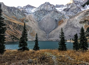
Blue Lakes Trail
5.08.81 mi / 2635 ft gainYour adventure begins at the Blue Lakes Trailhead, elevation 9400’, in Uncompahgre National Forest. Take CO-62 from Ridgway toward Telluride, turn left onto Ouray County Road 7, and follow it into the national forest to the end of the road. Just past the trailhead, the trail splits; be sure to ...Read more -
Placerville, Colorado
Hike Wilson Peak aka Coors Peak
4.0The mountain peak that turns blue when Coors and Coors Light bottles and cans are ice cold is real. No, it is not called Coors Peak. But it is in Colorado, where Coors was born. The snow-capped mountain in the Coors logo is really Wilson Peak near Telluride, Colorado.If you want to crack a Coo...Read more -
Lake City, Colorado
Explore Nellie Creek Falls
5.00.8 mi / 300 ft gainNellie Creek Falls is a beautiful little falls, up County Road 23. The waterfall is surrounded by a forest of aspens leading up the valley. To get to the falls take the northern route of the Alpine Loop from Lake City towards Engineer Pass. In about 5 miles you come to Nellie Creek Road on the ri...Read more -
Lake City, Colorado
Uncompahgre Peak (14,309')
5.07.3 mi / 2881 ft gainAt 14,309 feet, the summit of Uncompahgre Peak is the highest point in the entire San Juan range, but getting to it requires only good hiking skills, good physical shape, and a four-wheel-drive, high-clearance vehicle to get to the trailhead. From Lake City, head west along the Alpine Loop about...Read more -
Durango, Colorado
Hike Goulding Creek
4.05.9 mi / 2122 ft gainThis trailhead is only about 15 miles from Durango on Highway 550. Look out for Glacier Club/Tamarron on your right, and soon after (about a mile) there is a small dirt turn-off on the opposite side of the highway. There is one other turn off on the west side of the highway in this stretch, but i...Read more -
Lake City, Colorado
Backpack to Wetterhorn Basin
13 mi / 3000 ft gainThis trip is for the lover of solitude and the appreciator of the unscathed backcountry. Wetterhorn Basin is in the heart of the beautiful San Juan Mountain range in Southwestern Colorado.With a 4WD high clearance vehicle start at the West Cimarron Trailhead at 10,750 feet (38.1117N -107.5533W),...Read more -
Lake City, Colorado
Capture Fall Foliage and Whitmore Falls on Engineer Pass
5.0Just outside of the small community of Lake City, Colorado is Engineer Pass, a dirt road that has amazing views and opportunities to hike, take pictures, and maybe even explore an abandoned mining town. Four wheel drive or all wheel drive is preferable, but the road can definitely be driven by a ...Read more -
Durango, Colorado
Hike the First Fork/Red Creek Loop
9.8 mi / 2195 ft gainLeaving from Durango, head north on Florida Road/CR 240. From the intersection with County Road 250 (the last stoplight), drive about 8 miles until you reach Colvig Summer Camp. Turn northwest here. The road will soon narrow and turn to dirt - continue straight. 1 mile further, there will be a la...Read more -
Hesperus, Colorado
Summit Centennial Peak in the La Plata Mountains via Sharkstooth Trailhead
6 mi / 2162 ft gainFrom the western end of the town of Mancos, follow CR 42 north until it enters the national forest and becomes FR 561. Go right on FR 350 and keep right at any junctions (there are two of them) until you reach the signed Sharkstooth Trailhead about 19 miles from Mancos. Enjoy your drive through ...Read more -
Durango, Colorado
Hike the Falls Creek Loop
4.54.1 mi / 393 ft gainThe Falls Creek Loop is a 4.1 mile trail in the San Juan National Forest, just outside of Durango, Colorado. Lots of side trails jut out from the main trail, and it is easy to lose your way. Take the middle trail at the first split, and keep following the main splits. You will find yourself on a ...Read more -
Durango, Colorado
Hike the Colorado Trail to Gudy's Rest
4.08.1 mi / 1400 ft gainThis hike, a local favorite is less than five miles from downtown Durango. The entire hike offers beautiful views especially once your reach the top of Gudy's Rest. The trail starts off with a gradual uphill along Junction Creek. On this section of the trail, you will likely run into locals proba...Read more -
Durango, Colorado
Hike the Animas Mountain Trail
5.9 mi / 1535 ft gainThe Animas Mountain Trail is a 6 mile loop trail, easily accessible from town, and best used from March until October. In the early spring and late fall, it is advised to bring YakTrax or similar in case there are icy patches on the trail. This trail is located in the San Juan National Forest nea...Read more -
Durango, Colorado
Mountain Bike in Dalla Mountain Park
4 miThe Dalla Park shares a trailhead and parking lot with the Animas Mountain trail, frequently used for hiking and trail running. There is plenty of room in this lot, as well as several picnic tables. Immediately after crossing through the gate, the trail divides. The bike park takes up the south a...Read more

