Silver Plume, Colorado
Top Spots in and near Silver Plume
-
Frisco, Colorado
Hike Red Buffalo Pass, Frisco to East Vail
13.2 mi / 3400 ft gainStarting at the Meadow Creek trailhead in Frisco, you'll find yourself ending up in East Vail at Gore Lake Trailhead. See all photos here. The trail in Meadow Creek starts to climb at a gradual pace for the 3-4 miles, after a mile or so, take a look back upon the views of Lake Dillion. You'll ar...Read more -
Evergreen, Colorado
Maxwell Falls
3.43.95 mi / 928 ft gainLocated just outside of Evergreen, this beginner hike is a great escape from the city for a few hours. There are three different options to hike to the falls: Maxwell Falls Lower Trail (4 miles), Upper Maxwell Falls Trail (1.1 miles), and Maxwell Falls Bluffs Cliffside Trail Loop (5 miles). On th...Read more -
Breckenridge, Colorado
B&B to Reiling Dredge to Minnie Mine
4.02.84 mi / 436 ft gainB&B to Reiling Dredge to Minnie Mine is a loop trail that provides a good opportunity to view wildlife located near Breckenridge, Colorado.Read more -
Golden, Colorado
Summit Windy Peak via the Burro Trail
4.06.35 mi / 1825 ft gainThe Burro Trail starts at the Bridge Creek Trailhead Parking Lot and leads off to the left. While this trail is incredibly well marked it wouldn't hurt to grab a map at the visitors center before you start! From the parking lot you'll travel along the trail for 0.7 miles until you reach your firs...Read more -
Silverthorne, Colorado
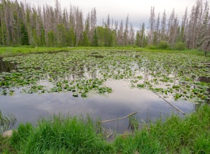
Lily Pad Lake
4.73.27 mi / 531 ft gainLily Pad Lake is a well known destination just outside of Silverthorne and in the Eagle's Nest Wilderness. The trail may be heavily trafficked on the weekends, but solitude can still be found in the early mornings or during the weekdays. The trail starts at the Lily Pad Lake Trailhead, just to t...Read more -
Golden, Colorado
Hike to Forgotten Valley
4.33.6 mi / 852 ft gainThere are over 35 miles of hiking trails in the park. The twelve trails in Golden Gate Canyon State Park are named after an animal and marked with the animal’s footprint.For a 2.6 round trip hike, start at the Burro Trailhead in Golden Gate Canyon State Park. You’ll immediately cross over a lit...Read more -
Nederland, Colorado
Hike to Arapaho Pass and Lake Dorothy
4.37.5 mi / 2080 ft gainBegin by parking at the 4th of July trailhead. This can be reached by conituing past the Eldora ski area and up a rough but passable (for all vehicles) gravel road to the trailhead. The trail is easy to find, and will continue to rise for the next 1.15 miles.At just over a mile there is a fork fo...Read more -
Nederland, Colorado
Hike South Araphaho Peak
5.08 mi / 2533 ft gainStart your hike at the 4th of July Trailhead, just outside of Eldora, CO. From the trailhead at the north end of the parking lot, steadily climb through the trees until a junction at 1 mile. Take the right fork towards Arapaho pass.You'll start to climb above treeline, with spectacular views of t...Read more -
Nederland, Colorado
Upper Diamond Lake via Fourth of July Trailhead
4.88.12 mi / 2037 ft gainThe trail begins at the 4th of July trailhead, which is located near the Eldora ski area and can be crowded during the summer and weekends. The road is rough in places but passable by any car when dry. From the parking area begin hiking the Arapaho pass trail, which will gently gain elevation thr...Read more -
Nederland, Colorado
Backpack to Caribou Lake
4.08.2 miThis is one of the most beautiful hikes I have ever done in Colorado. It is a great trip for photographers, fisherman or anyone who enjoys mountain views, forests filled with wildlife and peaceful meadows. Distances: Arapaho Pass: 3.2 miles, Caribou Lake: 4.2 miles, Caribou Pass: 6.4 miles, Meado...Read more -
Nederland, Colorado
Hike the Arapaho Traverse
8.3 mi / 3500 ft gainBegin at the Fourth of July Trailhead. Day parking is free and overnight parking is $5. Fourth of July is a popular trailhead and to ensure parking, you should arrive early in the morning (6am-ish... cause, I mean, you gotta 7 hour day in front of you). Follow the Fourth of July trail from the ...Read more -
Nederland, Colorado
Hike to Diamond Lake in the Indian Peaks Wilderness
5.05.7 mi / 1361 ft gainDiamond Lake is located in the Indian Peaks Wilderness. This is a super popular destination, so make sure you arrive early to get a parking spot (and be sure to follow all parking rules, they do give out tickets at this trailhead and others nearby). The drive to the trailhead is about 4 miles dow...Read more -
Fairplay, Colorado
French Pass Trail
5.06.87 mi / 1736 ft gainFrench Pass Trail is an out-and-back trail where you may see beautiful wildflowers located near Jefferson, Colorado.Read more -
Summit County, Colorado
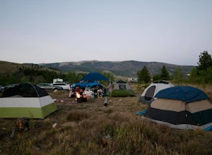
Camp at Blue River Campground
There are 24 sites at the Blue River Campground that have access to well maintained vault toilets, fire pits, and picnic tables. The campsites range in size, from single tent to multi-tent use (however no RV hookups).This campground is popular in the summer and can fill up every weekend, so I rec...Read more -
Nederland, Colorado
Drive the Peak to Peak Highway
4.555 mi / 705 ft gainThe Peak to Peak Highway is a 55-mile stretch of road that winds its way from Nederland to Estes Park (or Estes Park to Nederland). This road connects to many points of exploration, Indian Peaks Wilderness Area and Rocky Mountain National Park to name a couple, but the drive itself is an adventur...Read more -
Frisco, Colorado
Climb Mount Royal
4.7To access the trailhead, drive 4 blocks South to the end of 2nd Avenue from Frisco's Main Street. The trailhead is located around 9,075 feet.Being a popular hike, the trail is clear in the summer months and usually populated by boot prints and snowshoe tracks in the winter. Follow the trail from ...Read more

