Sedalia, Colorado
Top Spots in and near Sedalia
-
Franktown, Colorado
Inner Canyon Trail
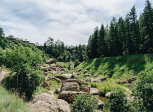
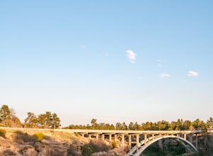
5.02.17 mi / 213 ft gainThe Inner Canyon Trail begins at the Canyon Point Parking Lot. There are a few trails that leave from this lot, so make sure you're following signs for "K." Right away, you'll descend down a few dozen stairs into the canyon itself. You'll quickly cross a bridge and be on your way. This trail is...Read more -
Franktown, Colorado
Lake Gulch & Inner Canyon Loop Trail
4.01.85 mi / 203 ft gainThis loop is a combination of two different trails - the Lake Gulch Trail (L) and the Inner Canyon Trail (K). Both of these trails leave from the Canyon Point Parking Lot, inside the east entrance to the park. I personally like the Inner Canyon Trail a lot more, so I like to start off from the ...Read more -
Colorado Springs, Colorado
Hike to Blodgett Peak
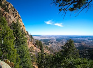
3.04.5 mi / 2325 ft gainGetting There Google Maps + "Blodgett Peak Open Space"= Easy Peasy. The parking lot only accommodates 11 cars with a one of those reserved for handicap. A port-a-potty is the only facility available at the trail head, so plan accordingly. The Hike Starting out at about 7,000 feet the first mile ...Read more -
Woodland Park, Colorado
Ski Pikes Peak
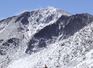
Pikes Peak Toll Road can grant you access to a ton of super accessible backcountry skiing if you have the equipment and knowledge. From roughly Glen Cove up to the summit of the mountain you can access terrain varying from steep chutes off the summit to easy glades in an abandoned ski resort. T...Read more -
Franktown, Colorado
Hike the Canyon View Nature Trail, Castlewood Canyon
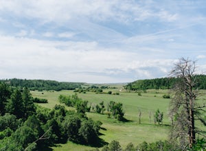
4.52.4 miThis is a well maintained, easy trail best hiked in spring and fall. Conditions make this trail great for families. The park is also popular for bird watching and rock climbing.Read more -
El Paso County, Colorado
Summit Pikes Peak via the Devils Playground Trail
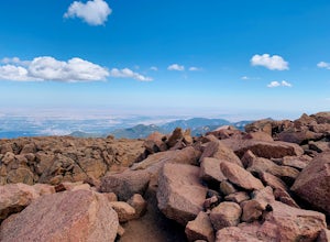
3.05.5 mi / 1348 ft gainThis portion of a trek to the Pikes Peak begins about 13,000 feet. From the parking lot walk across the road back to the Northeast side and look for the hikers trail that begins by paralleling the road. By hiking this path you will have the time to enjoy the amazing views of the mountain range a...Read more -
Conifer, Colorado
Upper Maxwell Falls Trail
1.11 mi / 135 ft gainUpper Maxwell Falls Trail is an out-and-back trail, which is the shortest and most direct route to Maxwell Falls located near Conifer, Colorado. If you're looking for a little longer trail, check out this Maxwell Falls adventure for a roughly 4-mile loop hike.Read more -
Lone Tree, Colorado
Hike Bluffs Regional Park Trail
2.7 mi / 200 ft gainThis loop trail is 2.7 miles long but has several options for overlooks that add 0.8 miles to the trip. This is an easy hike with minimal elevation gain and is a great option for the whole family. Every time I've done this hike I've seen numerous deer which only adds to the hike!Read more -
Lake George, Colorado
Camp and Fish at Eleven Mile Canyon
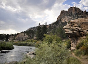
4.4Located below the dam of the Eleven Mile Reservoir, Eleven Mile Canyon is a scenic spot for camping, fishing, hiking and climbing. There are four different campgrounds to choose from (Cove, Riverside, Spillway and Springer), though only one campground remains open during the off season. Getting t...Read more -
Divide, Colorado
Snowshoeing to Sentinel Point
8 miSentinel Point is an appropriately-named 12,527-foot rockpile standing watch over the broad shoulder of the Pikes Peak massif. Rarely visited, especially in winter, you are almost guaranteed solitude on this high mountain snowshoeing adventure.Beginning at the Horsethief Park trailhead off CO Ro...Read more -
Divide, Colorado
Hike to Horsethief Falls and Pancake Rocks
4.87.6 mi / 1400 ft gainHorsethief Falls and Pancake Rocks can be found on the west side of Pikes Peak, so if you want to get away from the crowds and the city, put this trail on your to do list.Most of the trail runs through the forest, which makes this an excellent candidate for hiking in July and August when the summ...Read more -
Evergreen, Colorado
Maxwell Falls
3.43.95 mi / 928 ft gainLocated just outside of Evergreen, this beginner hike is a great escape from the city for a few hours. There are three different options to hike to the falls: Maxwell Falls Lower Trail (4 miles), Upper Maxwell Falls Trail (1.1 miles), and Maxwell Falls Bluffs Cliffside Trail Loop (5 miles). On th...Read more -
Manitou Springs, Colorado
Walk to Rainbow Falls
0.5 miThis waterfall was designated a historic site in 2016 due to its rich history dating back to the Native Americans and more recently the locals of Manitou Springs. The bridge itself that crosses over the falls was created in the early 20th century and was an architectural marvel during the time. ...Read more -
Colorado Springs, Colorado
Hike the Upper Loop Trail
5.00.75 mi / 72 ft gainThis short spur trail is right off Perkins Central Garden Trail. Most people walk by it because the walkway changes from paved to dirt, but it is definitely a must-see if you're exploring the park. It climbs just a short amount before reaching the rocks you can climb on. Make sure you take a mome...Read more -
Colorado Springs, Colorado
Perkins Central Garden Trail
5.01.13 mi / 138 ft gainGarden of the Gods has dozens of hiking trails that cover miles through the park itself. The Perkins Central Garden Trail takes you through the heart of the rock formations and really gives you perspective on the size of these red rocks. This trail also takes you past several areas where rock cl...Read more -
Cascade, Colorado
Manitou Incline
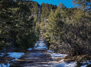
4.73.8 mi / 1949 ft gainIf you're ready for a fitness challenge like no other, look no further than the Manitou Incline. The trail climbs the remnants of an old cog railway bed, gaining 2000 feet of elevation in less than a mile. Busy all year round, the popular trail is used by everyone from Army Rangers and Olympic ho...Read more

