Sedalia, Colorado
Looking for the best hiking in Sedalia? We've got you covered with the top trails, trips, hiking, backpacking, camping and more around Sedalia. The detailed guides, photos, and reviews are all submitted by the Outbound community.
Top Hiking Spots in and near Sedalia
-
Jefferson, Colorado
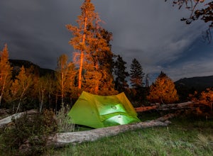
Backpack Lost Creek
4.05 miI included a trail map of where I camped. There are many sites all throughout this area. From the Lost Park Campground Parking lot follow the Lost Creek for 2.4 miles. At the 1 mile mark was the best place that we found to cross the creek (there are two logs that make a bridge across the creek). ...Read more -
Castle Rock, Colorado
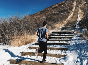
Run the Challenge Hill
5.00.6 mi / 200 ft gainThe Basics: The Challenge Hill, or as I like to call it, the Mini-Incline, is a shrunken version of its big brother to the south in Manitou. However, don't let its relatively small 200 stair count fool you - this hill is a serious workout! Located in Philip S. Miller Park, just one minute off I-2...Read more -
Littleton, Colorado
Winter Hiking and Wildlife in Waterton Canyon
3.712.4 miWaterton Canyon is the beginning of the Colorado Trail which stretches 500 miles from Denver to Durango. Camping is allowed on the Colorado Trail but is not allowed in the first 6 miles section of Waterton Canyon, which is managed by Denver Water. The gravel road is great for running, biking, hi...Read more -
Colorado Springs, Colorado
Hike Eagle's Peak (USAFA)
4.02.5 mi / 1100 ft gainThis is a short trail that goes very high in elevation. In about 1.25 miles you can go about 2000ish feet in elevation change. You need to wait till 9am to start the hike as it sits on the US Airforce Academy. It is definitely worth it. Bring shoes that can handle the rocky terrain.You take the f...Read more -
Jefferson, Colorado
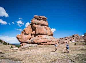
Trek through Granite Pillars on Bison Peak
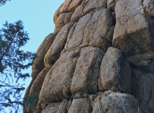
12.4 mi / 4000 ft gainBison peak sits 2 hours from Denver in the mountains of the Lost Creek Wilderness. To reach the 12,431 ft. summit you'll start in low density ponderosa forest at 8,750 ft on crushed granite trail. Early starts are recommended in the summer months as the trail's high albedo can make for an extreme...Read more -
Green Mountain Falls, Colorado
Hike Crystal Falls Trail to Crystal Creek Reservoir
5.25 mi / 1750 ft gainThe Basics: The little town of Green Mountain Falls often gets overlooked as motorists speed up Highway 24 to Woodland Park and beyond. However, big hiking opportunities abound here. The town probably has as many miles of hiking trails as it has miles of paved roads! Being on the base of Pikes Pe...Read more -
El Paso County, Colorado
Hike to the top of Castle Rock
5.02 mi / 800 ft gainThe Basics: If you've never been to Green Mountain Falls, you're missing out! This tiny mountain hamlet, just off Hwy 24 before Woodland Park, hosts a vibrant collection of local shops and eateries around its community lake. It is also home to many lesser-known hiking trails, including the H.B. W...Read more -
Conifer, Colorado
Elk Falls Loop
3.512.76 mi / 1893 ft gainBegin on Staunton Ranch Trail for 3.3 miles. Switch to Bugling Elk Trail for the next 1.1 miles, then to Lion's Back Trail for the last mile to the overlook. From here, you can create the loop by backtracking to the Chimney Rock Trail, which then connects with the Elk Falls Trail. To head back to...Read more -
Bailey, Colorado
Payne Creek Trail via Brookside McCurdy Trailhead
4.517.98 mi / 3773 ft gainDay 1: Park at the Payne Creek/Brookside Trailhead (8,040 ft.) right outside Bailey. You'll go on the trail for about a mile before the trail parts to Craig Meadows or Craig Park. If you start this in the nighttime, it's best to camp before you part ways on the trail as it's a little more spaciou...Read more -
Conifer, Colorado
Davis Ponds Trail
4.02.31 mi / 295 ft gainDavis Ponds Trail is a loop trail that takes you by a lake located near Conifer, Colorado.Read more -
Littleton, Colorado
Hike the Meadowlark Plymouth Trail
4.06 mi / 1197 ft gainFrom the parking lot, you can take the Meadowlark trail to the west or the Plymouth Creek Trail to the southeast. It does not matter which trail you take because it ends up becoming loop. For a more gradual slope up the hill, take the Meadowlark trail. After a little more than a mile, it intersec...Read more -
Littleton, Colorado
Golden Eagle Trail to Bill Couch Mountain
5.06.76 mi / 1509 ft gainGolden Eagle Trail to Bill Couch Mountain is an out-and-back trail that provides a good opportunity to view wildlife located near Indian Hills, Colorado.Read more -
Divide, Colorado
Hike to Raspberry Mountain
5.05.2 mi / 900 ft gainTake US-24 west and turn left at traffic light in Divide. Drive south on US-67 for about 4 miles. Turn left to CR-62 right after you pass the entrance to Mueller State park on the right. Drive about a mile on the dirt road and you will see the new trailhead parking lot on the left side.Once you p...Read more -
Divide, Colorado
Hike to Brook Pond
4.04.74 miThis hike begins at the east side of the Visitor's Center parking lot. The Visitor's Center keeps a record of any recent wildlife sightings, so its a good idea to check in the building if your goal is to see some animals. Otherwise, head to the end of the parking lot and take trail #5 down the hi...Read more -
Littleton, Colorado
Hike or Bike Hildebrand Ranch
4.05.1 mi / 324 ft gainHildebrand Ranch Park is often overshadowed by the other nearby Jeffco Parks, but for the few that it does attract the trails do not disappoint. The Two Brands Trail starts at about 5600ft just off of Deer Creek Canyon Rd. It is a relatively flat trail that tops out at about 5821ft making it a...Read more -
Divide, Colorado
Hike to Rock Pond
4.04.76 miThis hike begins at the east side of the Visitor's Center parking lot. The Visitor's Center keeps a record of any recent wildlife sightings, so its a good idea to check in the building if your goal is to see some animals. Otherwise, head to the end of the parking lot and take trail #5 down the hi...Read more

