Salida, Colorado
Top Spots in and near Salida
-
Gunnison County, Colorado
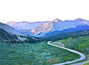
Take in the Views on Cottonwood Pass
4.7Starting in the town of Buena Vista, head west on E Main Street until it turns into State Highway 306. After about 40 minutes of driving and some winding roads the Continental Divide sign welcomes you to a gravel parking lot. You can get out and hike as you please, but the view from the parking l...Read more -
Parlin, Colorado
Hike to Roosevelt Mine
5.01.5 miAbandoned in 1919, Roosevelt Mine is a lost treasure of Gunnison County, Colorado. Exactly three miles outside the tiny town of Ohio City is the unmarked trailhead on the side of a road pull off for Roosevelt the mine. The trail is otherwise well established and easy to follow. The trail is a lit...Read more -
Hartsel, Colorado
Ice Fishing Antero Reservoir
The Antero Reservoir was the first dam built on the South Platte River. The reservoir is best known for its large rainbow trout and rainbow x cutthroat hybrid trout. It's also home to brown trout, snake river cutthroat trout, cutthroat trout, brook trout, and splake.The earth filled Antero Dam wa...Read more -
Cañon City, Colorado
Royal Gorge Bridge
3.53.3 miThe Royal Gorge Bridge and Park is located in Canon City which is about an hour outside Colorado Springs. Once you get there, it's a $26 entrance fee per person. The park is dog and family friendly. You can walk across the bridge, take the gondola, or zip line across. Taking the gondola and of c...Read more -
Gunnison County, Colorado
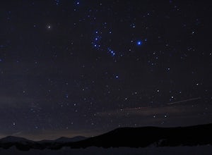
Winter Astrophotography at Taylor Reservoir
20 miles outside the south central Colorado mountain town of Almont lies Taylor Park Reservoir. The location is secluded and not penetrated by light pollution, making it a perfect place to photograph winter stars.When you arrive to your desired location by the edge of the reservoir you can begin ...Read more -
Buena Vista, Colorado
Backpack the Buffalo Peaks Wilderness Loop
5.011.7 mi / 2000 ft gainStarting at the Rich Creek Campground this wonderful moderate hike forms a loop by connecting the Rich Creek Trail and the Tumble Creek trail. in the Buffalo Peaks wilderness. Flanked by the Collegiate Peaks, in Spring and Summer the area is awash with rushing creeks, lush wet lowlands & deep...Read more -
Westcliffe, Colorado
Backpack to Sand Creek Lakes
5.04 mi / 1700 ft gainStart at the Music Pass trail head south of Westcliffe, Colorado off County Road 119. You will need a 4x4 with high clearance to get to the actual trailhead as the last 2.5 miles are rough. Otherwise, park at the Crape Creek TH and walk the 2.5 miles up to Music Pass Trailhead.Once on the trail...Read more -
Buena Vista, Colorado
Mt. Belford and Mt. Oxford
4.510.34 mi / 5856 ft gainYou'll being your ascent at the Missouri Gulch Trailhead, which is located a few miles up Chaffee County Road 390, at around 9,600 feet. The trail is very clear and very well maintained, but is steeper than most trails (even quite a few of the 14er trails I've done) right from the get-go. Remembe...Read more -
Buena Vista, Colorado
Hike Missouri Mountain
5.010.5 mi / 4500 ft gainGetting there: The trail begins at Missouri Gulch TH. If you are a car camper or are trying to snag a sunrise summit, there are many many drive off sites in trees and near water before and after the trailhead. The road to get to the trailhead is not paved, but is well maintained - a super high cl...Read more -
Buena Vista, Colorado
Hike Huron Peak
5.06.5 miIf you have a 4WD vehicle, drive 2 miles from Winfield along a dirt road to the trailhead. If you don't have a suitable vehicle, you can park before the road gets rough and hike the rest of the road to the trailhead.Starting at 10560 feet of elevation, this 6.5 mile roundtrip hike begins its 3500...Read more -
Lake George, Colorado
Camp and Fish at Eleven Mile Canyon
4.4Located below the dam of the Eleven Mile Reservoir, Eleven Mile Canyon is a scenic spot for camping, fishing, hiking and climbing. There are four different campgrounds to choose from (Cove, Riverside, Spillway and Springer), though only one campground remains open during the off season. Getting t...Read more -
Westcliffe, Colorado
Venable-Comanche Trail
5.012.08 mi / 4085 ft gainVenable-Comanche Trail is a loop trail that takes you by a lake located near Westcliffe, Colorado.Read more -
Cañon City, Colorado
Hike Temple Canyon
5.01 mi / 400 ft gainTake 1st Ave heading south out of Canon City and you'll come to Temple Canyon Road. You'll take 7 miles of dirt road to Temple Canyon Park. It is free to enter and there is a decent campground there where you can camp for free for up to 14 days. The trail begins at Temple Ridge Campground. The tr...Read more -
Guffey, Colorado
Paradise Cove
4.5From Colorado Springs, follow RT 24 to the town of Florissant (34.5 miles). From Florissant, follow Teller County Road 1 south for about 9.2 miles, until a Y fork, and bear right, into County Road 11. Follow County Road 11 for 4.1 miles, until a T intersection, and make a right turn at the inters...Read more -
Buena Vista, Colorado
Summit Mount Huron
6 mi / 3500 ft gainThere are some dispersed campsites along side the 4x4 road that leads to the trailhead. Ideally you can sleep here to get an early start to your hike in the morning, to avoid the afternoon storms that frequent the mountains. The 4x4 is rough in spots, though my Subaru Outback did make the trek un...Read more -
Cañon City, Colorado
Hike Tunnel Drive
3.8 mi / 521 ft gainThis 3.8 mile out and back trail is a very easy hike but can have moderate to high foot traffic depending on the season and time of day. I recommend doing this hike early in the morning to not only beat the heat, but to beat the other hikers. What I love about this hike is the chance to see the t...Read more

