Rollinsville, Colorado
Looking for the best fitness in Rollinsville? We've got you covered with the top trails, trips, hiking, backpacking, camping and more around Rollinsville. The detailed guides, photos, and reviews are all submitted by the Outbound community.
Top Fitness Spots in and near Rollinsville
-
Morrison, Colorado
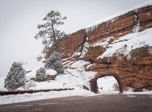
Explore Red Rocks Park in Winter
4.3Red Rocks is a bustling park in the summer when its famous amphitheater is filled with concerts. In winter though, the park dies down and becomes even more quiet when snow is falling. Grab your camera and head to the park during a winter storm to truly enjoy the beautiful red sandstone formations...Read more -
Dillon, Colorado
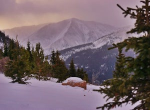
Snowshoe or Ski Watrous Gulch
4.04 mi / 1200 ft gainDespite sharing a trailhead with the popular Herman Gulch, I had not heard of Watrous Gulch until I stumbled across it while researching something else. Knowing that Herman Gulch is filled with spectacular views and deep snow ideal for snowshoeing/skiing, I had to discover if the smaller, lesser-...Read more -
Evergreen, Colorado
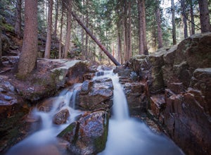
Maxwell Falls
3.43.95 mi / 928 ft gainLocated just outside of Evergreen, this beginner hike is a great escape from the city for a few hours. There are three different options to hike to the falls: Maxwell Falls Lower Trail (4 miles), Upper Maxwell Falls Trail (1.1 miles), and Maxwell Falls Bluffs Cliffside Trail Loop (5 miles). On th...Read more -
1398 Longs Peak Road, Colorado
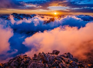
Storm Peak and Mount Lady Washington
4.512.57 mi / 5312 ft gainThis adventure began at the Longs Peak trailhead in southeastern Rocky Mountain National Park, Colorado. I followed the Longs Peak trail for 6 miles to the Boulderfield backcountry camping area. This is a fairly steep on-trail climb of 3,360 feet. After setting up camp at 12,760 feet, my partner...Read more -
Dillon, Colorado
Hike Grizzly Peak at Loveland Pass
5.06 mi / 2900 ft gainWhile a typical Colorado hike may be an ascent to your destination followed by a descent back to your car, the hike to Grizzly Peak at Loveland Pass (Grizzly Peak "D") breaks that mold. At 13,427 feet, Grizzly Peak stands in the path to Torreys Peak’s west face (14,267’). Even though it is only ~...Read more -
Estes Park, Colorado
Estes Cone
4.08.22 mi / 2275 ft gainThe trail begins on the left on a park service road before reaching a junction with the Storm Pass Trail just past .2 miles. Follow the trail as it enters the forest and continue past the private property signs and over a footbridge. Past the bridge the trail climbs more steadily for just under 2...Read more -
Longmont, Colorado
McIntosh Lake Loop
4.53.6 mi / 72 ft gainMcIntosh Lake is in northwest Longmont. The 3.6-mile loop extends all the way around the lake, with the first half being on a paved cement trail with neighborhood playgrounds, basketball, volleyball, and a seasonally open restroom. The trail turns to dirt on the western half of the loop, and here...Read more -
Longmont, Colorado
Hike or Trail Run on Rabbit Mountain, CO
4.03.95 mi / 472 ft gainThis is a great hike/trail run in Boulder County. It is located between Longmont and Lyons and is part of Boulder County Open Space. Rabbit Mountain has over 5 miles of trails and 2,733 acres of beautiful open space. The views are incredible as most of your hike you are looking out at the entire ...Read more -
Allenspark, Colorado
Hike to Verna, Spirit, Fourth, and Fifth Lakes
19 mi / 2460 ft gainThis summer backpacking trip provides plenty of opportunities for exploration and endless moments to take in awe-inspiring scenery. On our visit, after setting up camp at the Lake Verna backcountry site, I quickly made my way to the next lake (Spirit Lake) to photograph the sunset. The symmetry a...Read more -
Estes Park, Colorado
Green Lake via Glacier Gorge Trail
5.011.38 mi / 3400 ft gainBegin at the popular Glacier Gorge trailhead along Bear Lake Road in Rocky Mountain National Park. Arrive VERY early for parking as the lot typically fills by 7:30 am. For the best photography options - choose to either backpack into the Glacier Gorge campsite (reservations must be made early in ...Read more -
Estes Park, Colorado
Nymph Lake via Bear Lake Trailhead
4.81.13 mi / 245 ft gainWhile not as popular as Dream Lake, Nymph Lake is just as beautiful. The hike to Nymph Lake is an easy hike just over 1 mile. You start from the Bear Lake Trail head and can go further on to Dream Lake and Emerald Lake if you want to. Both Dream and Emerald Lakes are also stunning and very photog...Read more -
Lyons, Colorado
Hike the Kruger Rock Trail
4 mi / 1000 ft gainCutting through the forested hills surrounding Estes Valley, the Kruger Rock Trail is a well-marked 4 mile loop to the top of Kruger Rock. The trail begins in Hermit Park Open Space, located just a few miles southeast of Estes Park and is a moderate hike with around 1000 feet of elevation gain. C...Read more -
Estes Park, Colorado
Hike to Cub Lake
5.04.6 mi / 645 ft gainRocky Mountain National Park showcases 355 miles of hiking trails, 6 campgrounds, and hundreds of backcountry camp sites. The cost to enter the park is $20.00 per vehicle, I recommend buying the annual National Parks Pass for $80.00. Cub Lake is an excellent trail for viewing wildlife. There ar...Read more -
Estes Park, Colorado
Backpack to Odessa Lake via Fern Lake Trailhead
4.09.65 mi / 1890 ft gainOdessa Lake seems to be one of the true hidden gems of Rocky Mountain National Park. Don't get me wrong, you will likely see some folks there, but it is a far cry from the other crowded Bear Lake trailhead lakes. There are two ways to reach Odessa; one, from the Bear Lake Trailhead, and the oth...Read more -
Littleton, Colorado
Hike the Meadowlark Plymouth Trail
4.06 mi / 1197 ft gainFrom the parking lot, you can take the Meadowlark trail to the west or the Plymouth Creek Trail to the southeast. It does not matter which trail you take because it ends up becoming loop. For a more gradual slope up the hill, take the Meadowlark trail. After a little more than a mile, it intersec...Read more -
Estes Park, Colorado
Hike Deer Mountain
6.03 mi / 1200 ft gainBeginning in Rocky Mountain National Park near the Deer Ridge Junction (where US 34 & US 36 meet), park your car in one of the 20 spots on either side of the road. Start at the trailhead booth and head north, keeping to the right-side trail at the first intersection about a tenth of a mile fr...Read more

