Rocky Mountain National Park, Colorado
Looking for the best hiking in Rocky Mountain National Park? We've got you covered with the top trails, trips, hiking, backpacking, camping and more around Rocky Mountain National Park. The detailed guides, photos, and reviews are all submitted by the Outbound community.
Top Hiking Spots in and near Rocky Mountain National Park
-
Boulder, Colorado
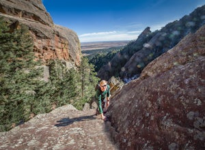
Scramble Angel's Way
5 mi / 1000 ft gainAngel's Way is an amazing 8 pitch rock climb scramble (5.2) that is tucked away in Skunk Canyon, hidden from the crowds of Chautauqua. The best part of this scramble is you only need your climbing shoes and chalk-bag. It is similar to the 'Free Way' on the Second Flatiron. I would encourage ev...Read more -
Boulder, Colorado
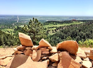
Woods Quarry via NCAR
4.23.28 mi / 755 ft gainYou can start from Chautauqua Park, but I prefer to start at NCAR, especially since there is ample parking and you can take a bathroom break inside before hitting the trail. From the intersection of Table Mesa Drive and Broadway in Boulder, drive west on Table Mesa to its end at the NCAR buildin...Read more -
Boulder, Colorado
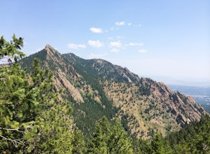
Mars Blocks via Bear Canyon Trailhead
4.89 mi / 1923 ft gainThe Bear Canyon Trailhead is just one of many starting points for this hike, one could also start at NCAR, North Fork Shanahan, or any point on the Mesa Trail. For the purposes of this adventure, I'll start at Bear Canyon Trailhead in South Boulder. This hike will take you about 2-4 hours dependi...Read more -
Bellvue, Colorado
Hike the Black Powder Trail
1.5 mi / 450 ft gainThe Gateway Natural Area, part of the City of Fort Collins public lands system, is a wonderful (and close to the city) place to begin exploring the many outdoor assets and activities found in the greater Fort Collins area. The Black Powder Trail is a relatively easy, well-marked 1.5 mile out and ...Read more -
Fraser, Colorado
Summit Byers Peak
8.8 mi / 2774 ft gainThe drive to the start of the trail is okay, having a high clearance vehicle would make the drive easier, but is not necessary. Free parking is available along the side of the road.The trail starts on a closed service road at a gate and requires you to either hike or bike up the dirt road (2 mil...Read more -
Fort Collins, Colorado
Hike the North Loop via Foothills Trail
5.06.5 mi / 700 ft gainDespite its singular name, the Foothills Trail in Fort Collins is an interconnected series of trails that follows the ridges and hogsbacks which comprise the majority of the eastern side of the Horsetooth Reservoir. The trail can be accessed at several points along its length (by trails also call...Read more -
Fort Collins, Colorado
Fat Tire Bike the Foothills Trail
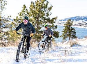
5.08.5 mi / 1000 ft gainThe Reservoir Ridge and Foothills trail system around Horsetooth Reservoir and Fort Collins is excellent for mountain biking, trail running, and hiking. During the winter it is particularly great for fat tire mountain biking, and the Foothills Trail is one of the best. The trail itself is roughly...Read more -
Laporte, Colorado
Hike the Bellvue Dome
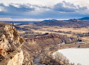
2.81.75 mi / 600 ft gainThe Bellvue Dome, known locally as "Goat Hill", was created by the same geological forces that made the Rocky Mountains, but what makes this structure unique is its shape, the steep cliff on its western edge carved by the Cache la Poudre River at the base, and its prominent location dominating th...Read more -
Boulder, Colorado
Boulder's Skyline Traverse
5.014.77 mi / 4583 ft gainHave you ever reached the bottom of a hike with some friends and thought, 'That was nice, but I'd still like to hike more... a lot more.'? Then the Skyline Traverse is for you. Instead of hiking just Green Mountain or Bear Peak, the Skyline Traverse links South Boulder Peak, Bear Peak, Green Mou...Read more -
Boulder, Colorado
Shanahan Ridge Trail
4.03.84 mi / 715 ft gainStarting on the edge of a neighborhood in South Boulder, this 3.8 mile loop begins its 869 foot elevation gain by meandering through a pine forest. You can 'choose your own adventure' by exploring the handful of trails that meet up with the Shanahan Ridge Trail, such as the South Mesa Trail, Shad...Read more -
Idaho Springs, Colorado
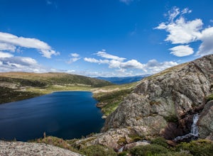
Camp and Fish at Loch Lomond
5.0The trail to Loch Lomond is very rocky. I suggest a high clearance 4x4 vehicle (I did see a small SUV and a Subaru..Not sure how they did it!!!). There are a few campsites at the lake and several along the way. I set up camp by the lake but had to move because the wind was so intense. I recommend...Read more -
Boulder, Colorado
Rattlesnake Gulch Trail
3.49 mi / 1093 ft gainRattlesnake Gulch Trail is a loop trail that takes you by a river located near Eldorado Springs, Colorado.Read more -
Boulder, Colorado
Hike the Rattlesnake Gulch Trail
4.35.3 mi / 1304 ft gainRattlesnake Gulch Trail is located in Eldorado Canyon State Park. It is a short 20 minute drive from Boulder and is one of three hikes in the park. You will need to pay an entrance fee to get inside to the park which costs $8. The trail is approximately 2.8 miles one way and carries a consistent ...Read more -
Boulder, Colorado
South Boulder Creek - Mesa Trail - Lower Big Bluestem Loop
4.04.46 mi / 453 ft gainThis 4 mile loop ascends only a slight amount in elevation, making for a pleasant loop in which opportunities for appreciation of the nature around you and broad vista photography are in plentiful supply. A great hike for those who may still be building their fitness, as so many trails in Boulder...Read more -
Boulder, Colorado
Hike the Eldorado Canyon Trail
4.56.3 mi / 1875 ft gainEldorado Canyon Trail makes for a great day hike, with great views and a steady, challenging uphill – bring lots of water!For something shorter, try Streamside Trail (1 mile roundtrip), Fowler Trail (1.4 miles), or Rattlesnake Gulch (2.8 miles). Streamside, appropriately, leads you alongside a cr...Read more -
Idaho Springs, Colorado
Hike St. Mary's Glacier
4.32 mi / 467 ft gainJust West of Idaho Springs on I-70 take the St. Mary's Alice Exit. Take a right and stay on the main road and follow the signs for about 8 miles (watch on the right side of the road for a surprise pink pig). There are two parking lots for the trailhead. The larger one is South of the trail and a ...Read more

