Pine, Colorado
Top Spots in and near Pine
-
Fraser, Colorado
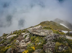
Summit Byers Peak
8.8 mi / 2774 ft gainThe drive to the start of the trail is okay, having a high clearance vehicle would make the drive easier, but is not necessary. Free parking is available along the side of the road.The trail starts on a closed service road at a gate and requires you to either hike or bike up the dirt road (2 mil...Read more -
Frisco, Colorado
Backpack the Colorado Trail: Copper Mountain to Hagerman Pass
39 miThe Colorado Trail (CT) runs for 483 miles from Denver to Durango, crossing through eight mountain ranges and passing through six wilderness areas. There are great resources on completing a thru-hike of the CT; this post is about Segments 8-9 of the CT from Copper Mountain to Tennessee Pass.These...Read more -
Frisco, Colorado
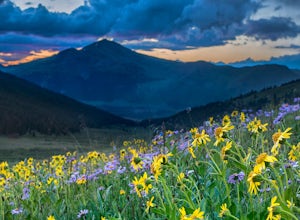
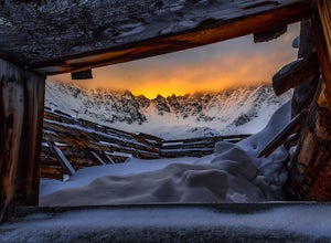
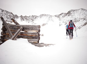
Hike to Mayflower Gulch
4.74 mi / 1000 ft gainGetting to the Mayflower Gulch is pretty easy, you can either hike an easy 2 mile forest road or drive all the way to end (you need decent clearance for the drive). At the end of the hike you are greeted with a stunning view of the Old Boston mining site. During the summer, wildflowers are abunda...Read more -
Frisco, Colorado
Snowshoe the Mayflower Gulch
4.74 mi / 1000 ft gainTo begin, park in the large parking lot (it is usually plowed all winter except right after a large storm). The parking lot can be reached via highway 91, approximately 6 miles south of Copper Mountain and will be on the east (left if coming from the north) side of the road. Begin up the obvious ...Read more -
Frisco, Colorado
Backcountry Ski or Snowboard at Mayflower Gulch
If you were driving down highway 91 towards Leadville and blinked at just the right moment, you'd drive right past this hidden gem of an area. Located just over 6 miles South of Copper Mountain ski resort on the East side of highway 91, the parking lot for the Mayflower Gulch trail head offers pl...Read more -
Divide, Colorado
Hike to Raspberry Mountain
5.05.2 mi / 900 ft gainTake US-24 west and turn left at traffic light in Divide. Drive south on US-67 for about 4 miles. Turn left to CR-62 right after you pass the entrance to Mueller State park on the right. Drive about a mile on the dirt road and you will see the new trailhead parking lot on the left side.Once you p...Read more -
Divide, Colorado
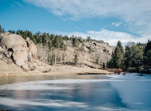
Hike to Brook Pond
4.04.74 miThis hike begins at the east side of the Visitor's Center parking lot. The Visitor's Center keeps a record of any recent wildlife sightings, so its a good idea to check in the building if your goal is to see some animals. Otherwise, head to the end of the parking lot and take trail #5 down the hi...Read more -
Divide, Colorado
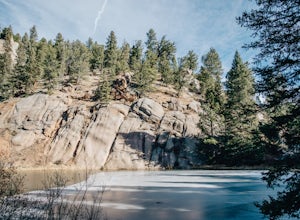
Hike to Rock Pond
4.04.76 miThis hike begins at the east side of the Visitor's Center parking lot. The Visitor's Center keeps a record of any recent wildlife sightings, so its a good idea to check in the building if your goal is to see some animals. Otherwise, head to the end of the parking lot and take trail #5 down the hi...Read more -
Boulder, Colorado
Foothills Trail to Wonderland Lake Loop Trail
2.93 mi / 223 ft gainFoothills Trail to Wonderland Lake Loop Trail is a loop trail that takes you by a lake located near Boulder, Colorado.Read more -
Green Mountain Falls, Colorado
Hike Crystal Falls Trail to Crystal Creek Reservoir
5.25 mi / 1750 ft gainThe Basics: The little town of Green Mountain Falls often gets overlooked as motorists speed up Highway 24 to Woodland Park and beyond. However, big hiking opportunities abound here. The town probably has as many miles of hiking trails as it has miles of paved roads! Being on the base of Pikes Pe...Read more -
El Paso County, Colorado
Hike to the top of Castle Rock
5.02 mi / 800 ft gainThe Basics: If you've never been to Green Mountain Falls, you're missing out! This tiny mountain hamlet, just off Hwy 24 before Woodland Park, hosts a vibrant collection of local shops and eateries around its community lake. It is also home to many lesser-known hiking trails, including the H.B. W...Read more -
Boulder, Colorado
Hogback Ridge Trail
2.85 mi / 830 ft gainHogback Ridge Trail is a loop trail where you may see beautiful wildflowers located near Manitou Springs, Colorado.Read more -
Leadville, Colorado
Backcountry Ski at Fremont Pass
Starting at 11,319 feet of elevation, you can choose which direction to head into the backcountry. Park at the pull-off area at the bend in the road. From here, you can head into the woods to the right (there are usually tracks from other skiers to follow) or follow Trail Rd. to reach some peaks ...Read more -
Divide, Colorado
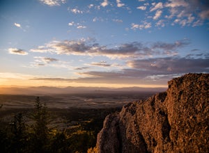
Summit The Crags
4.67.9 mi / 1379 ft gainAs you drive past Mueller state park (on the right), about 1/4 mile down the road you will see a small wooden sign for "The Crags" You will take a left there and follow the road about 1.5 miles, past the first stop, which is the Raspberry Mountain Trailhead, until you come to a fork in the road a...Read more -
Hartsel, Colorado
Ice Fishing Antero Reservoir
The Antero Reservoir was the first dam built on the South Platte River. The reservoir is best known for its large rainbow trout and rainbow x cutthroat hybrid trout. It's also home to brown trout, snake river cutthroat trout, cutthroat trout, brook trout, and splake.The earth filled Antero Dam wa...Read more -
Ward, Colorado
Snowshoe Long Lake
8 mi / 200 ft gainA long but extremely scenic hike tucked in Colorado's Indian Peaks wilderness. The entire Long Lake trail says 2.3 mile but due to winter conditions and snow pack you can really only make it the east edge of the lake. Exit Long lake loop back on to Brainard Lake Road (currently under construction...Read more

