
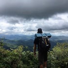
Summit The Crags
Divide, Colorado
Details
Distance
7.9 miles
Elevation Gain
1379 ft
Route Type
Out-and-Back
Description
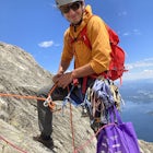
Added by Billy DiMirra
This hike is located about 45 minutes outside of Colorado Springs. Its almost an 8 mile hike that leads to some really cool rock formations on the back of Pikes Peak. This trail also has some great views of Divide, and the Sangre De Cristo Mountain Range.
As you drive past Mueller state park (on the right), about 1/4 mile down the road you will see a small wooden sign for "The Crags" You will take a left there and follow the road about 1.5 miles, past the first stop, which is the Raspberry Mountain Trailhead, until you come to a fork in the road at the Mennonite camp. Once you're there, take a right at the fork and follow the road for about 1/2 mile until you reach the first parking lot. You can try and brave the road from here, which leads to a second parking lot about a mile up, which is the start of the trailhead. That is if you have a 4 wheel drive and are feeling gutsy. From the first parking lot you will walk a mile on the road and come to a porta potty. Once there take a left and you're on the trail! You'll follow that about for about a mile and the trail will fork, STAY LEFT! You'll follow the trail after the fork for about 2 miles, trekking through some meadows and forest to the top!
Download Outbound mobile app
Find adventures and camping on the go, share photos, use GPX tracks, and download maps for offline use.
Get the appFeatures
Summit The Crags Reviews
This is a nice trail with good views throughout the middle and the end. There is kind of a lookout that I have heard of a few people turning around at pretty close to the end - continue all the way up its worth it.
4.0

Beautiful hike! Elevation gain was most difficult at the beginning and the end. Actual mileage of hike is approximately 5 miles. Took a little over 2 hours for us.
5.0
My wife and I spent a few nights at the Crags Campground, which is just at the start of the trailhead, in August 2016. The hike was manageable for us out-of-towners who weren't used to the elevation, but the last half mile was more difficult with more elevation gain. The view from the top was well worth the effort though!
5.0
Absolutely gorgeous hike with a refreshingly different view of Pikes Peak. Definitely would have been easier with some light crampons, but doable without. Also is very dog friendly. Thanks for posting!!
5.0

This hike was awesome- very easy while still offering some phenomenal views! The mileage suggested on the adventure is 7.9 miles, yet I believe that the actual trail was no more than 5 miles. Nonetheless, try to do this hike in the morning, as thunderstorms are bound to roll around in the afternoon!
4.0
Leave No Trace
Always practice Leave No Trace ethics on your adventures and follow local regulations. Please explore responsibly!
Nearby

Hike to Raspberry Mountain

Hike to Brook Pond

Ski Pikes Peak

Snowshoeing to Sentinel Point

Horsethief Falls and Pancake Rocks

Hike to Rock Pond
Discover
Community
Mobile Apps

© 2026 The Outbound Collective - Terms of Use - Privacy Policy