Pine, Colorado
Looking for the best chillin in Pine? We've got you covered with the top trails, trips, hiking, backpacking, camping and more around Pine. The detailed guides, photos, and reviews are all submitted by the Outbound community.
Top Chillin Spots in and near Pine
-
Castle Rock, Colorado
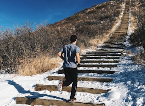
Run the Challenge Hill
5.00.6 mi / 200 ft gainThe Basics: The Challenge Hill, or as I like to call it, the Mini-Incline, is a shrunken version of its big brother to the south in Manitou. However, don't let its relatively small 200 stair count fool you - this hill is a serious workout! Located in Philip S. Miller Park, just one minute off I-2...Read more -
Idaho Springs, Colorado
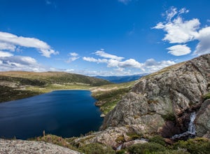
Explore 'The Hidden Gems' of Loch Lomond
5.04.6 mi / 950 ft gainGetting There From Denver, go W on I-70 and take exit 238 for Fall River Rd. Continue on this road before taking a left on Alice Rd. Continue on Alice Rd. until you see the right hand turn for Steuart Rd. This is where you park. Do not attempt this road in a AWD or 2WD you definitely need a good ...Read more -
Idaho Springs, Colorado
Hike to Loch Lomond
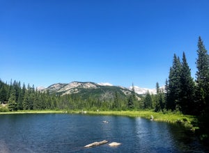
5.04.6 mi / 948 ft gainWhen you start the hike to Loch Lomond, you'll have a few options for parking. The further up the road you go the trickier it's going to be to get back out. I parked at the bottom of the road and hiked my way up. The first mile or two is mostly elevation gain and to be quite honest I thought I wa...Read more -
Idaho Springs, Colorado
Camp at Chinns Lake
Take the road as if you are going to St. Mary's Glacier, but you will take a left off the road (next to a very nice house) before the road makes a sharp right turn to go up hill. The road is a smooth dirt road for about a mile, but gets very rocky after that and you will need a good off road vehi...Read more -
Idaho Springs, Colorado
Explore Fall River Reservoir
4.01 mi / 144 ft gainThis spot may be a little more difficult to reach than others, but the payoff is worth it. You'll start by taking a dirt road that splits off from Fall River Road. It is pretty easy going for the first mile or so, but then you'll want to make sure you have a little higher clearance 4x4 vehicle to...Read more -
Idaho Springs, Colorado
Camp and Fish at Loch Lomond
5.0The trail to Loch Lomond is very rocky. I suggest a high clearance 4x4 vehicle (I did see a small SUV and a Subaru..Not sure how they did it!!!). There are a few campsites at the lake and several along the way. I set up camp by the lake but had to move because the wind was so intense. I recommend...Read more -
Breckenridge, Colorado
Camp at Boreas Pass
9 mi / 1500 ft gainBoreas pass is a high mountain pass in the Rocky Mountains that sits on the Continental Divide at 11,481'. Forest Service Road 33 goes over the pass and has numerous campsites all along its length, with several near the summit that feature breathtaking views of the Tenmile Range and the Breckenri...Read more -
Aurora, Colorado
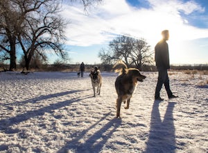
Walk the Cherry Creek Dog Off-Leash Area
4.53 miCherry Creek Dog-Off Leash Area is an extended part of Cherry Creek State Park and encompasses 107 acres of fenced-in play area. Within the park there is a 3 mile loop trail that takes you through the trees and along the Cherry Creek. What makes this park so great is the several access points to ...Read more -
Parshall, Colorado
Camp at Jones Pass
4.5To locate these campsites all you have to do is type in Jones Pass Road into google maps or your iPhone and it will take you straight there. There are road signs once you get off I-70 that will help you the rest of the way that say Jones Pass. Once you hit the dirt road and pass the Jones Pass Tr...Read more -
Larkspur, Colorado
Spruce Mountain Loop
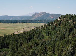
4.55.46 mi / 810 ft gainSpruce mountain is an approximately 4.2 mile loop outside of Colorado Springs near Palmer lake. The hike is a pretty easy one, that has some great views of the Front Range including peak a boo views of Pikes Peak. Starting at the Trailhead, you can either take the right or left trail which will t...Read more -
Nederland, Colorado
Drive the Peak to Peak Highway
4.555 mi / 705 ft gainThe Peak to Peak Highway is a 55-mile stretch of road that winds its way from Nederland to Estes Park (or Estes Park to Nederland). This road connects to many points of exploration, Indian Peaks Wilderness Area and Rocky Mountain National Park to name a couple, but the drive itself is an adventur...Read more -
Breckenridge, Colorado
Hike to & Stay at Francie's Cabin
5.01.09 mi / 1000 ft gainLocated at 11,360' and owned by the 10th Mountain Division Hut Association, Francies Cabin was built in memory of Frances Lockwood Bailey in 1994 and is located just a short distance (5 mile drive, 1.05 mile hike) from town of Breckenridge, Colorado. It has a summer and winter capacity of 20 peop...Read more -
Nederland, Colorado
Hike to the Lost Lakes via the Hessie Trail
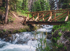
4 mi / 1000 ft gainAccessed by Hessie Trailhead, Lost Lake is a relatively moderate 4 mile round-trip hike with about 1,000 feet of elevation. The core of the hike is uphill and on a gravel path, 2/3rds of the hike runs parallel to a rushing waterfall. After parking your car, head towards the Hessie Trailhead. Yo...Read more -
Breckenridge, Colorado
Hike the Sawmill Trail to Fairy Forest
3.01.5 mi / 250 ft gainIf you brought the family to Breckenridge chances are you're probably not bringing the little ones on your next 14'er summit. Are you looking for an easy hike to let the kiddos experience some nature and run around a bit? Well then this short hike is perfect for you and the family. Plus, it's rig...Read more -
Boulder, Colorado
Shanahan Ridge Trail
4.03.84 mi / 715 ft gainStarting on the edge of a neighborhood in South Boulder, this 3.8 mile loop begins its 869 foot elevation gain by meandering through a pine forest. You can 'choose your own adventure' by exploring the handful of trails that meet up with the Shanahan Ridge Trail, such as the South Mesa Trail, Shad...Read more -
Nederland, Colorado
Hike Rollins Pass to Devils Thumb
2.1 mi / 622 ft gainCorona Lake is an easy, short hike if you're pressed for time. It's scenic, secluded, and will put you in a great spot to hike to Devils Thumb the next day. There are two ways to reach Devils Thumb. This is considered the "easier" route because of the "lack of elevation gain." The sun and wind re...Read more

