Parshall, Colorado
Top Spots in and near Parshall
-
Frisco, Colorado
Backpack to the Gore Range's Wheeler and Lost Lakes
4.510 mi / 2200 ft gainThe range offers many remote lakes and peaks which hikers can access from various points of entry. Wheeler and Lost Lakes lie within the boundaries of the Eagle's Nest Wilderness Area.The Gore Trail begins on the north side of the CO-91 pedestrian bridge over I-70. You will follow the trail up al...Read more -
Frisco, Colorado
Ski to Janet's Cabin
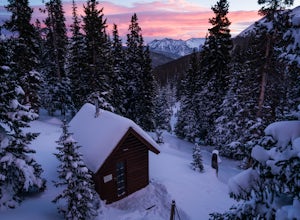
6 mi / 1900 ft gainJanet's Cabin is located on the eastern slope of the Continental Divide at 11,610 ft, near Copper Mountain ski resort. This hut is one of the rare huts with not only a sauna but indoor bathrooms (composting pits)! The cabin was built in 1990 and due to the location helicopters were required to b...Read more -
Frisco, Colorado
Backpack the Colorado Trail: Copper Mountain to Hagerman Pass
39 miThe Colorado Trail (CT) runs for 483 miles from Denver to Durango, crossing through eight mountain ranges and passing through six wilderness areas. There are great resources on completing a thru-hike of the CT; this post is about Segments 8-9 of the CT from Copper Mountain to Tennessee Pass.These...Read more -
Estes Park, Colorado
Camp at Aspenglen Campground
5.0Aspenglen is one of the four main campgrounds within the park boundaries. The campground is for car camping and there are areas just for tents and then broader areas for tents and campers. There are 53 sites at this campground and it fills up quickly each year. Reservations are available six mont...Read more -
Ward, Colorado
Hike the Ceran St. Vrain Trail
5.04 mi / 1207 ft gainThe Ceran St. Vrain trail north of Jamestown offers the hiker a nice respite from the summer sun as this path runs through dense pine forests. The trail follows the South St. Vrain Creek for most of the way and follows moderate grades throughout. There is no official end to the trail, only that i...Read more -
Dillon, Colorado
Silver Dollar Lake Trail
5.03.93 mi / 945 ft gainGuanella Pass, which connects the charming and historic town of Georgetown in the north to the blink-and-you’ll-miss-it Grant to the south, is a recreational outdoorsman’s dream. Volumes could be written on what this 22-mile scenic byway has to offer. Silver Dollar Lake Trail is just one tiny po...Read more -
Idaho Springs, Colorado
Camp at Guanella Pass
4.5This is a beautiful campground that serves as a great basecamp for many different outdoor activities in the Front Range. Whether you are looking for a casual day fishing or trying to knock one of the nearby 14ers off of your bucket list, this is an excellent place to begin. There are also abandon...Read more -
Boulder, Colorado
Catch the Sunrise on Sugarloaf
4.51 mi / 400 ft gainTo get there from downtown Boulder, head west on CO 119 and almost 4.5 miles after you have left Boulder, turn right onto Sugarloaf Road. 4 miles after the turn from CO 119, turn right onto Sugarloaf Mountain road (located at the top of the road). If the road starts descending, you've gone too fa...Read more -
Bellvue, Colorado
Snowshoe Sawmill Creek Trail
7 mi / 1660 ft gainTo reach the Sawmill Creek Trailhead you have to park at the Blue Lake Trailhead parking lot located across from Long Draw Road (Rd 156) Turn-off. Once you park here you'll see a big sign for the Blue Lake Trail but you'll have to continue following the road up (Southwest) for about 100 yards unt...Read more -
Estes Park, Colorado
Oldman Mountain
5.00.54 mi / 374 ft gainOldman Mountain trail is an out-and-back trail that takes you past scenic surroundings located near Estes Park, Colorado.Read more -
Georgetown, Colorado
Hike to Square Top Lakes
4.3 mi / 1080 ft gainStarting from Guanella Pass, right across from the Bierstadt trailhead, Square Top Lakes is definitely a hidden gem. Most people here are attempting to do the 14er, but if you've already bagged that one (or are just looking for some high altitude hiking to get you ready for it), Square Top Lakes ...Read more -
Breckenridge, Colorado
Hike to Ski Peak 7 Powder in Breckenridge
5.0Your journey to the deepest powder in Breckenridge begins at the Breckconnect Gondola. If it snowed more than half a foot or it is the weekend you will want to arrive by 8:30 am to secure parking in one of the Gondola Lots.Ride the gondola up to Peak 8. On your way up you will pass over the Cucu...Read more -
Dillon, Colorado
Mount Bierstadt
4.67.18 mi / 2697 ft gainIf you’re ready for your first 14er, Mount Bierstadt holds a reputation for a great “starter” 14er. Of course, experienced climbers will enjoy this (relatively speaking) easy mountain as well. Besides the joy of the hike itself, Bierstadt is a stunning wildflower hike in July and August. Thanks t...Read more -
Idaho Springs, Colorado
Bierstadt, Evans, and The Sawtooth Loop
4.59.76 mi / 3438 ft gainStarting from the oddly poorly marked Guanella Pass Trailhead (Google maps directions to Guanella Campground and then drive about two miles past it to the south), the trail heads southeast toward Bierstadt, and much of your route to the first summit is visible from the parking lot. The trail to ...Read more -
Idaho Springs, Colorado
Watch the Sunrise at Guanella Pass
5.01 mi / 100 ft gainFrom Denver, take i70 to Georgetown and simply follow the signs through town to the top. This pass can also be accessed from the south via US Highway 285 at the town of Grant. Guanella Pass is closed in the winter, typically from about the last week in November through the last week of May. Watch...Read more -
Nederland, Colorado
Climb the Avalon Crag in Boulder Canyon
From Boulder, the pullout that is best to park at for the Avalon crag is 8.4 miles up the canyon. You will walk down the side of the road past the talus field, where if the river is too high to wade you can use the tyrolean traverse. Otherwise, you can wade or hop across rocks according to the da...Read more

