Parshall, Colorado
Looking for the best hiking in Parshall? We've got you covered with the top trails, trips, hiking, backpacking, camping and more around Parshall. The detailed guides, photos, and reviews are all submitted by the Outbound community.
Top Hiking Spots in and near Parshall
-
Grand Lake, Colorado
Hike to Big Meadows and Granite Falls
5.010.3 miThe Green Mountain Trail is part of the Continental Divide National Scenic Trail (CDT) which is a foot path from Mexico to Canada. Big Meadows is a great place to view elk, moose, and deer. Other animals you can see in the area are abert squirrels, river otters, weasels, and black bear.Big Meadow...Read more -
Parshall, Colorado
Camp at Jones Pass
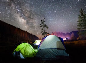
4.5To locate these campsites all you have to do is type in Jones Pass Road into google maps or your iPhone and it will take you straight there. There are road signs once you get off I-70 that will help you the rest of the way that say Jones Pass. Once you hit the dirt road and pass the Jones Pass Tr...Read more -
Parshall, Colorado
Butler Gulch
4.55.26 mi / 2008 ft gainButler Gulch is a pristinely beautiful day hike in the heart of the Arapaho National Forest near Idaho Springs, Colorado. Easily accessible from Denver, Butler Gulch is full of jaw-dropping views in all seasons, and anyone in good health can enjoy this gem. The hike is five miles long and rated ...Read more -
Idaho Springs, Colorado
Snowshoe Jim Creek Trail
5 mi / 965 ft gainStarting at 9,220 feet of elevation, this 5 mile out-and-back snowshoe begins its 965 foot elevation gain meandering through a quiet forest. The trail will take you through the woods for a few miles, and you can turn around whenever you like. If you're up for a challenge and have a lot of time, y...Read more -
Parshall, Colorado
Ski or Snowshoe Jones Pass
4.06 mi / 1600 ft gainIts sister trail, Butler Gulch, is an all-time favorite hike (both summer and winter), and since they share a trailhead, I knew Jones Pass would be special as well.Jones Pass is not the type of trail I normally take, since it is actually a 4x4 road that is used for Jeeping in the summer and snowm...Read more -
Winter Park, Colorado
Snowshoe to Broome Hut
1.5 mi / 729 ft gainTake I-70 from Denver and then US 40, go all the way to Mile marker 240 of US 40 and park in the area at the side of the road. The Second Creek trail head is just behind the parking area and is easy to find.The trail climbs from a start at 10,600ft and finishes up at 11,325ft at the hut, but you ...Read more -
Winter Park, Colorado
Twin Cones via Second Creek Trailhead
5.04.85 mi / 1614 ft gainThis hike begins at Second Creek Trailhead off of US Highway 40. It's pretty steep right off the bar gaining about 800ft of elevation in the first mile. This first mile takes you to Broome Hut, which has a bathroom and is a great place to stop and take a break. Keep in mind that there are no dogs...Read more -
Nederland, Colorado
Hike Rollins Pass to Devils Thumb
2.1 mi / 622 ft gainCorona Lake is an easy, short hike if you're pressed for time. It's scenic, secluded, and will put you in a great spot to hike to Devils Thumb the next day. There are two ways to reach Devils Thumb. This is considered the "easier" route because of the "lack of elevation gain." The sun and wind re...Read more -
Berthoud Pass Parking Lot, Colorado
Mount Flora
5.06.29 mi / 1788 ft gainColorado’s Rocky Mountains offer hikes of all lengths, sizes and difficulties. Mt. Flora stands at a lofty 13,146 ft and is a great intro to climbing peaks in Colorado. Roundtrip, this hike is 6.3 miles and will take you (in the summer) through fields of alpine wildflowers as you climb into Color...Read more -
U.S. 40, Colorado
Parry Peak
11.82 mi / 4209 ft gainThe trek to Parry Peak crosses three other peaks (Colorado Mines Peak, Mt. Flora, and Mt. Eva) along the Rocky Mountains. Begin your hike around sunrise as inclement weather often rolls in during the late afternoon. The trail is extremely rocky and steep. From the Berthoud Pass parking lot, fol...Read more -
Grand Lake, Colorado
Car Camp at Timber Creek Campground
3.0This campground just 10 miles north of Grand Lake is a prime example of the amazing campgrounds you can find in Rocky Mountain National Park. Located along the Colorado River, Timber Creek has 98 campsites that are all first-come-first-serve. If you're on top of it and show up at a decent time, y...Read more -
Silverthorne, Colorado
South Willow Falls
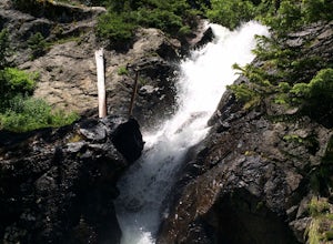
4.66.17 miStart at the Willowbrook Trailhead. You’ll hit a “Y” in the trail pretty quickly - go left and you’ll soon be at the first log bridge. There are quite a few water crossings on the trail, but they are easy to maneuver. After hiking in the Willow Creek Open Space for a bit, you’ll enter Eagle’s Ne...Read more -
Grand Lake, Colorado
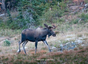
Photograph Moose in Rocky Mountain National Park
4.3Moose are the largest members of the deer family. They can stand over 6ft tall at their shoulders and weigh over 1500lbs. Males have antlers which can reach 6ft across and weigh up to 40lbs each. Amazingly these impressive creatures are strictly herbivores and will eat several dozen pounds of veg...Read more -
Nederland, Colorado
Hike to Arapaho Pass and Lake Dorothy
4.37.5 mi / 2080 ft gainBegin by parking at the 4th of July trailhead. This can be reached by conituing past the Eldora ski area and up a rough but passable (for all vehicles) gravel road to the trailhead. The trail is easy to find, and will continue to rise for the next 1.15 miles.At just over a mile there is a fork fo...Read more -
Nederland, Colorado
Hike South Araphaho Peak
5.08 mi / 2533 ft gainStart your hike at the 4th of July Trailhead, just outside of Eldora, CO. From the trailhead at the north end of the parking lot, steadily climb through the trees until a junction at 1 mile. Take the right fork towards Arapaho pass.You'll start to climb above treeline, with spectacular views of t...Read more -
Nederland, Colorado
Backpack to Caribou Lake
4.08.2 miThis is one of the most beautiful hikes I have ever done in Colorado. It is a great trip for photographers, fisherman or anyone who enjoys mountain views, forests filled with wildlife and peaceful meadows. Distances: Arapaho Pass: 3.2 miles, Caribou Lake: 4.2 miles, Caribou Pass: 6.4 miles, Meado...Read more

