Pagosa Springs, Colorado
Looking for the best hiking in Pagosa Springs? We've got you covered with the top trails, trips, hiking, backpacking, camping and more around Pagosa Springs. The detailed guides, photos, and reviews are all submitted by the Outbound community.
Top Hiking Spots in and near Pagosa Springs
-
Creede, Colorado
Hike the Weminuche Wilderness to Fourmile Falls
5.08 miLocated in Southern Colorado’s Weminuche Wilderness, Fourmile Falls is a beautiful day hike perfect for hikers and photographers. The highlights of the trail are the two massive, thundering waterfalls. The falls make this hike ideal in early to mid summer, when the falls are full of icy snowmel...Read more -
Pagosa Springs, Colorado
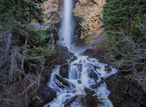
Visit Treasure Falls
4.80.4 mi / 200 ft gainTreasure Falls is reached via short .4 mile walk from the parking lot on highway 160 about 15 miles outside Pagosa Springs (which is home to the worlds deepest hot springs). There is a paved path and dirt trail that both end up at the falls and if you are inclined, make into a loop. There is a br...Read more -
Archuleta County, Colorado
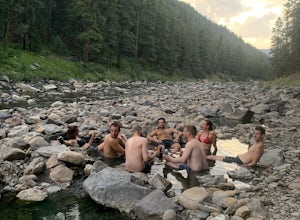
Hike to the Piedra River Hot Springs
4.73 miAbout a 45 minute drive east of Durango, sits the trailhead for the Piedra River Hot Springs. This free use, natural hot spring on the Piedra River has several 100 degree pools. The springs are accessible via a 3 mile roundtrip hike, often with wildlife sightings along the way. The hike to the ho...Read more -
Pagosa Springs, Colorado
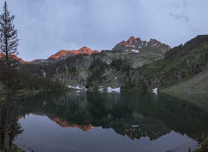
Crater Lake in the South San Juan Wilderness
9.17 mi / 2133 ft gainHoliday weekends can be frustrating for solitude seekers. The extra day to play always seems to be challenged by the expected crowds of competition for your sought after spots. Fortunately for those of us who prefer quieter pastures, Colorado's 3.5+ million acres of wilderness still hold plenty ...Read more -
Pagosa Springs, Colorado
Camp and Fish at Platoro Reservoir
5.0Platoro is the blending of the Spanish words "plata" (silver) and "oro" (gold), and this secluded mountain reservoir strikes it rich when it comes to outdoor recreation. In 1870, gold and silver was discovered in area, which lead to a small boom in 1913 and the settling of the small town which st...Read more -
Durango, Colorado
Hike the First Fork/Red Creek Loop
9.8 mi / 2195 ft gainLeaving from Durango, head north on Florida Road/CR 240. From the intersection with County Road 250 (the last stoplight), drive about 8 miles until you reach Colvig Summer Camp. Turn northwest here. The road will soon narrow and turn to dirt - continue straight. 1 mile further, there will be a la...Read more -
Durango, Colorado
Summit 3 Peaks in the Chicago Basin
5.0I tell people all the time that if they only do one hike in Colorado, this is it. You get a little taste of everything: Colorado history, wildlife, beautiful campsite views, 14ers, and the largest wilderness in the state.This itinerary assumes you’re hitching a ride on the train from Silverton. ...Read more -
Durango, Colorado
Hike the Falls Creek Loop
4.54.1 mi / 393 ft gainThe Falls Creek Loop is a 4.1 mile trail in the San Juan National Forest, just outside of Durango, Colorado. Lots of side trails jut out from the main trail, and it is easy to lose your way. Take the middle trail at the first split, and keep following the main splits. You will find yourself on a ...Read more -
Durango, Colorado
Hike the Animas Mountain Trail
5.9 mi / 1535 ft gainThe Animas Mountain Trail is a 6 mile loop trail, easily accessible from town, and best used from March until October. In the early spring and late fall, it is advised to bring YakTrax or similar in case there are icy patches on the trail. This trail is located in the San Juan National Forest nea...Read more -
Durango, Colorado
Mountain Bike in Dalla Mountain Park
4 miThe Dalla Park shares a trailhead and parking lot with the Animas Mountain trail, frequently used for hiking and trail running. There is plenty of room in this lot, as well as several picnic tables. Immediately after crossing through the gate, the trail divides. The bike park takes up the south a...Read more -
Durango, Colorado
Hike Goulding Creek
4.05.9 mi / 2122 ft gainThis trailhead is only about 15 miles from Durango on Highway 550. Look out for Glacier Club/Tamarron on your right, and soon after (about a mile) there is a small dirt turn-off on the opposite side of the highway. There is one other turn off on the west side of the highway in this stretch, but i...Read more -
Durango, Colorado
Hike the Colorado Trail to Gudy's Rest
4.08.1 mi / 1400 ft gainThis hike, a local favorite is less than five miles from downtown Durango. The entire hike offers beautiful views especially once your reach the top of Gudy's Rest. The trail starts off with a gradual uphill along Junction Creek. On this section of the trail, you will likely run into locals proba...Read more -
Durango, Colorado
Crater Lake via Crater Lake Trail
5.011.73 mi / 2077 ft gainReaching this trailhead actually begins off of Andrews Lake - you will see signs for Andrews Lake off HWY 550. I will provide directions from both Durango and Silverton at the end. The trailhead is extremely well marked the entire way. The mileage from Andrews lake to Crater lake one way is 5.5...Read more

