Morrison, Colorado
Looking for the best hiking in Morrison? We've got you covered with the top trails, trips, hiking, backpacking, camping and more around Morrison. The detailed guides, photos, and reviews are all submitted by the Outbound community.
Top Hiking Spots in and near Morrison
-
Golden, Colorado
Hike the Blue Grouse Trail Loop
3.06 mi / 400 ft gainStart the hike at the Blue Grouse Trailhead located next to Kriley Pond. Travel along Blue Grouse Trail for 0.7 miles until you reach a fork in the trail at Mule Trail where you will take a right. Along the Mule Trail you will travel up a series of switch backs before the trail levels out and you...Read more -
Denver, Colorado
Westerly Creek Trail
2.25 mi / 105 ft gainWesterly Creek Trail is an out-and-back trail that is good for all skill levels located near Denver, Colorado.Read more -
Lone Tree, Colorado
Hike Bluffs Regional Park Trail
2.7 mi / 200 ft gainThis loop trail is 2.7 miles long but has several options for overlooks that add 0.8 miles to the trip. This is an easy hike with minimal elevation gain and is a great option for the whole family. Every time I've done this hike I've seen numerous deer which only adds to the hike!Read more -
Boulder, Colorado
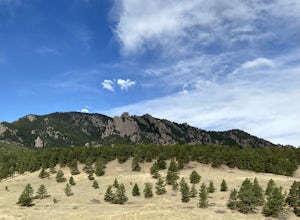
Hike the Flatirons Vista Loop Trail
4.73.3 miFrom the parking lot, take South Flatiron Vista Trail for 2.4 miles, where you'll cross onto North Flatiron Vista Trail. In 1 mile, take the connector trail back to the trailhead. To shorten the loop to 2 miles, hike South Flatiron for just 1 mile to Prairie Vista Trail, which leads back to the c...Read more -
Denver, Colorado
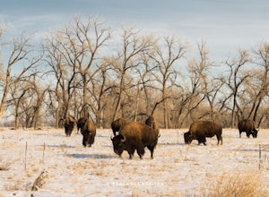
Photograph Bison at the Rocky Mountain National Arsenal Wildlife Refuge
5.09 miBison are the largest and heaviest land animals in North America. They are a symbol of a wild and free landscape. Despite their size these big beasts are extremely agile. They can run up to 35 miles per hour and jump 6ft high from a stand still. Very few animals pose a threat to a healthy, fully ...Read more -
Boulder, Colorado
Hike the Rattlesnake Gulch Trail
4.35.3 mi / 1304 ft gainRattlesnake Gulch Trail is located in Eldorado Canyon State Park. It is a short 20 minute drive from Boulder and is one of three hikes in the park. You will need to pay an entrance fee to get inside to the park which costs $8. The trail is approximately 2.8 miles one way and carries a consistent ...Read more -
Boulder, Colorado
Rattlesnake Gulch Trail
3.49 mi / 1093 ft gainRattlesnake Gulch Trail is a loop trail that takes you by a river located near Eldorado Springs, Colorado.Read more -
Boulder, Colorado
Hike the Eldorado Canyon Trail
4.56.3 mi / 1875 ft gainEldorado Canyon Trail makes for a great day hike, with great views and a steady, challenging uphill – bring lots of water!For something shorter, try Streamside Trail (1 mile roundtrip), Fowler Trail (1.4 miles), or Rattlesnake Gulch (2.8 miles). Streamside, appropriately, leads you alongside a cr...Read more -
Boulder, Colorado
Doudy Draw Trail
4.37 mi / 433 ft gainDoudy Draw Trail is an out-and-back trail where you may see beautiful wildflowers located near Boulder, Colorado.Read more -
Boulder, Colorado
Hike Bear Peak
4.87 mi / 2810 ft gainThe best advice I can give you? Wake up early to start this hike.Even though the Bear Peak hike will only take you about 4-5 hours round trip, it will still be advantageous to get off the mountain before afternoon and evening storms might pass through. This is a steep 7-mile out and back trail.St...Read more -
Boulder, Colorado
Hike South Boulder Peak
4.56.7 mi / 2900 ft gainStarting at the Mesa trailhead, continue a half a mile through a relatively even grade before arriving at the North Fork Shanahan trailhead, which will take you another half a mile on much steeper grade up to Fern Canyon where you will start a much harder portion of the hike; here, you'll head st...Read more -
Boulder, Colorado
Hike the Big Bluestem Trail Loop
4.04.35 mi / 841 ft gainThis is a great spot for an easy/moderate hike or trail run. The trail is accessible year round and can often be hiked in winter as well as other seasons. You start out at the Mesa Trailhead parking lot off of Hwy 170. There is a parking lot here but this is a starting spot for several hikes into...Read more -
Aurora, Colorado
Walk the Cherry Creek Dog Off-Leash Area
4.53 miCherry Creek Dog-Off Leash Area is an extended part of Cherry Creek State Park and encompasses 107 acres of fenced-in play area. Within the park there is a 3 mile loop trail that takes you through the trees and along the Cherry Creek. What makes this park so great is the several access points to ...Read more -
Boulder, Colorado
South Boulder Creek - Mesa Trail - Lower Big Bluestem Loop
4.04.46 mi / 453 ft gainThis 4 mile loop ascends only a slight amount in elevation, making for a pleasant loop in which opportunities for appreciation of the nature around you and broad vista photography are in plentiful supply. A great hike for those who may still be building their fitness, as so many trails in Boulder...Read more -
Evergreen, Colorado
Hike the Resthouse/Lincoln Lake Trail
4.5While the Mt. Evans Wilderness never has a shortage of visitors, thanks to its proximity to Denver, it is possible to find a more private hike if you know where to look. Lincoln Lake Trail, accessible from Echo Lake year-round, is not as glamorous as its sister trail, Chicago Lakes, but is a wond...Read more -
Pine, Colorado
Little Scraggy Peak Loop
5.012.18 mi / 1621 ft gainLittle Scraggy Peak Loop is a loop trail that takes you past scenic surroundings located near Buffalo Creek, Colorado.Read more

