Minturn, Colorado
Looking for the best fishing in Minturn? We've got you covered with the top trails, trips, hiking, backpacking, camping and more around Minturn. The detailed guides, photos, and reviews are all submitted by the Outbound community.
Top Fishing Spots in and near Minturn
-
Vail, Colorado
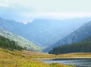
Hike the Upper Piney River Trail
4.05.6 mi / 350 ft gainBeginning at an elevation of 9,397 feet, this hike provides an easy 2.8 mile (one way) trip through the gorgeous meadows against the distant aspens and alpines. Wildflowers and wildlife are abundant, which make this trip a fantastic education and play experience for kids.Coordinates for the trail...Read more -
Vail, Colorado
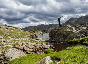
Backpack to Bubble Lake
3.013 mi / 3600 ft gainThe Gore's are a rough and remote section of the Eagle's Nest Wilderness. What this trip may lack in overall miles, it more than makes up for in elevation gain, scrambling, boulder hopping, and overall hard miles on the trail. Every trip I have had the pleasure of taking into the Gore Range has...Read more -
Minturn, Colorado
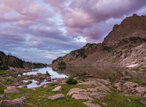
Backpack the High Alpine Seven Sisters Lake Chain
12 mi / 1000 ft gainThis lake chain is in a spectacular, undeveloped bowl of jagged and rugged mountain goodness located in the Holy Cross Wilderness Area. This hidden gem is easily accessible and, to my amazement, it is relatively unheard of even among many locals. More wonderful perks included in this backpacking ...Read more -
Basalt, Colorado
Backpack & Fish at Lake Charles
11 mi / 1700 ft gainI decided to make an Outbound listing for this because the AllTrails listing is incredibly inaccurate. Hopefully you're reading this one! Your adventure starts at the trailhead of Fulford Cave / Fulford Cave Campground in Yeoman Park. Yeoman Park is just past Sylvan Lake State Park and is consid...Read more -
Frisco, Colorado
Backpack to the Gore Range's Wheeler and Lost Lakes
4.510 mi / 2200 ft gainThe range offers many remote lakes and peaks which hikers can access from various points of entry. Wheeler and Lost Lakes lie within the boundaries of the Eagle's Nest Wilderness Area.The Gore Trail begins on the north side of the CO-91 pedestrian bridge over I-70. You will follow the trail up al...Read more -
Silverthorne, Colorado
Backpack to Upper Slate Lake
5.028 mi / 1386 ft gainStarting from the Rock Creek Trailhead parking lot, it is an up and down trek to Upper Slate Lake. The trail map states 10 miles each way, but accounting for switchbacks it ends up being closer to 14 long, hard miles.You will be among aspens and pines for the first half as you have a few moderate...Read more -
Leadville, Colorado
Savage Lakes Trail
5.03.97 mi / 1299 ft gainThe majority of this hike traverses through the beautiful forest that is part of the Holy Cross Wilderness. No significant views are to be had until you've climbed 1,300 ft over 2. miles and reach lower Savage Lake. The trail is easy enough to follow with no junctions along the way, and is adjace...Read more -
Silverthorne, Colorado
Lily Pad Lake
4.73.27 mi / 531 ft gainLily Pad Lake is a well known destination just outside of Silverthorne and in the Eagle's Nest Wilderness. The trail may be heavily trafficked on the weekends, but solitude can still be found in the early mornings or during the weekdays. The trail starts at the Lily Pad Lake Trailhead, just to t...Read more -
Silverthorne, Colorado
Hike Cataract Lake and Falls
4.72.1 mi / 200 ft gainMy husband and I heard about this hike while we were at a marriage retreat in nearby Dillon. This is the perfect casual day hike for a couple, small groups, or families with children. While we were there in May, just before the aspens were fully leafed out, it was easy to see that this location w...Read more -
Silverthorne, Colorado
Hike to Old Dillon Reservoir
4.51.7 mi / 137 ft gainToday, Lake Dillon is one of the biggest attractions in the Dillon Valley, attracting boaters, anglers, and campers. However, the large reservoir we know today was not the first one in the area. The Old Dillon Reservoir was built in the 1930s to supply water to the original town of Dillon, which...Read more -
Turquoise Lake, Colorado
Escape to Turquoise Lake
5.0Turquoise Lake is an 'off the beaten path' gem only 3 hours from the Denver Metro Area. The area surrounding the lake is home to some spacious and tree-shaded campgrounds. If you plan ahead and book early, you'll have your pick of the best spots within close proximity to the lake. The campground ...Read more -
Breckenridge, Colorado
Hike McCullough Gulch to Upper Blue Reservoir
5.02.8 mi / 910 ft gainThe trail first takes you to Upper Blue Reservoir, about 1.4 miles in. Past this point, it can be somewhat tricky to find the trail, but for experienced hikers, the upper valley holds a number of lakes, a waterfall, and open tundra for exploring. Mountain goat sightings are also common in this ar...Read more -
Breckenridge, Colorado
Backpack & Fish The Mohawk Lakes
4.06.8 mi / 1940 ft gainThe trailhead is located a few miles out side of Breckenridge Colorado. The trail starts at 10,390' and the first two miles are spent walking through a mix of fir, aspen, and spruce trees until the trail goes parallel to Spruce Creek Road and eventually crosses it and continues over a small dam (...Read more -
Breckenridge, Colorado
Lower Crystal Lake via Crystal Creek Road
5.04.52 mi / 1624 ft gainTo get to the Crystal Lakes start at the Spruce Creek Trailhead. You can hike or drive to the Lower Crystal Lake along Crystal Creek Road. If you choose to drive, you will need a high clearance 4x4 vehicle as you follow along Crystal Creek Road. The road is steep, but when they get to the top it ...Read more -
Meredith, Colorado
Hike to Chapman Lake
1.6 miFrom downtown Basalt, drive up the Fryingpan River Road 28 miles and turn right on CR #504, also known as Elliot Way, just before Norrie Colony. Drive across the river and up the switchbacks for approximately 3 miles. Take the left fork, continue 1 mile and take the right fork approximately 1/2 m...Read more -
Bond, Colorado
Camp at Radium Campground
This was a rafting/camping trip. We camped at the Radium Campground and rafted 4.5 miles from Pump House Boat Launch. BLM charges $5.00 per vehicle at the boat launch sites and $10.00 per night for camping.Keep an eye out for big horn sheep. I saw them grazing on the side of the colorado river.Yo...Read more

