Loveland, Colorado
Looking for the best hiking in Loveland? We've got you covered with the top trails, trips, hiking, backpacking, camping and more around Loveland. The detailed guides, photos, and reviews are all submitted by the Outbound community.
Top Hiking Spots in and near Loveland
-
Laporte, Colorado
Hike the Bellvue Dome
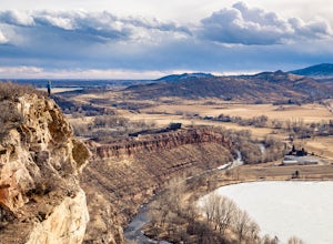
2.81.75 mi / 600 ft gainThe Bellvue Dome, known locally as "Goat Hill", was created by the same geological forces that made the Rocky Mountains, but what makes this structure unique is its shape, the steep cliff on its western edge carved by the Cache la Poudre River at the base, and its prominent location dominating th...Read more -
Lyons, Colorado
Sleepy Lion Trail
4.7 mi / 712 ft gainThe trailhead is about eight tenths of a mile from the parking area. You pass some sport climbs, a man made waterfall, and some large boulders in the North St. Vrain Creek.The trailhead is clearly marked on the left. There is some elevation gain at the beginning but nothing difficult. Once the el...Read more -
Lyons, Colorado
Winter Camp Near Coulson Gulch
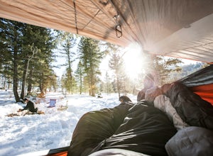
4.0County Road 47 is between Lyons and Estes Park. It's an easy drive from Denver and is a great place to get away for the weekend. I have camped here in the summer, fall, and winter. I have to say that snow camping was my favorite. I didn't see anyone the whole weekend and had the entire area to ex...Read more -
Lyons, Colorado
Camp at Coulson Gulch
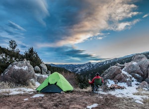
4.09 miCoulson Gulch is a lightly used area of the Roosevelt National Forest which makes it perfect for a weekend getaway without the crowds. This is a great place to camp out under the stars!To get to Coulson Gulch From Lyons, head west on U.S. Highway 36 for about 9 miles. Turn southwest onto Larimer ...Read more -
Lyons, Colorado
Hike the Kruger Rock Trail
4 mi / 1000 ft gainCutting through the forested hills surrounding Estes Valley, the Kruger Rock Trail is a well-marked 4 mile loop to the top of Kruger Rock. The trail begins in Hermit Park Open Space, located just a few miles southeast of Estes Park and is a moderate hike with around 1000 feet of elevation gain. C...Read more -
Bellvue, Colorado
Hike the Black Powder Trail
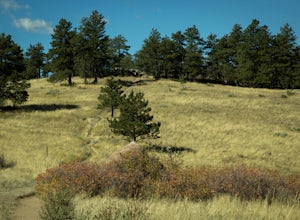
1.5 mi / 450 ft gainThe Gateway Natural Area, part of the City of Fort Collins public lands system, is a wonderful (and close to the city) place to begin exploring the many outdoor assets and activities found in the greater Fort Collins area. The Black Powder Trail is a relatively easy, well-marked 1.5 mile out and ...Read more -
Estes Park, Colorado
Lumpy Ridge to Gem Lake
4.33.12 mi / 950 ft gainBegin by parking at the Lumpy Ridge trailhead, which is a couple miles outside of Estes Park on McGregor Avenue. At the trailhead, there are numerous signs indicating hiking trails, climbing routes, and other information about the area. After parking start hiking on the trail to the right of the ...Read more -
Bellvue, Colorado
Climb Greyrock Mountain
5.07.1 mi / 3000 ft gainThe main trail begins at the Cache La Poudre river on the Poudre Canyon Highway about 30 minutes from Fort Collins. After about .75 miles the trail splits. To go left on Greyrock Meadows trail adds 2 miles to your trip and provides excellent views of Greyrock Mountain and Meadows from the south, ...Read more -
Boulder, Colorado
Hike the Eagle Sage Loop
4.33.75 mi / 205 ft gainThis is a great trail if you are in the Boulder area and want something fairly easy or quick. This 3.75 loop can be hiked in about an hour and a half since it is fairly flat. The elevation gain is minimal. You start out at the Eagle Trailhead located west of the Boulder Reservoir.Start out at the...Read more -
Bellvue, Colorado
Trail Run the Hewlett Gulch Trail
5.08.5 mi / 800 ft gainHewlett Gulch Trailhead is located about 20 minutes from Fort Collins and offers easy hiking in the Poudre Canyon.From Fort Collins, take 287 to Ted's Place. Take a left onto CO 14 and follow 14 through the canyon just past Poudre Park where you see the trailhead sign. Turn left onto the road tha...Read more -
Boulder, Colorado
Hogback Ridge Trail
2.85 mi / 830 ft gainHogback Ridge Trail is a loop trail where you may see beautiful wildflowers located near Manitou Springs, Colorado.Read more -
Estes Park, Colorado
Estes Cone
4.08.22 mi / 2275 ft gainThe trail begins on the left on a park service road before reaching a junction with the Storm Pass Trail just past .2 miles. Follow the trail as it enters the forest and continue past the private property signs and over a footbridge. Past the bridge the trail climbs more steadily for just under 2...Read more -
Estes Park, Colorado
Twin Sisters Peak
5.07.48 mi / 2470 ft gainThe trailhead starts close to 9,000 ft elevation. It continues at a gradual slope through the forest for a long way. The trail does not exit the tree line until close to the top, where there is a boulder field, of sorts (slightly over 11,000 ft). Don't worry, there is a nice trail all the way to ...Read more -
Boulder, Colorado
Foothills Trail to Wonderland Lake Loop Trail
2.93 mi / 223 ft gainFoothills Trail to Wonderland Lake Loop Trail is a loop trail that takes you by a lake located near Boulder, Colorado.Read more -
Boulder, Colorado
Wonderland Lake Trail
5.01.85 mi / 98 ft gainWonderland Lake Trail is a loop trail that takes you by a lake located near Boulder, Colorado.Read more -
Estes Park, Colorado
Longs Peak
5.013.3 mi / 5100 ft gainFor the most part, this hike is very straightforward, so I'll essentially skip over the first 5.5 or so miles of the hike, but, in case you don't know: Start (very early so you get a parking spot) from the trailhead right next to the parking lot (the road to it is paved - seriously this mountain...Read more

