Littleton, Colorado
Looking for the best skiing in Littleton? We've got you covered with the top trails, trips, hiking, backpacking, camping and more around Littleton. The detailed guides, photos, and reviews are all submitted by the Outbound community.
Top Skiing Spots in and near Littleton
-
Dillon, Colorado
Backcountry Snowshoe and Ski Paradise
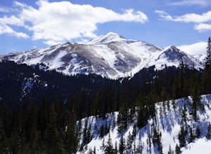
5.07 mi / 1700 ft gainA popular wildflower hike in summer, Herman Gulch is arguably even prettier covered in snow. The north-south trail offers views of the impressive Mount Sniktau to the south and Pettingell Peak to the north--with much to see along the way. Officially, the trail weaves in and out of the forest and ...Read more -
Parshall, Colorado
Ski or Snowshoe Jones Pass
4.06 mi / 1600 ft gainIts sister trail, Butler Gulch, is an all-time favorite hike (both summer and winter), and since they share a trailhead, I knew Jones Pass would be special as well.Jones Pass is not the type of trail I normally take, since it is actually a 4x4 road that is used for Jeeping in the summer and snowm...Read more -
Dillon, Colorado
Hike Grizzly Peak at Loveland Pass
5.06 mi / 2900 ft gainWhile a typical Colorado hike may be an ascent to your destination followed by a descent back to your car, the hike to Grizzly Peak at Loveland Pass (Grizzly Peak "D") breaks that mold. At 13,427 feet, Grizzly Peak stands in the path to Torreys Peak’s west face (14,267’). Even though it is only ~...Read more -
Parshall, Colorado
Snowshoe Butler Gulch
5 mi / 1500 ft gainIn fall, winter and spring, the trail is covered in snow, which makes it ideal for backcountry skiing and snowshoeing. The trail becomes indistinguishable after the first mile or two, but usually you can follow previous skiers' tracks up the mountainside.What you miss in wildflowers or mine sight...Read more -
Breckenridge, Colorado
Mount Guyot Snow Climb
5 mi / 2500 ft gainFrom Jefferson follow 35 north to 54 and drive up 54 as far as possible ending a few miles before Georgia pass. Depending on the snowpack and drifts on the unplowed road, you could hike as few as 5 miles round trip or as many as 10. If the snow blocks you from driving past Michigan Creek Campgro...Read more

