Idaho Springs, Colorado
Top Spots in and near Idaho Springs
-
Estes Park, Colorado
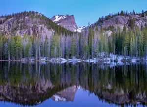
Nymph Lake via Bear Lake Trailhead
4.81.13 mi / 245 ft gainWhile not as popular as Dream Lake, Nymph Lake is just as beautiful. The hike to Nymph Lake is an easy hike just over 1 mile. You start from the Bear Lake Trail head and can go further on to Dream Lake and Emerald Lake if you want to. Both Dream and Emerald Lakes are also stunning and very photog...Read more -
Estes Park, Colorado
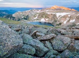
Ptarmigan Lake via Bear Lake Trailhead
11.33 mi / 3850 ft gainThe hike to Ptarmigan Lake has plenty of elevation gain for mountain lovers and views for miles from the Continental Divide. If you want to reach this spot for sunrise you'll need a very early start in the morning, but that also means you won't have to use the shuttle system to Bear Lake. The las...Read more -
Estes Park, Colorado
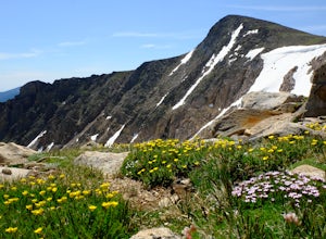
Flattop Mountain and Hallett Peak
4.49.73 mi / 3240 ft gainArrive at the Bear Lake Trailhead. Follow abundant signage toward Flattop Peak. Once you arrive at the summit of Flattop identify the unnamed unmaintained trail leading south toward Hallett Peak. Round the head of Tyndall Gorge and ascend the rocky slopes toward the summit by connecting short use...Read more -
Estes Park, Colorado
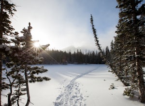
Snowshoe to Emerald Lake
4.63.6 mi / 605 ft gainSnowshoeing to Emerald Lake was completely different from hiking the trail during summer. Instead of hiking around Nymph Lake, Dream Lake, and Emerald Lake, I was able to go straight across them (check the ice to make sure it's thick enough to support your weight). Rocky Mountain National Park's...Read more -
Estes Park, Colorado
Climb Notchtop Mountain in Rocky Mountain National Park
5.03.5 mi / 1550 ft gainPark at Bear Lake, and follow the signs north of the lake to Odessa Lake. However, do NOT go all the way to Odessa Lake; after about 3 miles, when Notchtop is in full view, the trail begins to descend to Odessa Lake. Find an unmarked spur trail to the left which leads to shallow Lake Helene, then...Read more -
Estes Park, Colorado
Hike Flattop Hallett Andrews Loop
5.010.9 mi / 3238 ft gainBear Lake to Flattop Mountain The trail starts at Bear Lake, where you get a view of Hallett Peak (12,713 ft) which will be the highpoint of your hike. After a short walk on the Bear Lake Trail, take the path to the right. After 1/2 a mile, take a trail left to the north. 1/2 a mile later, stay l...Read more -
Estes Park, Colorado
Dragon's Tail Couloir Climb
5.0Start your day at the Bear Lake parking lot, and head out on the short 2-mile approach that winds uphill past Nymph and Dream Lake. After arriving at Emerald Lake, skirt around the shore on the left side to reach the bottom of the couloir, clearly visibile on the far side of the lake.The 1500 ft ...Read more -
Sedalia, Colorado
Backpack the McCurdy Park Loop
25 mi / 7202 ft gainThe total distance of the loop is a little under 25 miles and you will climb a total of 7202 feet. It can be done as a 3 day backpacking trip as shown below.The LoopDay 1: After Parking in the trail head's parking lot, which fills up quickly on weekends, start down the trail after signing your pe...Read more -
Sedalia, Colorado
Backpack the Lost Creek Loop
33.5 mi / 6200 ft gainLost Creek Wilderness may be my favorite part of Colorado. It contains varied terrain and geography, and is less crowded than most places. This loop will take you through everything the wilderness area has to offer. You will get sweeping panoramas of mountain ranges to the south, as well has m...Read more -
Sedalia, Colorado
Camp at Goose Creek
3.08 mi / 1300 ft gainGoose Creek is a fantastic spot to hike or camp. There is a dirt road leading to the trailhead, and it winds through the mountains and offers a great view of the valley. The dirt road is relatively easy and well-maintained. The burn scar from the Hayman fire is still really evident, so there are ...Read more -
Estes Park, Colorado
Sprague Lake Loop
5.00.81 mi / 26 ft gainLocated in Rocky Mountain National Park at an elevation of almost 8,700 feet, Sprague Lake offers visitors great views with very little effort required. It's a short 15 minute drive from Estes Park and hikers can take the short trail around the circumference of the lake. You'll find bathrooms and...Read more -
Larimer County, Colorado
Bierstadt Lake Loop
4.32.93 mi / 675 ft gainFrom the Bierstadt Lake Trailhead on Bear Lake Road in Rocky Mountain National Park, you start out in lodgepole pines at 8850 feet high. But you quickly get into the aspens. In the breeze, aspens flutter or quake. It's unique sound as the leaves almost dance in the wind. The views and aspens ...Read more -
Frisco, Colorado
Hike to Mayflower Gulch
4.74 mi / 1000 ft gainGetting to the Mayflower Gulch is pretty easy, you can either hike an easy 2 mile forest road or drive all the way to end (you need decent clearance for the drive). At the end of the hike you are greeted with a stunning view of the Old Boston mining site. During the summer, wildflowers are abunda...Read more -
Frisco, Colorado
Snowshoe the Mayflower Gulch
4.74 mi / 1000 ft gainTo begin, park in the large parking lot (it is usually plowed all winter except right after a large storm). The parking lot can be reached via highway 91, approximately 6 miles south of Copper Mountain and will be on the east (left if coming from the north) side of the road. Begin up the obvious ...Read more -
Frisco, Colorado
Backcountry Ski or Snowboard at Mayflower Gulch
If you were driving down highway 91 towards Leadville and blinked at just the right moment, you'd drive right past this hidden gem of an area. Located just over 6 miles South of Copper Mountain ski resort on the East side of highway 91, the parking lot for the Mayflower Gulch trail head offers pl...Read more -
Lyons, Colorado
Hike the Kruger Rock Trail
4 mi / 1000 ft gainCutting through the forested hills surrounding Estes Valley, the Kruger Rock Trail is a well-marked 4 mile loop to the top of Kruger Rock. The trail begins in Hermit Park Open Space, located just a few miles southeast of Estes Park and is a moderate hike with around 1000 feet of elevation gain. C...Read more

